Source: Fresh Date Classroom (ID: xzclasscom)
In today’s mobile internet era, smartphones have become a standard part of everyone’s life.
These smartphones are equipped with various apps that provide different services, fundamentally changing our lives.
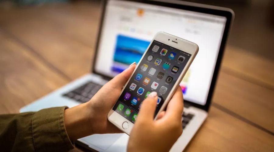
Among these services is our main focus today—positioning.

Every person and every object on this planet has a spatial location information, which is positioning. It is very important as we rely on it to find a person or an object.
Since the beginning of human civilization, maps have been invented to indicate location information. However, due to the limitations of technology, people could only rely on reference points to “Buddha-like” position.

Buddha-like positioning, following one’s feelings
Later, with the invention of the compass and navigational tools, human positioning capabilities have continuously improved, and the accuracy of positioning has also increased.
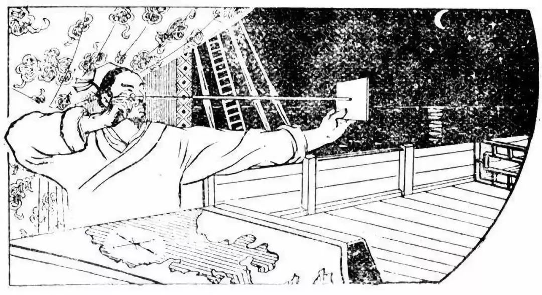
Zheng He’s voyages used “star guiding technique” for positioning
In modern times, with social progress and technological development, positioning technology has advanced by leaps and bounds. We can almost measure and locate every corner of the world.
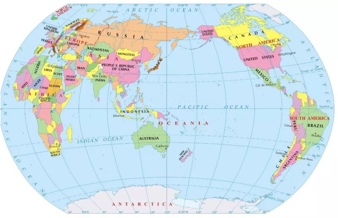
World Map
The devices and technologies used for positioning have gradually permeated from “high-end” fields like navigation, aviation, surveying, and disaster relief into the lives of ordinary people, becoming an indispensable part of life. For example, vehicle navigation, logistics tracking, and traffic management.
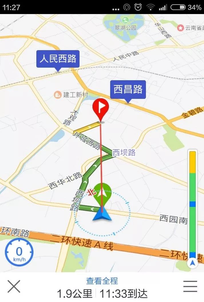
Vehicle positioning navigation
So, when using mobile positioning services, have you ever thought about these questions:
How does the phone achieve positioning? What is the working principle?
Everyone knows about satellite positioning, but is satellite the only way to locate? Why can we still position even when we haven’t turned on the satellite positioning on our phones?
If we are indoors and there is no satellite signal coverage, can we still not be positioned at all?
…
In today’s article, I will reveal the answers to these questions.
Satellite Positioning
Positioning is typically divided into indoor positioning and outdoor positioning based on usage scenarios.
Let’s first talk about the most commonly used outdoor positioning.
The most mainstream outdoor positioning method, as mentioned earlier, is satellite positioning.
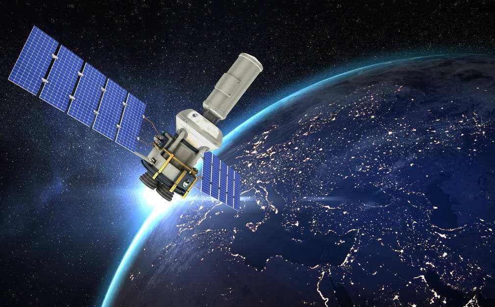
Satellite positioning is a technique that uses artificial Earth satellites for point measurement, and it is currently the most widely used and popular positioning technology. Its characteristics are very prominent: high accuracy, fast speed, and low cost.
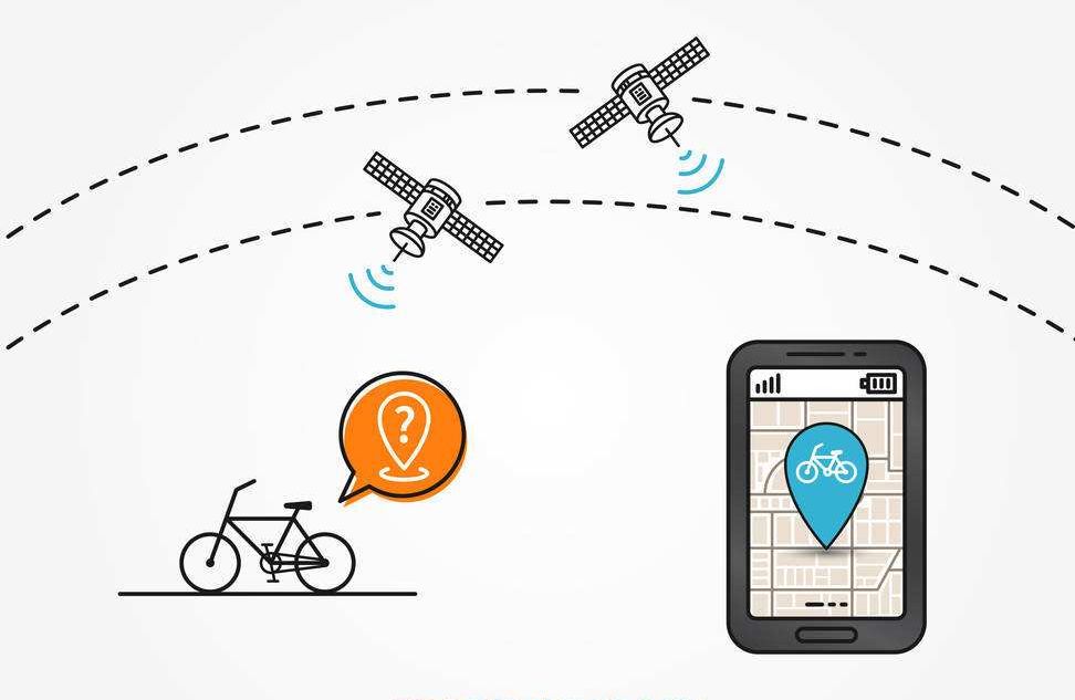
However, currently only a few countries in the world have the capability to build and maintain satellite positioning systems.
Familiar examples include: the USA’s GPS, China’s BeiDou (BDS), Europe’s Galileo, and Russia’s GLONASS. Additionally, there is Japan’s Quasi-Zenith Satellite System (QZSS) and India’s IRNSS.
Let’s take the most widely used American GPS system as an example.
GPS, which stands for Global Positioning System, was initiated in 1958 as a military project in the USA, became operational in 1964, and was fully deployed by 1994.
The main purpose of building the GPS system is to provide real-time, all-weather, and global navigation services for land, sea, and air, and to be used for intelligence gathering, nuclear explosion monitoring, and emergency communications for military purposes.
The system consists of 24 satellites, of which 21 are operational satellites, and 3 are on-orbit backup satellites. Together, they form the GPS satellite constellation.
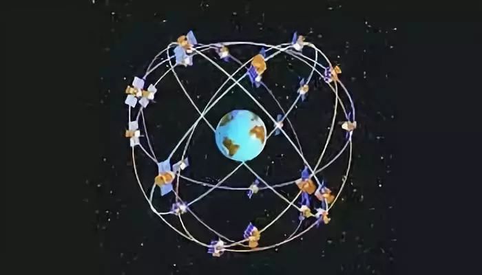
The 24 satellites are located at an altitude of 20,200 km, with an orbital period of 11 hours and 58 minutes (12 hours in sidereal time), evenly distributed across 6 orbital planes.
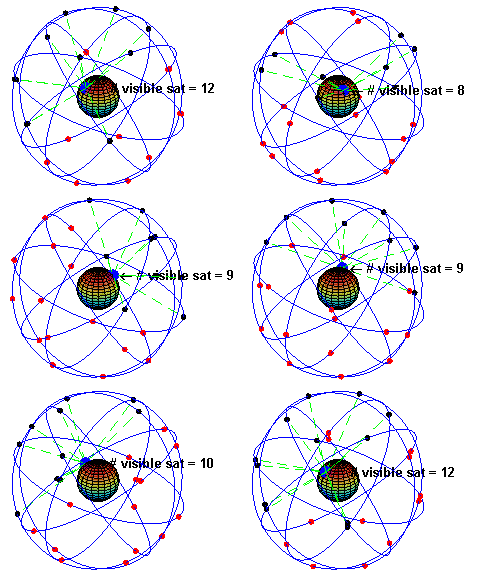
Under normal circumstances, at any location on the Earth’s surface, an average of 6 GPS satellites can be observed simultaneously, with a maximum of 10 satellites.
Apart from the satellites in the sky, ground-related equipment is also needed for coordination and monitoring, which is the ground monitoring system.
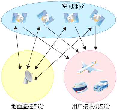
The ground monitoring system for GPS working satellites includes a master control station, three injection stations, and five monitoring stations.
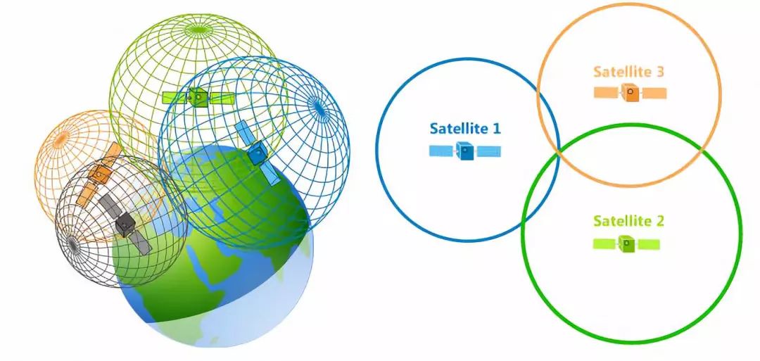
The basic principle of the GPS navigation system is to measure the distance between the known position of the satellites and the user’s receiver, and then integrate the data from multiple satellites to determine the specific location of the receiver.
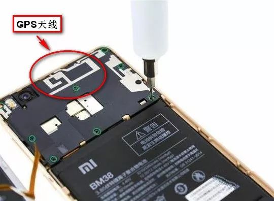
Our phones are equipped with GPS modules and antennas, acting as receivers responsible for receiving and processing GPS data.
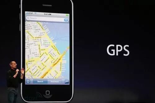
This data is called by the phone’s operating system or app software (such as Baidu Maps) to achieve precise positioning.
Tip: If you are interested, you can install apps like “GPS Radar” to check which positioning satellites your phone can currently detect at any time:
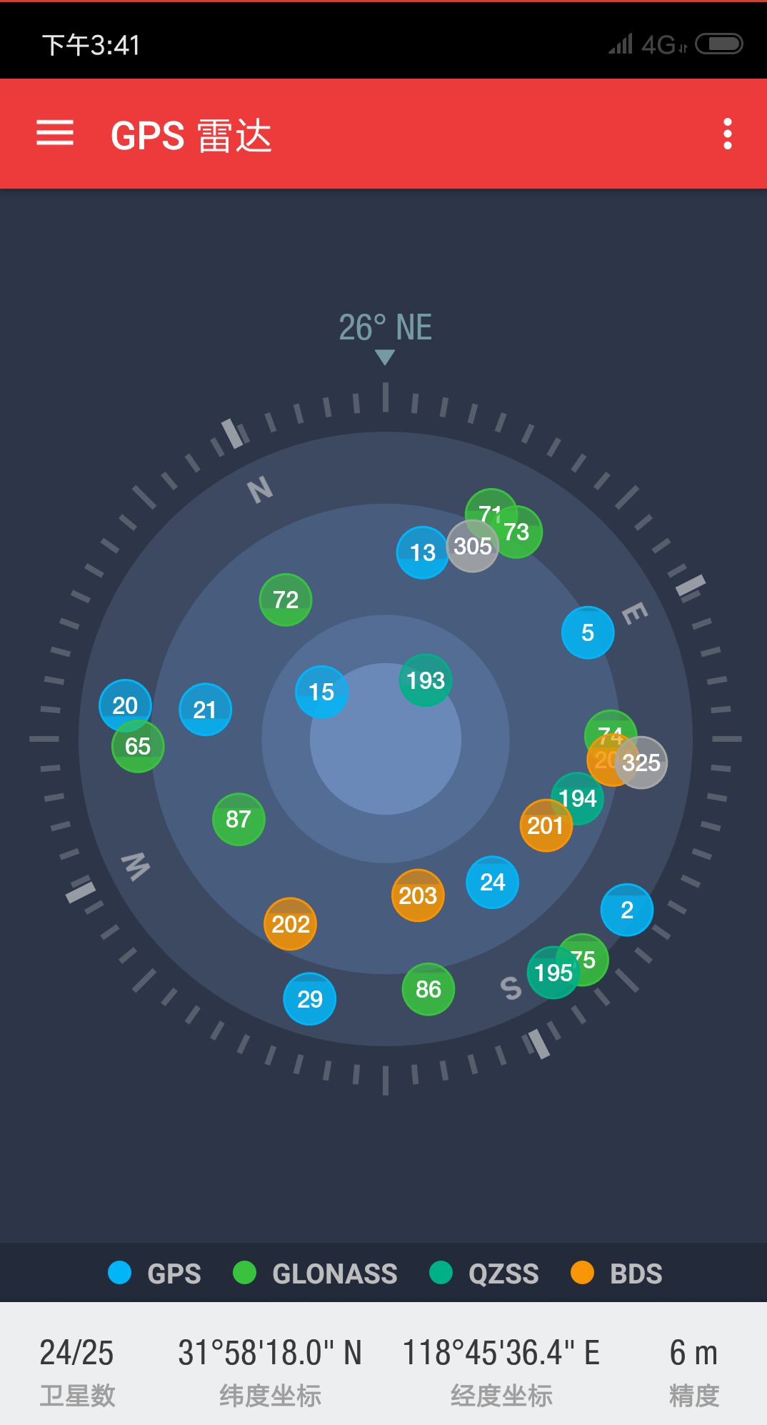
I casually scanned and found quite a few satellites above me.
Satellite positioning involves national security, so it cannot be fully reliant on foreign systems. Therefore, despite the maturity of the GPS system, our country has developed the BeiDou system.
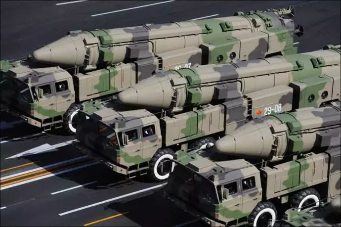
For ballistic missiles, we certainly can’t use the Americans’ satellites for positioning, right?
As of now, our BeiDou system has commercial capabilities and can provide positioning services accurate to 10 meters, comparable to GPS.
At the same time, BeiDou also compensates for the shortcomings of GPS, possessing short message capabilities (GPS satellites broadcast in one direction and do not have two-way communication capabilities, making it somewhat limited in function).

For satellite positioning systems like GPS, factors affecting positioning accuracy mainly come from two aspects: one is the ionosphere in the atmosphere (the ionosphere is filled with ions and electrons under sunlight, severely affecting GPS signals which are electromagnetic waves), and the other is multipath effects (as previously mentioned in communication basics, due to buildings and other factors, direct signals and reflected signals arrive at different times, causing signal interference).
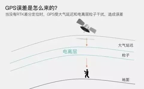
However, generally speaking, if the weather is fine, the accuracy of GPS positioning will not be too poor.
Base Station Positioning
Now that we’ve talked about satellite positioning, let’s take a look at ground positioning.
When it comes to ground positioning, what comes to mind first? Haha, is it radar?

Indeed, radar, as a search and positioning technology, is widely used in military and civilian fields. However, considering the vast number of ordinary phones and the complexity of obstacles in living places, it is not suitable to use radar for positioning from both technical and cost perspectives.

Dragon Ball Radar is actually a pretty good thing
So what method do we use?
Actually, there are many methods that can be used, the most common of which is base station positioning, also known as LBS, Location Based Service.
The principle of base station positioning is similar to that of radar. Radar positioning involves emitting radar waves and calculating spatial positions based on reflections from targets.
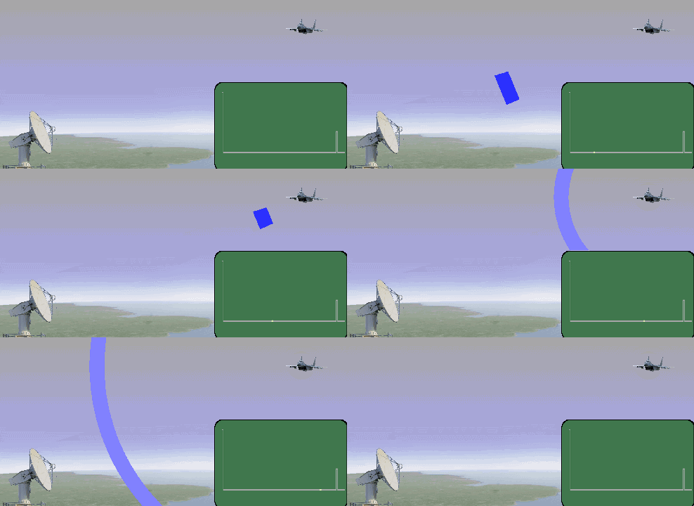
In base station positioning, the base station acts as a “radar”.
Usually, in urban areas, a mobile phone will be under the signal coverage of multiple base stations. The phone will measure the downlink pilot signals from different base stations to obtain the signal TOA (Time of Arrival) or TDOA (Time Difference of Arrival) from each base station. Based on this measurement result and the coordinates of the base stations, the coordinates of the phone can be calculated.
Let’s draw a diagram; it will be clear:
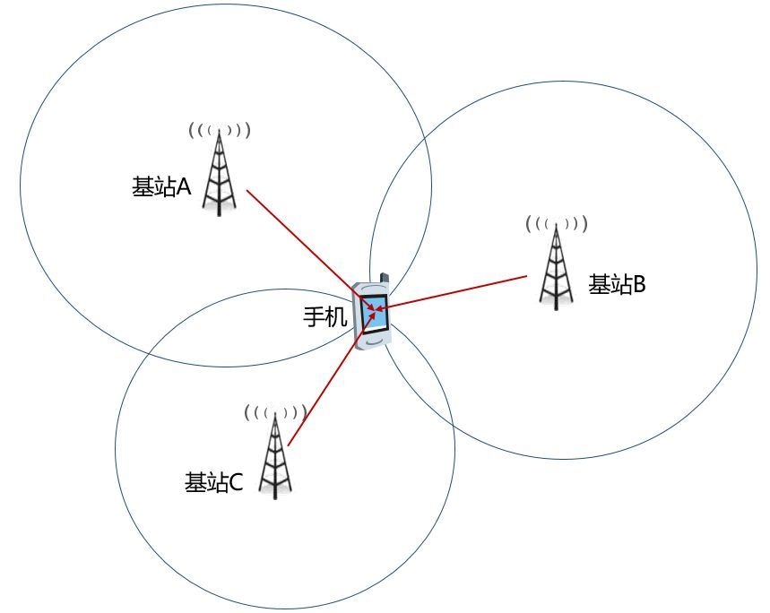
Got it? Three points determine a position.
The accuracy of base station positioning is not high, with errors ranging from 100 meters to several kilometers. The main sources of error come from the location and density of the base stations. In short, the more base stations there are and the higher their density, the higher the positioning accuracy. The fewer obstacles between the base station and the phone, the better the positioning accuracy will be.
Typically, the low accuracy of base station positioning in rural areas is due to the scarcity of base stations and the presence of blind spots. Sometimes, only one station’s signal is available, making precise positioning impossible.

One station can locate a circle but cannot pinpoint a point.
Besides the aforementioned base station positioning, if you don’t require high positioning accuracy, you can also directly check the information of the cell your phone is currently in to confirm the target location.
All our phones, as long as they connect to the carrier’s network, are effectively “registered” in the network. The current connected base station information can be checked in the phone.
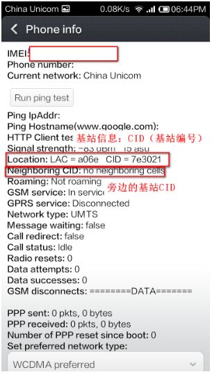
In the call dialing interface, enter *#*#4636#*#* to view the corresponding base station information.
For Apple, enter *3001#12345#*
Even if you turn off your phone, the carrier’s HSS (which manages user data) can still find out which base station cell you were in previously.
This method of checking location is relatively quick, but the accuracy is quite low, as the coverage of one base station can range from hundreds of meters to several kilometers.
Wi-Fi Positioning
In addition to base station positioning, there is another ground positioning method that you may be less familiar with, which is Wi-Fi positioning.
That’s right, Wi-Fi can also be used for positioning!
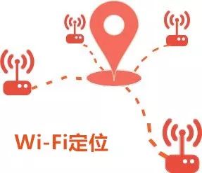
You might think that what I’m referring to as Wi-Fi positioning is IP-based positioning. However, that is not the case!
As you may know, everyone has a public IP address when they go online. These IP addresses are registered in the network system, such as belonging to Nanjing Telecom or Shanghai Unicom, etc.

IP addresses can indeed roughly track your location (carriers can find out more accurately), but this type of positioning has limitations. On one hand, many carriers now use NAT technology, so they may not assign a public address to every user. On the other hand, IP addresses can be easily spoofed. If I set up a proxy address, the IP you see might be from the USA.
What I mean by Wi-Fi positioning is based on the MAC address of the Wi-Fi router.
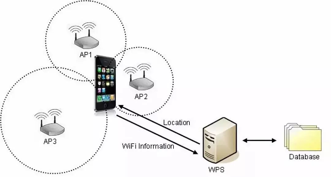
Each wireless AP (Wi-Fi router) has a globally unique MAC address, and generally, the wireless AP does not move over a period of time.
When Wi-Fi is enabled, the collecting device (such as a phone) can detect the signal of this wireless AP and obtain its MAC address and signal strength information.
The collecting device uploads this information to the server, which calculates and saves it as a “MAC-latitude and longitude” mapping. When enough information is collected, a huge Wi-Fi information database is established on the server.
When a device is in such a network, it can send the collected data that can identify the AP to the location server, which retrieves the geographical location of each AP and calculates the device’s geographical location based on the signal strength of each AP, returning it to the user device. The calculation method is similar to that of base station positioning, also utilizing three-point positioning or multi-point positioning technology.
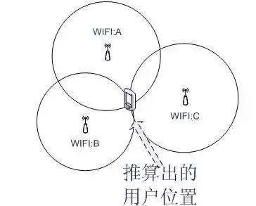
Location service providers need to continuously update and supplement their databases to ensure data accuracy.
Now, the question arises: How is this AP location mapping data collected?
It can be roughly divided into two types—active collection and user submission.
-
Active Collection:
Google’s Street View cars, who would have thought? They are collection devices. They collect wireless signals along the way and tag them with coordinates obtained through GPS to be sent back to the server.
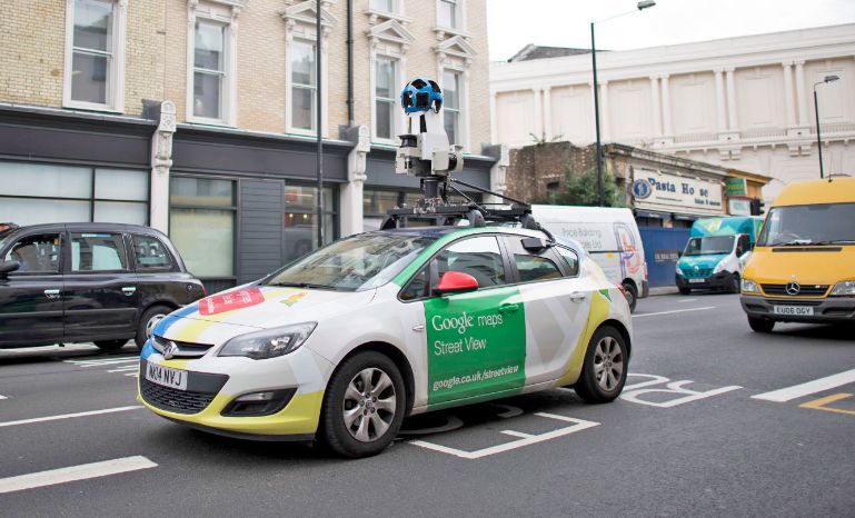
Google Street View Car
-
User Submission
Android phone users, when they enable “use wireless network positioning,” will be prompted to allow Google’s positioning service. If allowed, the user’s location information will be collected by Google. iPhone will automatically collect the Wi-Fi MAC address, GPS location information, carrier base station code, etc., and send it to Apple’s servers.
Like base station positioning, Wi-Fi positioning works well in areas with dense APs. If there are few APs, accurate positioning is difficult.
Overall, Wi-Fi positioning has significant execution challenges, and its usability and accuracy are not high. Therefore, it mainly serves as an auxiliary positioning method.
A-GPS Positioning
Speaking of assistance, we must mention A-GPS.
A-GPS, or Assisted GPS, is an enhanced function of GPS.
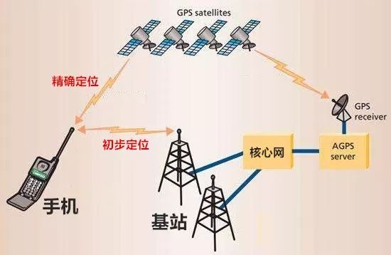
A-GPS network architecture
This technology combines GPS positioning and base station positioning.
The phone roughly determines its location through the base station and then informs the A-GPS server of this location. The server then provides the satellite parameters (which satellites, frequencies, positions, angles, etc.) passing overhead based on this location information, allowing your phone’s GPS to quickly search for satellites.
Using A-GPS, the phone’s satellite search speed is greatly increased, allowing for positioning in just a few seconds.

The above are the commonly used outdoor positioning technologies.
To be honest, the most reliable method is still satellite positioning. You may often find yourself positioned in a river; this is mostly due to the lack of satellite signal, and you get misled by base station positioning and Wi-Fi positioning.

Indoor Positioning
In fact, positioning technologies like GPS, while accurate, have a significant drawback: they cannot penetrate buildings and cannot achieve indoor positioning.
However, there is a strong demand for indoor positioning. For example, in underground parking lots, people often forget where they parked their cars. Additionally, in large shopping malls with heavy foot traffic, finding people can be challenging, and if a child goes missing, positioning is needed.

Underground parking lots really test one’s sense of direction.
In industrial settings, there is also a demand for positioning, such as tracking production lines in factories and asset management.
Now that we are talking about the “Internet of Things,” you must know where the objects are, right?

IoT, Internet of Things
What positioning methods should we adopt to meet this indoor positioning demand?
In fact, any communication technology inherently has positioning capabilities. Just like we mentioned base station positioning and Wi-Fi positioning, which are both communication technologies, they can measure location by measuring time differences.
Therefore, whatever short-distance communication technologies exist, those are the indoor positioning technologies available.
For instance, Bluetooth positioning, infrared positioning, RFID positioning, ultrasound positioning, Zigbee positioning, and UWB positioning all belong to indoor positioning technologies. Wi-Fi positioning can also be applied indoors.
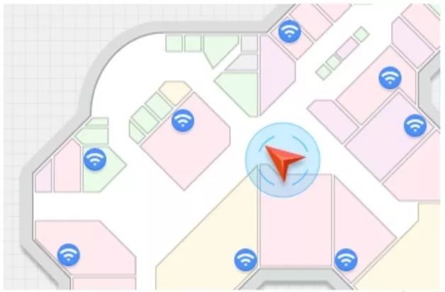
Wi-Fi Indoor Positioning
Let’s briefly introduce a few typical ones.
First, let’s talk about Bluetooth positioning.

Bluetooth is a well-known short-range, low-power wireless transmission technology.
Bluetooth positioning is achieved by installing beacons (which can emit Bluetooth signals) in designated areas to achieve precise positioning. These beacons, smaller than phones, are placed every few meters and can communicate with all mobile devices equipped with Bluetooth modules.
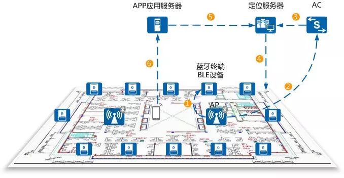
Bluetooth Positioning Networking
The advantage of Bluetooth positioning is that the devices are small, operate over short distances, have low power consumption, and are easy to integrate into mobile devices like phones. As long as the Bluetooth function of the device is enabled, it can be positioned.
When discussing Bluetooth positioning, we must mention iBeacon, a low-power precision micro-positioning service launched by Apple in 2013. It has a longer transmission distance and higher accuracy than traditional Bluetooth technology.

Another popular indoor positioning technology is UWB (Ultra-Wideband).
UWB positioning technology uses pre-arranged anchor nodes and bridge nodes with known positions to communicate with newly added blind nodes and determine their positions using triangulation or “fingerprint” positioning methods.
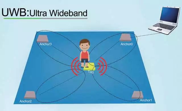
The UWB indoor positioning technology does not require the use of carriers in traditional communication systems; instead, it transmits data by sending and receiving extremely narrow pulses with nanosecond or sub-nanosecond duration, thus achieving GHz-level bandwidth.
Due to its strong penetration capability, good resistance to multipath effects, high safety, low system complexity, and precise positioning accuracy, UWB technology has a very broad prospect.
Due to space constraints, I won’t go into detail about other indoor positioning technologies.
It is worth mentioning that systems like GPS positioning and base station positioning have high barriers to entry in terms of both technology and investment, which most companies cannot afford. However, indoor positioning technology is entirely different; it does not require large investments and has much lower technical difficulties, so many companies are researching it and have produced many mature products. The market prospects in this area are quite broad.
Well, that’s it for my introduction to commonly used positioning technologies.
Finally, I want to remind everyone: positioning data is an important piece of personal privacy information that should not be illegally obtained or used for illegal purposes.
Please make sure to protect your location data and do not authorize unreliable apps to access your location information, as this may bring life-threatening risks.

Source: Fresh Date Classroom

Editor: Spiced Salt Cat Roll Rice
Recent Popular Articles Top 10
↓ Click the title to view ↓
1. Where does China come from?
2. What does a four-dimensional person look like in a three-dimensional world?
3. What have we lost in the Brazilian fire that burned nearly 20 million items in 6 hours?
4. A quick introduction to quantum mechanics; this article is enough!
5. What will you see when a camera is launched like a bullet?
6. Using just one middle school math formula, he won the lottery 14 times, changing the rules in multiple countries.
7. This is a magical paradox that 99.9% of people have never heard of (Part 2)
8. Why do we always use a pentagram to represent stars? Aren’t they spherical?
9. This is math and physics that can be understood without formulas; everyone who has seen it says it’s good (Part 1)
10. The reason my advisor forced a second author onto my paper was…
Click here to view all past popular articles