For students in the Geospatial Information Science major, the first step in learning programming is choosing a programming language. With so many programming languages available, which ones should Geospatial students learn? Here, I will introduce three commonly used programming languages in our field.
01. Python
Python is one of the most popular programming languages in geospatial analysis and general data science. Its popularity stems from Python’s high-level, human-readable syntax and great flexibility, making it a very easy-to-learn language in recent years. In the geospatial industry, it is the language that best matches ArcGIS.
Most students who want to work in internal positions will eventually end up in data analysis and processing roles. Therefore, the most useful language is arguably Python.
1. Strong support for geospatial libraries: Python has a rich set of libraries for geospatial data processing, such as GeoPandas, Shapely, Rasterio, GDAL, and PyProj. These libraries provide powerful tools for GIS data processing, analysis, and visualization.
2. Open-source and community support: Python is an open-source language with an active community and a large number of developers. This means that students in the Geospatial Information Science major can easily access the latest geospatial processing tools and libraries, while also receiving help and support from the community.
3. Easy to learn and use: Python is known for its clear and concise syntax, making it relatively easy for beginners to start. This allows GIS students to begin coding more quickly and focus on the practical applications of geospatial data processing, rather than the complexities of the language itself.
4. Cross-platform compatibility: Python can run on multiple operating systems, including Windows, Linux, and macOS, providing flexibility for GIS students to develop and deploy on different platforms.
5. Integration and extensibility: Python can integrate with other programming languages and tools, such as C/C++, Java, and .NET, as well as various GIS software systems like ArcGIS and QGIS. This integration allows Python to be used to extend existing GIS applications or create new custom solutions.
6. Data processing capabilities: Python is also very popular in data analysis and machine learning, with powerful data processing and analysis libraries such as NumPy, Pandas, SciPy, and Scikit-learn. This is particularly useful for processing and analyzing geospatial data, especially in the context of geospatial big data analysis and intelligent applications.
7. Automation and scripting: Python is very suitable for writing automation scripts, which is especially important for GIS students, as it can help automate repetitive tasks such as data conversion, map generation, and report creation.
8. Future development directions:
Python is an interpreted scripting language with hundreds of web development frameworks and many mature template technologies, making it highly efficient for web development.
Artificial intelligence is currently a hot direction, and the AI boom gives Python’s future unlimited potential. Python has many convenient libraries that are mainstream programming languages in data mining, machine learning, neural networks, and deep learning within the broad field of AI, receiving widespread support and application.
Python Resource Sharing
“Python Programming Based on ArcGIS”
“Secrets of Python Programming Based on ArcGIS” (2nd Edition)
“Python Programming: From Beginner to Practice – Directory”
“Python Beginner Tutorial”
If you need resources, scan to add GIS wizard, note: Python
02. C Language
For our Geospatial Information Science major, the highest-level positions are in low-level development, which is also the most challenging. In the geospatial industry, “development” refers to participating in the writing and development of professional software, which requires proficiency in C language. Learning C language will provide broader future development opportunities.
1. Performance advantages: C language is a compiled language, and programs written in C typically have higher running efficiency compared to interpreted languages like Python. Performance is an important consideration for GIS applications that process large amounts of spatial data and perform complex calculations.
2. System-level programming: C language provides deeper control over the operating system, allowing developers to perform low-level programming. This is an advantage for GIS system development that requires direct interaction with hardware interfaces or the operating system.
3. Memory management: C language allows programmers to manage memory manually, which is very useful for optimizing the storage and access of spatial data. Effective memory management can significantly improve program performance when handling large geospatial datasets.
4. Cross-platform capability: Programs written in C can be compiled and run on various operating systems, making C an ideal choice for cross-platform GIS application development.
5. Persistence and stability: C language has been around for decades, with a large existing codebase and stable development environment. Learning C language allows students to tap into these long-accumulated resources and knowledge.
6. Hardware interfaces: GIS applications sometimes need to interact with hardware devices like GPS devices and sensor networks. C language provides better support for these hardware interfaces, as it can directly interact with system calls and hardware-level APIs.
7. Foundation for learning other languages: C language is the foundation for many modern programming languages, including C++, C#, and Objective-C. Mastering C language can help students learn these languages more easily, thereby expanding their skill set.
8. Embedded system development: For embedded GIS applications, such as GIS functions in drones, mobile devices, and onboard systems, C language is a suitable choice due to its efficiency and low resource requirements.
Although the application of C language in the GIS field may not be as widespread as Python, it still has significant advantages in performance, system-level programming, memory management, and cross-platform development. For students in the Geospatial Information Science major who wish to gain a deeper understanding of computer systems, improve program performance, or develop embedded GIS systems, learning C language is valuable.
C Language Resource Sharing
“C Language Textbook”
“C Language Programming Exercise Analysis and Application Case Study”
If you need resources, scan to add GIS wizard, note: C Language
03. Java
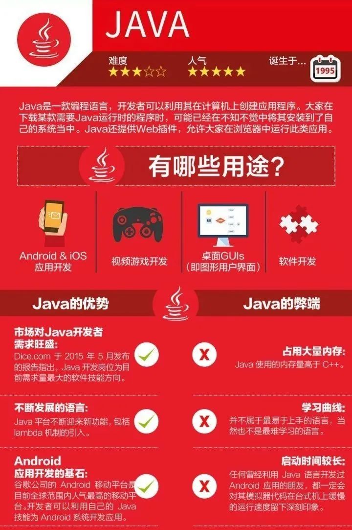
Java is a powerful programming language widely used in GIS software development. Students can focus on developing desktop GIS applications, mobile GIS applications, or web GIS platforms. Java’s cross-platform characteristics allow GIS software developed with it to run on different operating systems.
Java is very popular in enterprise application development, and GIS students can participate in the development and maintenance of large enterprise GIS systems.
Currently, it is a leader in user interfaces for web applications. Google Maps uses a lot of JavaScript, and many GIS software’s GIS API for JavaScript supports web map development, with leading open-source web map clients (OpenLayers, Mapbox GL JS) also based on JavaScript.
1. Mature GIS libraries and frameworks: Java has a series of mature GIS libraries and frameworks, such as GeoTools and GeoServer, which provide strong support for GIS application development, including data processing, map generation, spatial analysis, and more.
2. Cross-platform compatibility: Java’s “Write Once, Run Anywhere” (WORA) feature allows GIS applications written in Java to run seamlessly on different operating systems and hardware platforms, which is particularly important for GIS projects that require widespread deployment.
3. Strong enterprise-level support: Java is widely used in enterprise application development and has strong backend support, including security, transaction processing, and network communication, which is very beneficial for developing large and complex GIS systems.
4. Multithreading and concurrency: Java provides powerful multithreading and concurrency capabilities, which are very useful for handling big data and high-performance computing tasks in GIS.
5. Extensive community and resources: Java has a large developer community that provides a wealth of learning resources, documentation, and open-source projects, making it easier for GIS students to find solutions and learning materials.
6. Good employment prospects: Java is one of the most popular programming languages globally, and GIS students who master Java skills can find job opportunities in various fields of the IT industry, including software development, system analysis, and architecture design.
7. Integration with other technologies: Java can easily integrate with other technologies, such as databases (SQL, NoSQL), web services (SOAP, RESTful), and cloud services, which is very important for building comprehensive GIS solutions.
8. Object-oriented programming: Java is an object-oriented programming language, which helps build modular, scalable, and maintainable GIS applications.
9. Performance optimization: Although Java’s performance may not be as high as C language, it can still provide good performance through mechanisms like JIT compilation and garbage collection, which is usually sufficient to meet the needs of most applications in the GIS field.
10. Security: Java provides a range of security features, including sandbox execution environments and access control, making GIS applications written in Java more secure, especially when handling sensitive data.
Programming Language Resource Sharing
-
“JavaScript: The Definitive Guide” (Revised Edition)
-
“Web GIS from Basics to Development Practice (Based on ArcGIS API for JavaScript)”
If you need resources, scan to add GIS wizard, note: Java
The GIS development field is currently in a growth phase, with a high demand for talent. Students can completely enter this industry through short-term vocational training.
At New Zhongdi, we offer free trial spots in every class!
All students interested in the GIS development industry can register online to attend the free trial GIS development boot camp course.
There are three main ways to attend the trial:
1) Online live broadcast
2) Online recorded session
3) Attend a trial session at the Wuhan New Zhongdi offline campus
The course is in sync with our upcoming 2403rd GIS development boot camp!Officially starting on April 15, 2024, with a free trial available within a week