Mr. Bai Meichu’s investigation of Northern Henan was not limited to a single area. In the “Chronicles of Lu, Yu, and Jin Provinces,” he viewed the regions of Zhangde, Weihui, and Huaqing from a higher perspective of the “Hebei Circuit,” considering them as a complete geographical unit. This area, “sandwiched between the provinces of Zhili and Shanxi,” has always developed in close connection with the Taihang Mountains, the Yellow River, and the Wei River that traverse it. Jixian County, as the former administrative center of Weihui, embodies the glory, decline, and transformation of this region from the traditional postal road era to the modern railway era.
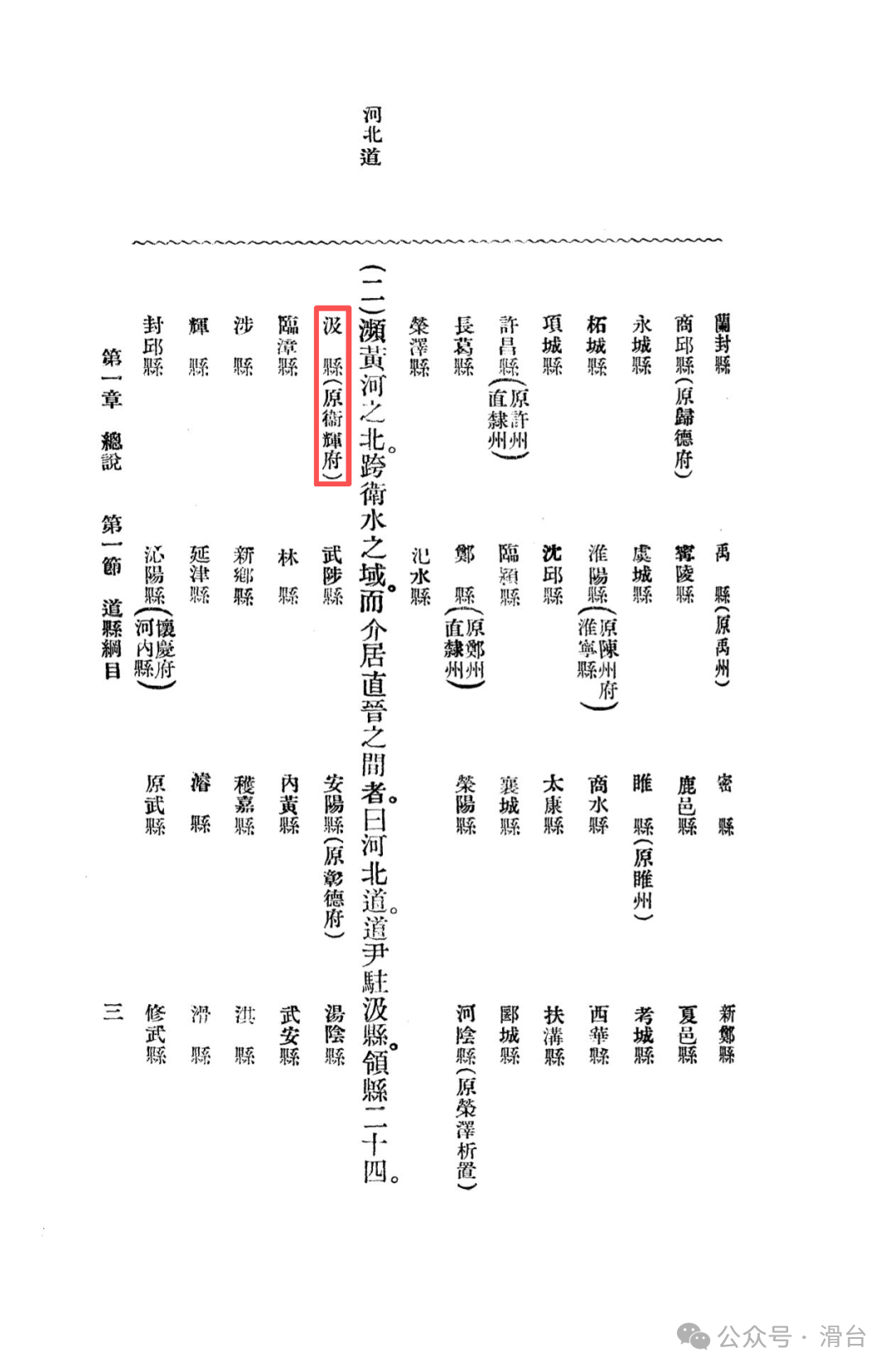
Hebei Circuit: The Geographical Pattern of Northern Henan
The Hebei Circuit is located north of the Yellow River, bordered by the Taihang Mountains to the west and the North China Plain to the east. The western region, “close to the Shanxi border, relies heavily on the Taihang Mountain range, with peaks interspersed,” while the eastern part consists of alluvial plains formed by the Yellow River’s frequent flooding and rerouting, with “the old course of the Yellow River and the long embankments of the Taihang still extending along the southeastern border.” Except for the southwestern areas where the Jishui and Qingshui rivers flow directly into the Yellow River, most belong to the Zhanghe and Wei River basins. These two major water systems have historically been the lifeblood of irrigation and transportation in the region. This macro-geographical background is the cornerstone for understanding all the characteristics of Jixian County.
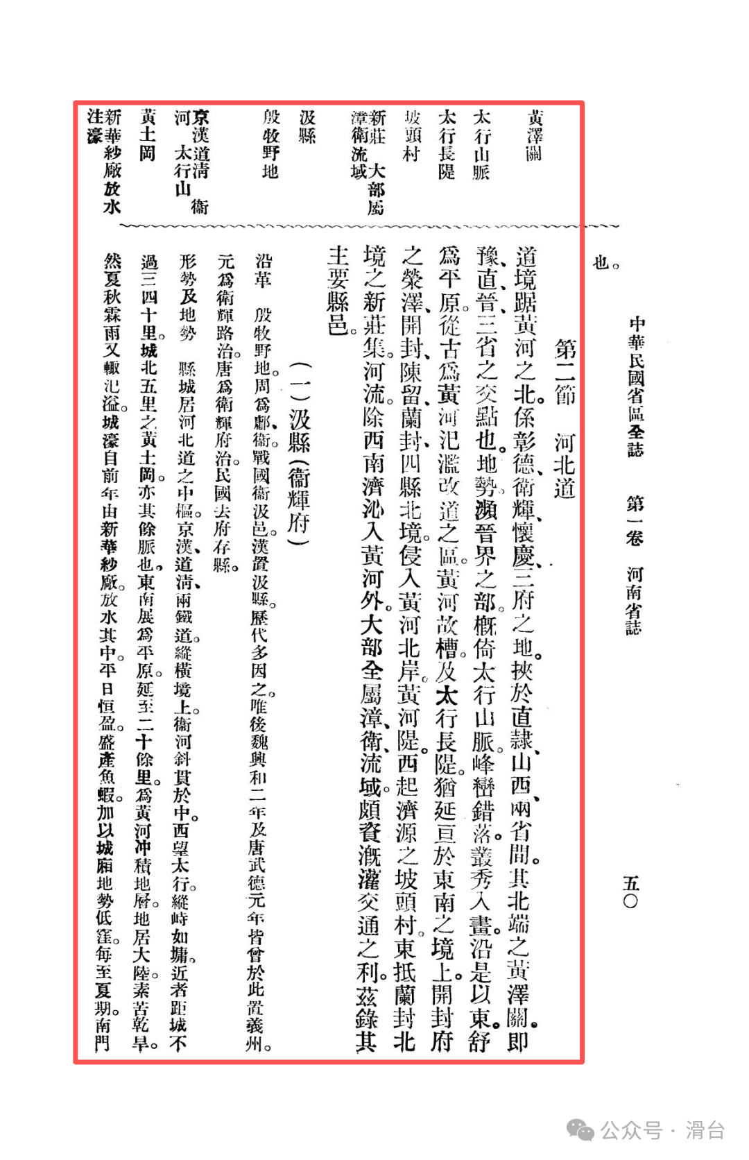
The Millennium Administrative Center of the Ancient Muyu
Jixian County is one of the regions with the richest historical heritage in Northern Henan. During the Shang and Zhou dynasties, it was known as “Muyu,” and during the Warring States period, it was called Jiyu, with Jixian officially established during the Han dynasty. Although there were occasional administrative upgrades throughout the ages (such as during the Northern Wei period when it was called Yizhou), its name and core status as a county-level administrative division have remained stable. Notably, from the Yuan to the Qing dynasties, it served as the administrative center of Weihui Road and Weihui Prefecture, making it one of the traditional administrative centers of Northern Henan. After the abolition of the prefectural system in the early Republic of China, Jixian lost its higher administrative functions, but its historical accumulation and urban scale still exist.
Geographical Advantages and Real Challenges
The local chronicles reveal the advantageous conditions and potential vulnerabilities of Jixian’s geographical location as a transportation hub.
Hub Position:The county town is located in the central area of the Hebei Circuit, where the Jinghan Railway and the Daoqing Railway intersect, and the Wei River runs diagonally through the territory, creating unique water and land transportation conditions.
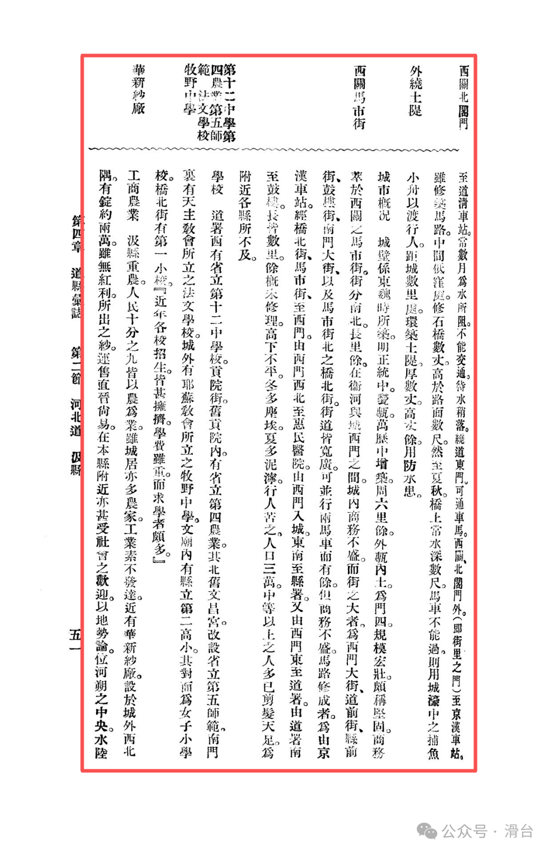
Flood Threat:However, due to the low-lying terrain of the urban area, with the southeastern part being a floodplain of the Yellow River, “continuous rainfall in summer and autumn can lead to flooding.” The chronicles document this predicament with specific examples: the section from the South Gate to the Daoqing Railway Station is often submerged for months, and the road from the West Gate to the Jinghan Railway Station can have water several feet deep on the bridge during summer and autumn, requiring the use of small fishing boats from the city moat to ferry pedestrians. To prevent flooding, an earthen embankment, several feet thick and over a yard high, had to be built around the city. The contrast between convenient transportation and flood threats is stark.
Current Urban Development
The urban form of Jixian retains the grandeur of a traditional administrative center but also shows signs of relative decline in commercial functions.
Sturdy City Walls:The city walls were first built during the Eastern Wei period and reinforced and expanded with bricks and stones during the Ming dynasty, with a circumference of six li, making them quite formidable.
Imbalanced Commercial Layout:The commercial essence of the entire city is concentrated in the Mashi Street outside the West Gate, while “business within the city is not prosperous.” This phenomenon of “commercial relocation” is a typical example of the development of outer districts driven by modern railway stations.
Municipal Progress and Road Lag:The city has a population of about thirty thousand, and “most of those with a standard of living above average have cut their braids and unbound their feet, showing a level of enlightenment not seen in nearby counties,” indicating a significant change from feudal traditions to modernity and progress in social customs. The streets within the city are wide enough to accommodate two vehicles side by side, but the planned roads “are mostly not well maintained, uneven, dusty in winter, and muddy in summer,” creating a stark contrast between ideal planning and reality.
Cultural and Industrial Development
During the Beiyang government period, Jixian presented a complex picture of vigorous educational development while industrial construction struggled.
Regional Education Center:Within the city, there are several secondary educational institutions, including the Provincial No. 12 Middle School, the Fourth Agricultural School, and the Fifth Normal School, as well as a French school established by the Catholic Church and Muyu Middle School set up by the Jesus Church. All schools“are fully enrolled, and although tuition is high, there are many students,” clearly indicating that Jixian has successfully transformed into the educational center of Northern Henan.
Isolated Modern Industry:The Huaxin Cotton Mill is located outside the city, with about twenty thousand spindles, and the cotton yarn produced has a stable market in Zhili, Shanxi, and the county itself. However, the chronicles bluntly state that it “has no profits,” reflecting the difficulty of survival for a single modern factory in a fiercely competitive and unfavorable external economic environment.
Analysis of Commercial Difficulties
The chronicles provide a profound economic geography analysis of the reasons for Jixian’s commercial stagnation, which is the insight of the entire text:
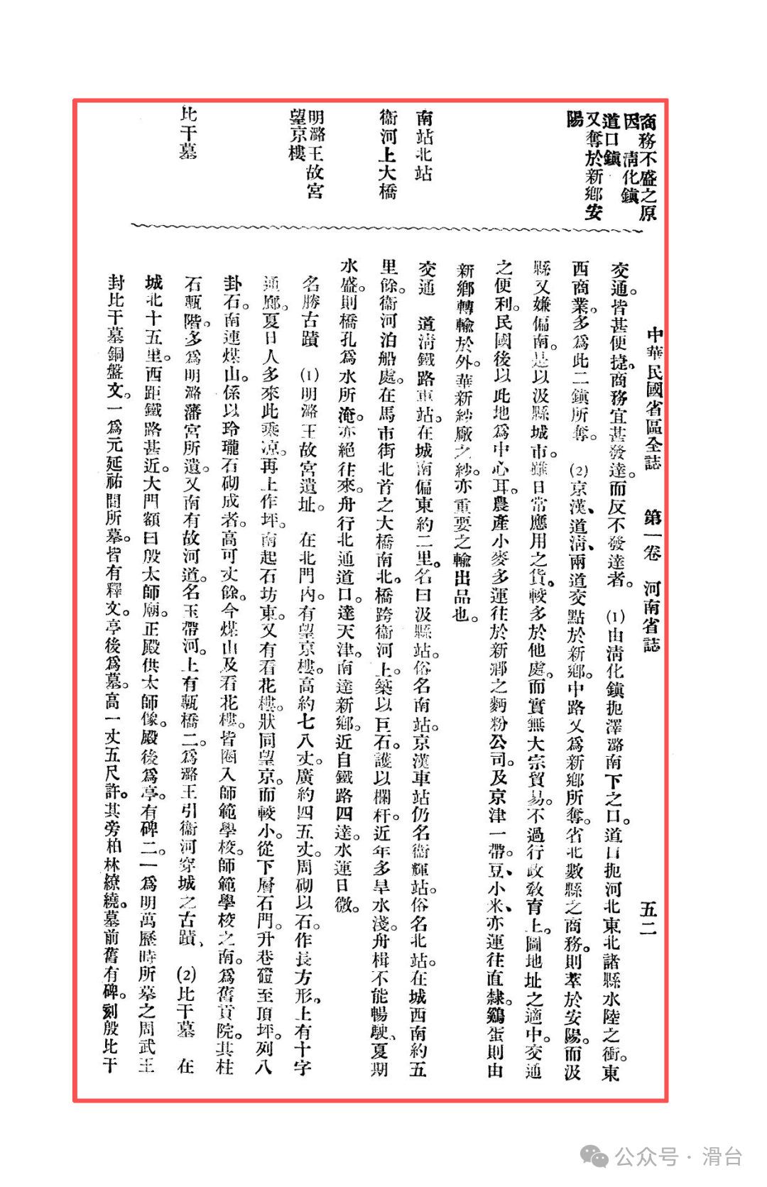
Trapped on Three Sides:“Qinghua Town controls the passage south from Zezhou and Luan’an, while Daokou Town holds the water and land junctions of the northeastern counties of Hebei,” diverting commerce in the east and west directions.
Middle Route Cut Off:“The Jinghan and Daoqing railways intersect in Xinxiang,” cutting off middle route trade.
Northward Diversion:“Commercial activities in several counties in the northern province are concentrated in Anyang.”
Although Jixian is centrally located and has convenient transportation, its commercial functions have been largely divided by surrounding towns with greater comparative advantages under the new regional economic pattern. It retains administrative and educational functions, but the loss of bulk trade means its commerce can only sustain daily needs.
Transportation and Historical Heritage
Decline of Water Transport:The Wei River navigation connects north to Tianjin and south to Xinxiang. However, “in recent years, frequent droughts have caused the river to shallow, making navigation difficult,” coupled with railway competition, leading to the inevitable decline of water transport.
Rich Historical Accumulation:The historical relics of Jixian carry a long history from the Shang dynasty to the Ming and Qing dynasties.
Tomb of Bi Gan:The temple, pavilions, steles, and trees are well preserved, especially the stele of “Yin Bi Gan’s Tomb,” which is said to be written by Confucius himself, and the stele commemorating Bi Gan from the Northern Wei dynasty, which are the most precious, symbolizing the important culture of loyalty in Huaxia.
Ruins of the Luwang Palace:The grand remains of the Ming dynasty princely residence, including the Wangjing Tower, the Flower Viewing Tower, and Meishan, still display the former royal grandeur.
Hometown of Taigong Wang:It contains the famous Mu Ziyong Wei stele, which verifies this place as the hometown of Jiang Ziya.
Other Relics:The place where Confucius struck the chime, Xiangquan Temple, etc., together form the rich historical and cultural landscape of Jixian.
In Mr. Bai Meichu’s records, Jixian in the fourteenth year of the Republic of China (1925) was a traditional central city seeking a new position amid the changes of the times. It stands in stark contrast to other counties we previously discussed:
It is not based on agriculture like Huaxian, nor is it focused on commerce like Daokou;
It does not have the mountainous terrain of Xunxian, nor does it have the clear agricultural product output direction of Yanjin;
Its hub position has been replaced by Xinxiang, and its industrial scale and historical political status are inferior to Anyang.
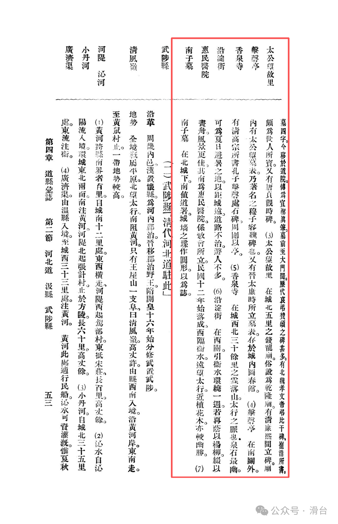
Perhaps, the unique value of Jixian lies here. It is like a teacher who has shed heavy political duties, guarding the millennium historical heritage (such as the Tomb of Bi Gan and the Luwang Palace) at the intersection of railways and canals, managing a thriving educational enterprise (numerous middle schools and normal schools), and struggling to attempt modern industrialization (such as the Huaxin Cotton Mill). Its “silence” is, in fact, an inevitable result of the reconstruction of regional economic geography; while its “rebirth” is reflected in the successful transformation from an administrative center to an educational center. This picture allows us to see the complexity and diversity of the modernization process in Northern Henan, enriching and deepening the historical and geographical tapestry of the entire region.
Previous Readings:
Memories of Northern Henan in the Republic of China: The Ancient Sites of Anyang County and Tangyin during the Beiyang Period
Memories of Northern Henan in the Republic of China: Xinxiang County during the Beiyang Period
Memories of Northern Henan in the Republic of China: Yanjin County during the Beiyang Period
Memories of Northern Henan in the Republic of China: Xunxian County during the Beiyang Period
Memories of Northern Henan in the Republic of China: Huaxian and Daokou Town during the Beiyang Period
From the Battle of Weizhou in 1232, why did the military system of Huazhou collapse?
Did ancient people also make mistakes in dates? The wisdom behind a “historical error” investigation
Excavated Brick Inscriptions Reveal: The Thousand-Mile Migration and Geographical Code of a Family Settling in Baima County, Huatai during the Tang Dynasty
The Sleeping Eight-Hundred-Year-Old Central Plains Code: Why Understanding Huaxian is Key to Understanding the Northern and Southern Dynasties?
#Anyang City #Huaxian County, Anyang City #Memories of Northern Henan #Anyang Culture #Wei River Navigation #What You Don’t Know About Henan