Mr. Bai Meichu’s investigation in Northern Henan began in the plains commercial hub, traversing through hilly prefectures, and ultimately entering the continuous mountainous regions in the west. When we turn our gaze towards Lin County, located on the eastern foothills of the Taihang Mountains, the previously observed scenes of plain agriculture, water transport trade, and railway hubs have all vanished, revealing a magnificent landscape surrounded by mountains.
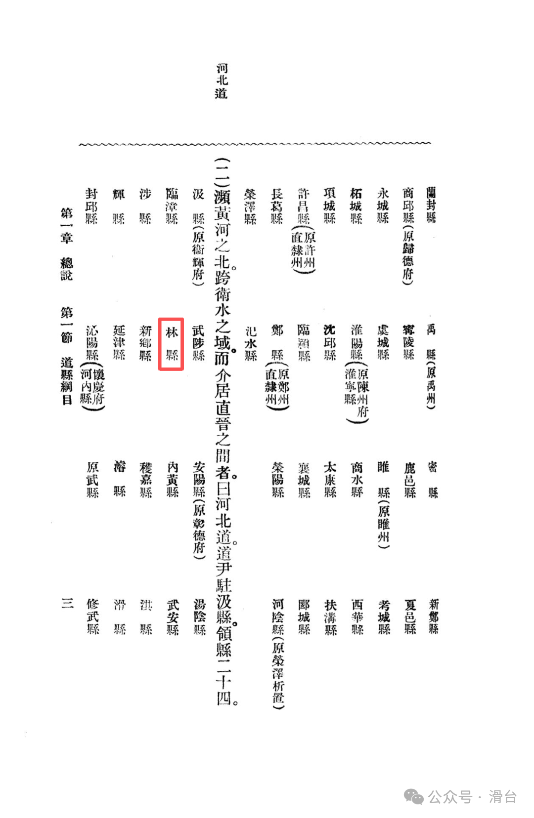
In the records, Lin County is a place defined by mountains. Due to its geographical isolation, it has preserved its natural primitive landscape and local characteristics relatively intact, serving as both a secluded paradise and an important ecological barrier in Northern Henan.
Administrative Evolution: Named for the Mountains, Transitioning from Prefecture to County
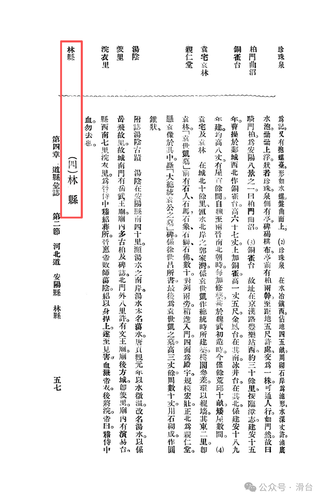
During the Warring States period, Lin County was known as Linlu County of the Han state, and during the Han dynasty, it was established as Longlu County. In the Eastern Han period, to avoid the taboo of Emperor Liu Long, the name was changed from “Longlu” to “Linlu,” which is derived from Linlu Mountain in the Taihang Mountains and has been used for a long time. Due to its important geographical position, it was once elevated to Lin Prefecture during the Jin dynasty, but in the third year of the Hongwu era of the Ming dynasty (1370), it was downgraded back to Lin County. This process of transitioning from a prefecture to a county reflects, to some extent, the historical trajectory of Lin County returning from a regional center to an ordinary mountainous town as the political and economic focus shifted.
Location and Topography: A World Surrounded by Mountains
The records begin by highlighting the core characteristics of Lin County: “120 miles east of Anyang, at the eastern foothills of the Taihang.” The summary of its topography describes the entire region as a winding mountain range with undulating hills, aptly using the phrase “surrounded by mountains.” The northern boundary is defined by the Zhuozhang River, while the southern boundary crosses the Qi River, with the Huan River originating here and traversing the central region. Lin County constitutes an independent geographical unit enveloped by mountains and rivers.
Mountains: A Convergence of Nature and Culture
The mountainous section of Lin County is the most captivating chapter in the records. Mr. Bai Meichu, as both an explorer and scholar, takes us deep into the secret realms of the Taihang Mountains.
Linlu Mountain and the Three Peaks:
Twenty miles west of the city lies Longlu Mountain (i.e., Linlu Mountain), the main mountain range, which features three major peaks: the Southern Peak Xianren Tower, the Central Peak Yunu Platform, and the Northern Peak Luban Gate. From the names, one can easily discern the cultural and folk imaginations embedded within.
The Mystique of Huanghua Mountain:
As the first peak of Linlu Mountain, the scenery of Huanghua Mountain is meticulously recorded: from the densely wooded valley entrance to the oddly shaped stones of Mingyu Gorge, Mingyue Pool, and the Huanghua Temple at the bend of the stream. Among these, the most astonishing is Zhu Lian Spring, “spraying down like a silk curtain, light and shimmering,” reading it evokes the refreshing sensation of the mountain spring. The site of the upper temple also contains the ruins of the summer palace of Gao Huan from the Northern Qi dynasty, indicating that this place has long been a retreat for the powerful.
The Peril of Tianping Mountain:
South of Huanghua Mountain, Tianping Mountain has a road that ascends along the cliffs for about ten miles, with eighteen turns, and the scenery is described as “six peaks piercing the sky, like the wings of a roc hanging in the air, and whales surfacing in the sea, magnificent and breathtaking.” The records compare it to Tiantai Mountain in Zhejiang, asserting that it surpasses in “lofty and ethereal” aspects. The narrow paths in the mountain can only lead to Luan’an in Shanxi (now Changzhi, Shanxi), “not allowing carriages,” vividly reflecting the local transportation’s isolation and geographical seclusion.
Hydrology: The Sources of Three Rivers and the Wonders of Subterranean Flow
Lin County is the source or transit point for several important rivers in Northern Henan, and its hydrological phenomena are quite distinctive.
The Three Rivers: Zhang, Qi, and Huan:
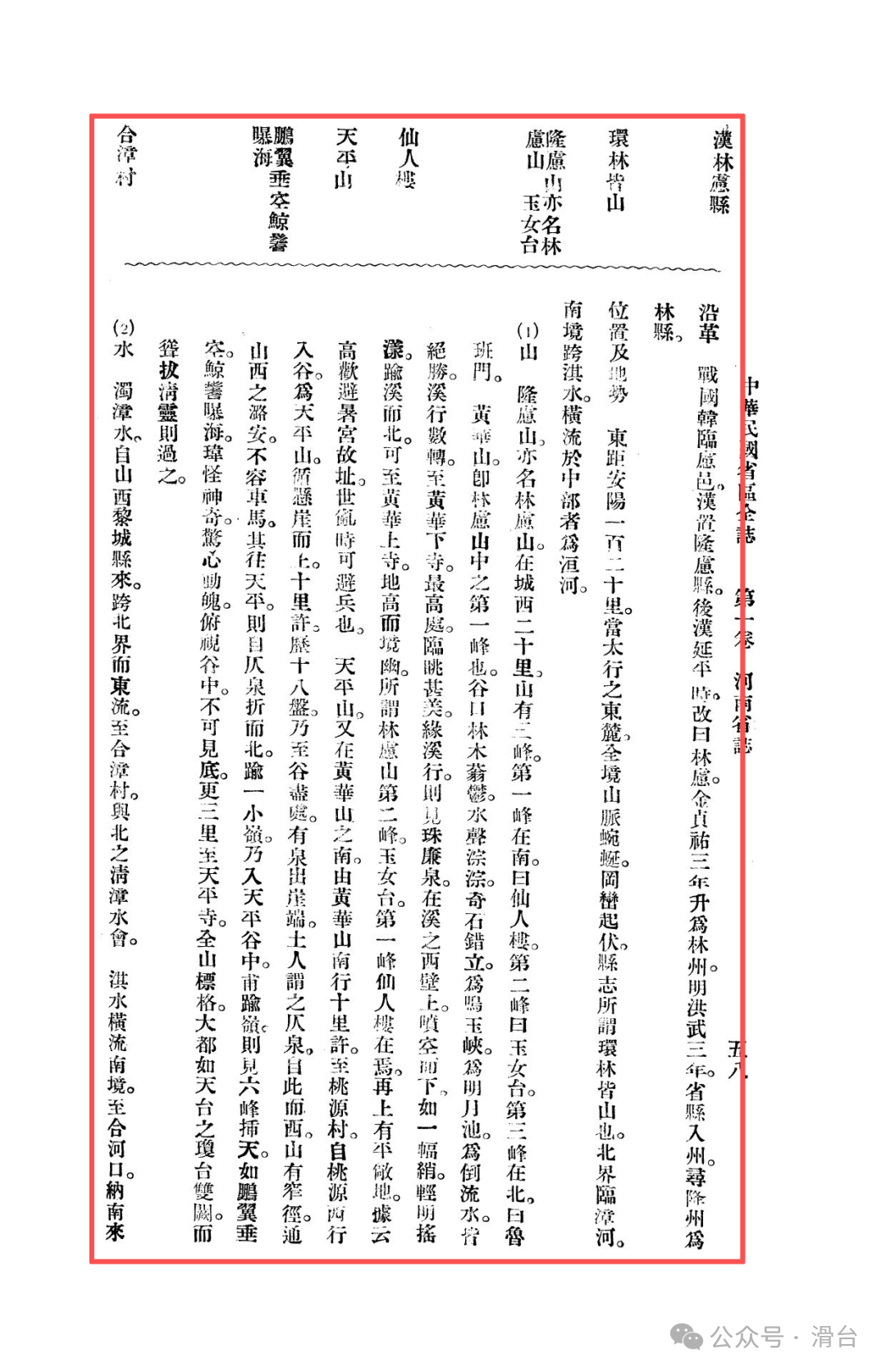
The Zhuozhang River flows along the northern boundary, while the Qi River crosses the southern boundary, both flowing eastward out of the county.
Subterranean Flow of the Huan River:
The most peculiar phenomenon is the Huan River, which flows northeast to Longtoushan and then submerges underground for about two hundred miles, re-emerging at Longshan on the western boundary of Anyang County. This two-hundred-mile-long underground flow is a rare phenomenon in regional geography, revealing the hidden connection between Lin County and Anyang in terms of groundwater resources.
Cities, Products, and Transportation: The Self-Sufficiency and Limitations of the Mountain City
Compared to the magnificent natural scenery, the urban and economic life of Lin County appears simple and introspective.
Scale of the Mountain City:
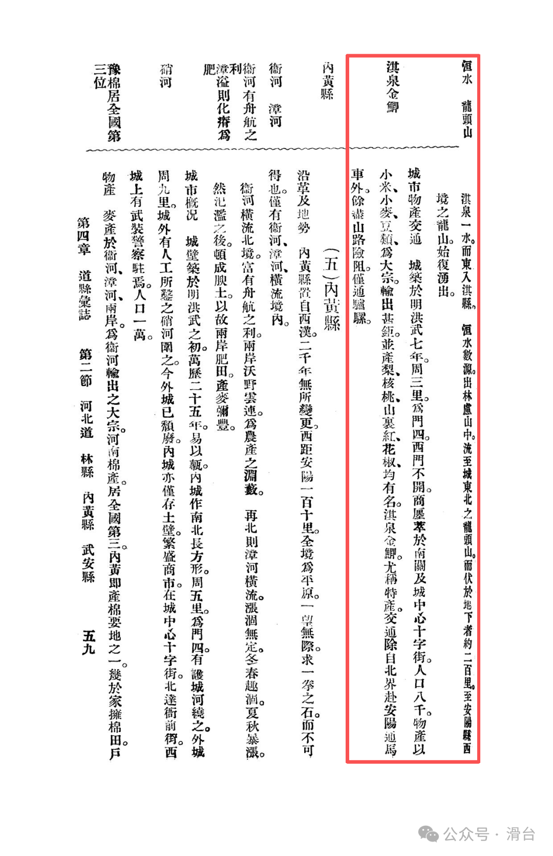
The county town was established in the early Ming dynasty, with a circumference of only three miles, making it relatively small. Shops are concentrated in the southern gate and the cross streets within the city, with a population of about eight thousand, typical of a small mountainous town layout.
Products:
The main agricultural products are millet, wheat, and beans, with a large output, becoming an important supplement to the grain supply in the Northern Henan plains. Special products such as pears, walnuts, mountain hawthorn, Sichuan pepper, and Qi Spring golden carp all bear distinct marks of the mountainous region and are of high quality.
Transportation Isolation:
Except for the road to Anyang in the north that can accommodate horse-drawn carriages, other roads into the mountains “only allow donkeys and mules.” This transportation condition not only restricts economic development but also provides a premise for the preservation of natural landscapes.
In Mr. Bai Meichu’s narrative, Lin County’s positioning in Northern Henan is clear and unique. When placed within the broader regional context:
Huaxian is the granary, Daokou is the commercial hub, together forming the foundation of the plain economy;
Xun County is a military fortress and center of faith, guarding historical and spiritual traditions;
Yanjin is a land supply line, Xinxiang is a new railway hub, representing the transformation of transportation methods;
Anyang is the regional core, integrating politics, industry, and culture;
Jixian is the educational and cultural center, finding a new positioning after the decline of commerce;
Wuzhi is the gateway to the Yellow River, connecting north and south with an iron bridge, holding a key position.
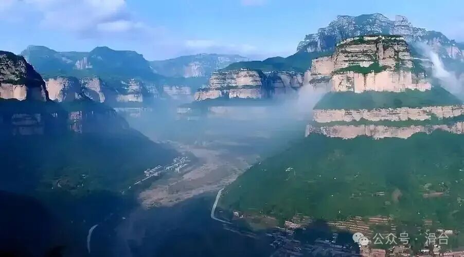
And Lin County, then, is the ecological backdrop and natural sanctuary for all of this. It is the “water tower” of Northern Henan (the source of the Zhang, Qi, and Huan rivers) and the “back garden.” Its value lies not in participating in the economic division of the plain region, but in preserving a precious natural heritage with its majestic, perilous, and serene diverse topography, becoming a tranquil place to escape worldly chaos.
Previous Readings:
Memories of Northern Henan in the Republic of China: Wuzhi County during the Beiyang Period (Qing Dynasty Hebei Road stationed here)
Memories of Northern Henan in the Republic of China: Hebei Road and Jixian during the Beiyang Period (original Weihuifu)
Memories of Northern Henan in the Republic of China: Anyang County and Tangyin Historical Sites during the Beiyang Period
Memories of Northern Henan in the Republic of China: Xinxiang County during the Beiyang Period
Memories of Northern Henan in the Republic of China: Yanjin County during the Beiyang Period
Memories of Northern Henan in the Republic of China: Xun County during the Beiyang Period
Memories of Northern Henan in the Republic of China: Huaxian and Daokou Town during the Beiyang Period
From the Battle of Weizhou in 1232, examining why the military system of Huazhou collapsed
Did ancient people also make mistakes in dates? The verification wisdom behind a “historical error”
Excavated brick inscriptions reveal: the thousand-mile migration and geographical code of a family settling in Huatai Baima County during the Tang Dynasty
The sleeping eight-hundred-year-old Central Plains code: why understanding Huaxian is key to understanding the Northern and Southern Dynasties?
#Henan Linzhou #Anyang Lin County #Northern Henan Memories #Henan Tourism Culture #Linlu Mountain #What You Don’t Know About Henan