Following the footsteps of Mr. Bai Meichu’s investigation, we traveled south from Anyang and Jixian, reaching the throat that connects Northern Henan with the Central Plains—— Wuzhi County.The gazetteer records that Wuzhi, presents a unique appearance defined by the Yellow River’s perilousness and the accessibility provided by bridges. It is not only a key location on the northern bank of the Yellow River but also a vivid testament to the modern railway breaking through geographical barriers and connecting the north and south. As the seat of the Hebei Circuit during the Qing Dynasty, Wuzhi’s strategic position in the region is thus evident.
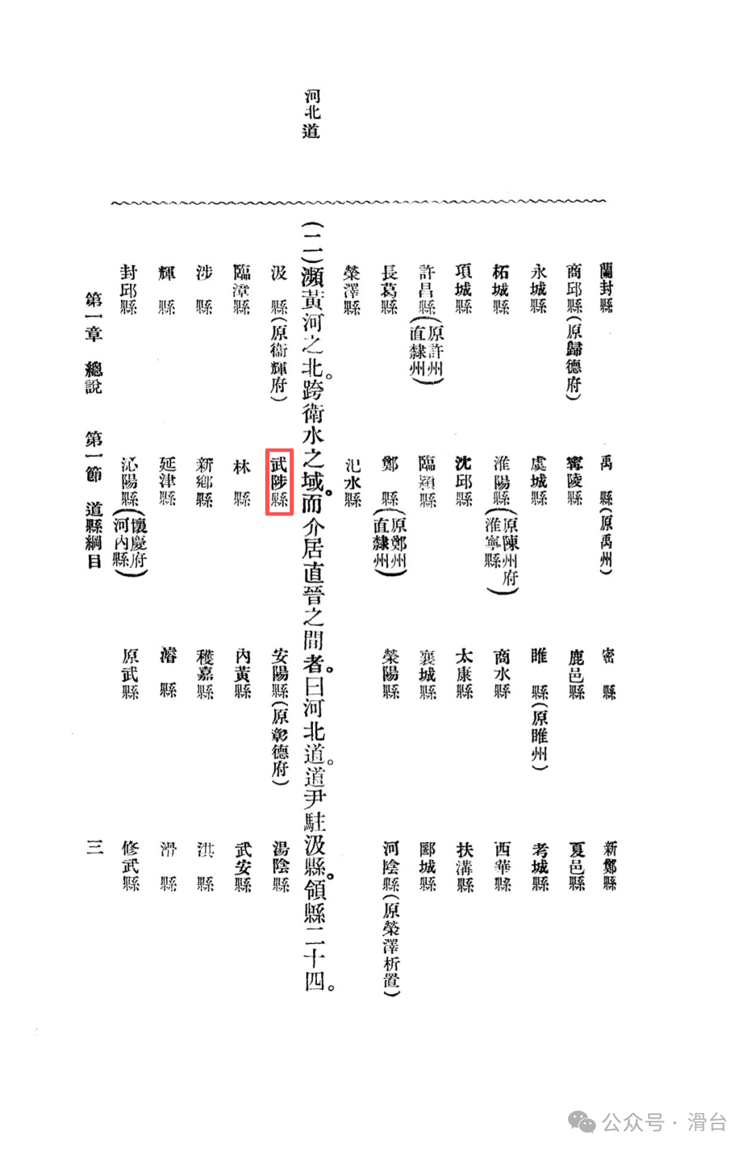
Administrative Evolution: From County Seat to Circuit Office
Wuzhi has a long and rich history. During the Zhou Dynasty, it was part of the royal territory, and in the Han Dynasty, Huai County was established here, which at one point became the seat of He’nan County, indicating its early importance. After the Jin Dynasty, although the county seat was relocated, Wuzhi’s status as a regional center remained. It was not until the sixteenth year of the Kaihuang era of the Sui Dynasty (AD 596) that a portion was separated from Xiuwu County to establish Wuzhi County. Notably, during the Qing Dynasty, it became the seat of the Hebei Circuit, overseeing civil affairs in the three prefectures of Zhangde, Weihui, and Huaqing, until it was abolished in the early Republic of China. This history endowed Wuzhi with administrative functions and political influence that surpassed those of an ordinary county.
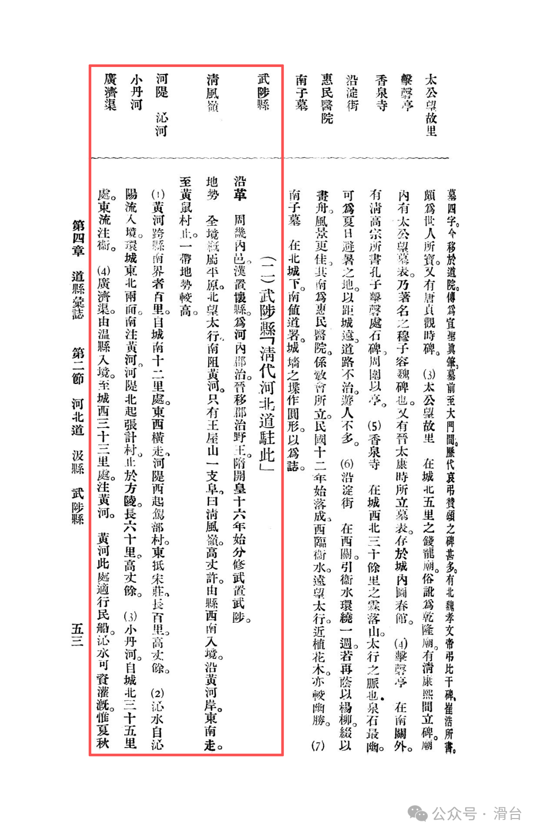
Topography and Hydrology: A Plain Defined by Rivers
The entire area of Wuzhi is primarily flat, but its micro-topography is significantly shaped by river systems such as the Yellow River and the Qin River.
The geographical pattern: Looking north towards the Taihang Mountains and south towards the Yellow River, forms the macro-geographical framework of Wuzhi. The only mountain range within its borders is the Wangwu Mountain foothills“Qingfeng Ridge,” which is only about one zhang high, resembling a continuous earthen ridge extending southeast along the Yellow River bank.
Water System Distribution:
The Yellow River flows through the southern boundary of the county for about a hundred miles, with high riverbanks serving as a natural barrier to the south.
The Qin River flows in from Qinyang, encircling the northeastern sides of the county town, ultimately merging into the Yellow River, forming“Qin Water Surrounding the City,” a unique landscape.
The Xiaodan River flows east into the Wei River, and the Guoji Canal comes from the west to merge into the Yellow River, together forming a dense irrigation network. The gazetteer records that “Qin water can be used for irrigation, but it poses a threat to the people during the summer and autumn floods,” revealing the coexistence of local irrigation and water disasters.
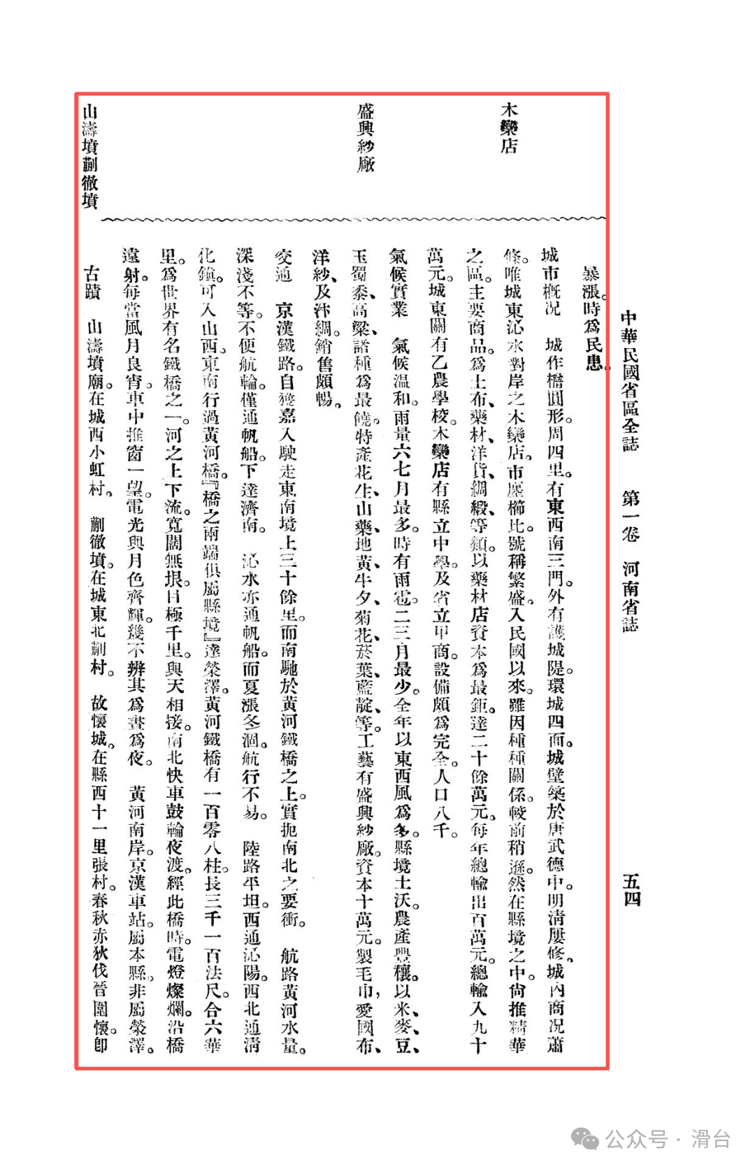
Urban Layout: A Tale of Two Cities and the Rise and Fall of Commerce
Unlike most county towns, Wuzhi presents a“two centers in one county” layout.
Main City Decline:The county town was built during the Tang Dynasty’s Wude era, in an oval shape, with a circumference of four li, and its commerce is relatively stagnant. This contrasts sharply with its glorious administrative history, suggesting a shift in its economic vitality.
Prosperity of Muluandian:The real prosperity lies across the Qin River to the east in Muluandian. Here,“shops are densely packed, claiming to be prosperous,” making it the actual economic center of Wuzhi County. Major products include coarse cloth, medicinal materials, foreign goods, and silk, among which the medicinal material shops are the most capital-rich, reaching over twenty thousand yuan, showcasing its professional status as a distribution center for medicinal materials. The county’s annual output is about one million yuan, with an input of about nine hundred thousand yuan, indicating active trade.
Cultural and Educational Facilities:In the eastern city gate, there is a Yinan School, and Muluandian has a county high school and a provincial commercial school, indicating relatively complete educational facilities. With a population of about eight thousand, it reflects the cultural and educational heritage of the former administrative center.
Climate, Products, and Industry: Fertile Agriculture and Challenging Industry
Climate and Products:The climate is mild with concentrated rainfall. The land is fertile, and agricultural products are abundant, mainly producing rice, wheat, beans, corn, and sorghum. Special products include peanuts, yam, rehmannia, ox knee, chrysanthemum,tobacco leaves (tobacco leaves) and indigo, among others, showcasing the diversity of the agricultural economy.
Modern Industry:There is a Shengxing Cotton Mill with a capital of one hundred thousand yuan, producing towels, patriotic cloth, foreign yarn, and Bian silk, with sales being relatively good. This is similar to the situation of the Huaxin Cotton Mill in Jixian, both being difficult attempts at modern industrialization in an agricultural region.
Transportation: The Key to North-South Communication
This part represents the core value of Wuzhi and is the fundamental characteristic that distinguishes it from other counties in Northern Henan.
Beijing-Hankou Railway and the Yellow River Iron Bridge:The Beijing-Hankou Railway runs through the southeastern part of the county and crosses the Yellow River here. The gazetteer vividly describes the Yellow River Iron Bridge: “It has one hundred and eight pillars, is three thousand one hundred legal feet long, equivalent to six li, and is one of the world’s famous iron bridges.” Even more captivating is the description of crossing the Yellow River at night: “Electric lights are brilliant, shining far along the bridge… the electric light and moonlight shine together, making it hard to distinguish day from night.” This bridge is not only an engineering marvel but also a symbol of Wuzhi as a key hub for north-south transportation.
Water and Land Assistance:The Yellow River and Qin water can accommodate sailing boats, but are greatly affected by seasonal water volume changes. The land routes are flat, connecting west to Qinyang, northwest to Qinghuazhen into Shanxi, and southeast across the Yellow River bridge to reach Rongze. It is worth noting that the Beijing-Hankou Station on the south bank of the Yellow River also belongs to Wuzhi County, extending its control over transportation lines to the south bank of the Yellow River.
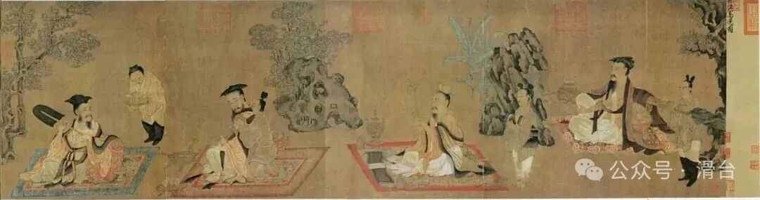
“The High and Lofty Picture” by Tang Sun Wei, depicting from right to left, Shan Tao, Wang Rong, Liu Ling, and Ruan Ji
Historical Sites: Scattered Imprints of History
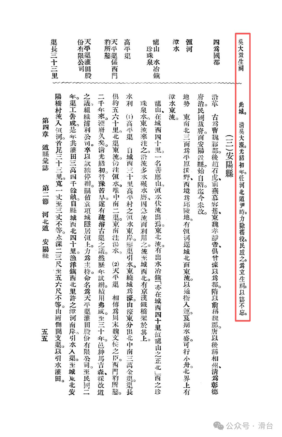
Compared to Anyang and Jixian, Wuzhi’s historical sites appear more scattered, but still have highlights: there is the tomb temple of the famous Jin Dynasty scholar Shan Tao (one of the Seven Sages of the Bamboo Grove), the tomb of the Han Dynasty debater Kuai Che, and the ruins of the ancient Huai City from the Spring and Autumn period. During the Guangxu era of the Qing Dynasty, Wu Dacheng, the governor of the Hebei Circuit, abolished harsh taxes, and the people built a shrine for him, marking a rare record of good governance in the Qing Dynasty.
In Mr. Bai Meichu’s grand narrative, Wuzhi County’s unique role is clear and crucial. When we place it within the entire map of Northern Henan:
It is not an industrial and ancient capital like Anyang
It is not a cultural and educational center like Jixian
It is not a hub for internal logistics and commerce like Daokou and Xinxiang
The true role of Wuzhi is as the“gateway” and “bridge” of Northern Henan and even the entire northern China. It defines the traditional north-south geographical boundary with the Yellow River’s natural barrier and breaks this boundary with its magnificent iron bridge. The history of being the seat of the Hebei Circuit during the Qing Dynasty grants it a high-level administrative perspective; while the existence of the Beijing-Hankou Railway Yellow River Bridge makes it an irreplaceable transportation backbone in the modernization process. The products here are distributed through Muluandian, and trains cross the Yellow River day and night. Wuzhi, in its unique way, tells us: some places derive their core value not from internal output, but from their location and their strategic significance as a passage.
Previous Readings:
Memories of Northern Henan in the Comprehensive Gazetteer of the Republic of China: The Beiyang Period of the Hebei Circuit and Jixian (Formerly Weihui Prefecture)
Memories of Northern Henan in the Comprehensive Gazetteer of the Republic of China: The Beiyang Period of Anyang County and Tangyin Historical Sites
Memories of Northern Henan in the Comprehensive Gazetteer of the Republic of China: The Beiyang Period of Xinxiang County
Memories of Northern Henan in the Comprehensive Gazetteer of the Republic of China: The Beiyang Period of Yanjin County
Memories of Northern Henan in the Comprehensive Gazetteer of the Republic of China: The Beiyang Period of Xun County in Henan
Memories of Northern Henan in the Comprehensive Gazetteer of the Republic of China: The Beiyang Period of Huaxian and Daokou Town
From the Battle of Weizhou in 1232, examining why the military system of Huazhou collapsed
Did ancient people also make mistakes in dates? The wisdom behind a “historical error”
Excavated brick inscriptions reveal: the migration of a family settling in Baima County, Huatai, during the Tang Dynasty and the geographical code
The sleeping code of the Central Plains for eight hundred years: why understanding Huaxian is key to understanding the Northern and Southern Dynasties?
#Jiaozuo Wuzhi #Henan Wuzhi County #Memories of Northern Henan #Henan Culture #Wei River Navigation #What You Don’t Know About Henan