Drones are small remote-controlled aircraft, meaning they are unmanned aerial vehicles. They resemble helicopters or reconnaissance planes, and undoubtedly one of their advantages is their versatility in various applications.
The compact size of drones allows them to be packed into canvas backpacks or even held in the palm of your hand, making them our best allies in different situations: they can monitor crops, detect leaks, track endangered species, search for people in emergencies, assist in weather forecasting, expedite power grid inspections and maintenance tasks, and extend working hours.Different drones can operate at varying altitudes and distances. Very close-range drones typically can travel three miles and are mostly used by hobbyists. Short-range drones have a range of about 30 miles. Medium-range drones can fly 90 miles, mainly used for espionage and intelligence gathering. Long-range drones, known as “endurance” drones, can exceed 400 miles and reach altitudes of up to 3,000 feet.Due to their remote control capabilities and ability to fly at different distances and altitudes, drones are ideal candidates for undertaking some of the world’s most challenging tasks. They can be found assisting in search and rescue operations after hurricanes, deterring law enforcement and military forces in terrorist situations, and advancing scientific research in some of the Earth’s most extreme climates. Drones have even entered our homes, serving as recreational tools for hobbyists and as essential equipment for photographers. Aerial Photography
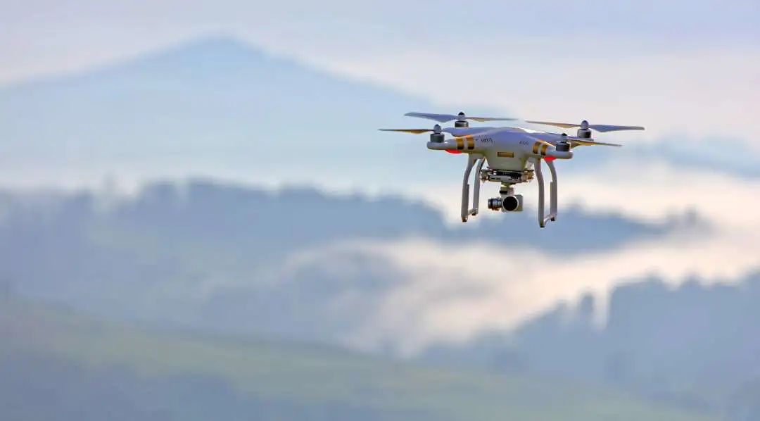 Drones for aerial photography offer advantages such as high clarity, scalable proportions, and the ability to cover larger areas. They are particularly suitable for capturing aerial images of linear areas (roads, railways, rivers, reservoirs, coastlines, etc.). Moreover, unmanned aerial vehicles provide a convenient and easily portable remote sensing platform for aerial photography. They can take off and land with minimal site restrictions, operating on playgrounds, roads, or other open grounds, with good stability and safety, making transitions very easy.Small, lightweight, low-noise, energy-efficient, highly maneuverable, and clear imaging are standout features of drone aerial photography.Traffic Monitoring
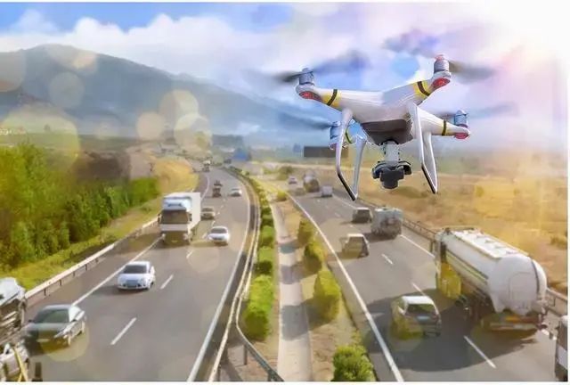 Drones can regularly monitor traffic conditions. Urban traffic networks have a wide coverage area, and due to the differences between commercial areas, workplaces, and residential areas, the regions prone to traffic congestion can vary, making manual road traffic inspections and assessments very difficult. However, drones equipped with monitoring devices can regularly inspect frequently congested traffic routes and stream the monitored footage in real time to application platforms. Once congestion or traffic accidents are detected, nearby law enforcement personnel will be immediately notified to take action.Drones can monitor quickly and accurately, allowing predefined routes and time periods to be set for real-time inspections.Emergency Rescue
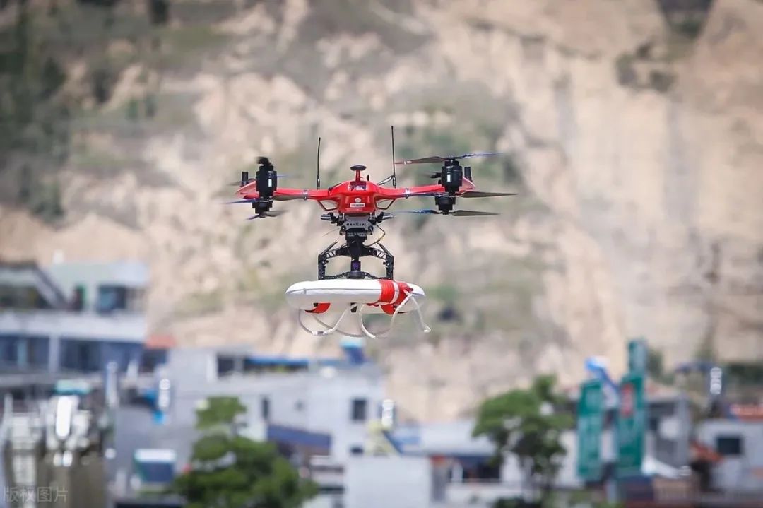 Firefighting emergency rescues are crucial for life and property safety and require professional teams, advanced equipment, and rapid responses. In an increasing number of rescue scenes, drones are seen weaving in and out alongside frontline personnel. In the national firefighting industry skills competition, two out of three subjects in the “fire communication officer” project involve drone tasks, namely drone aerial reconnaissance and precise drone drop-offs. This shows that drones have evolved from being “backup personnel” in firefighting and rescue operations to becoming an indispensable force.In complex environments such as mountainous areas, where vehicles cannot pass easily, it may take several hours for personnel to reach the scene on foot, while a drone can arrive within 10 minutes, quickly locating trapped individuals. If assistance is needed, drones can also deliver life rings, water, and food supplies.Forest Firefighting
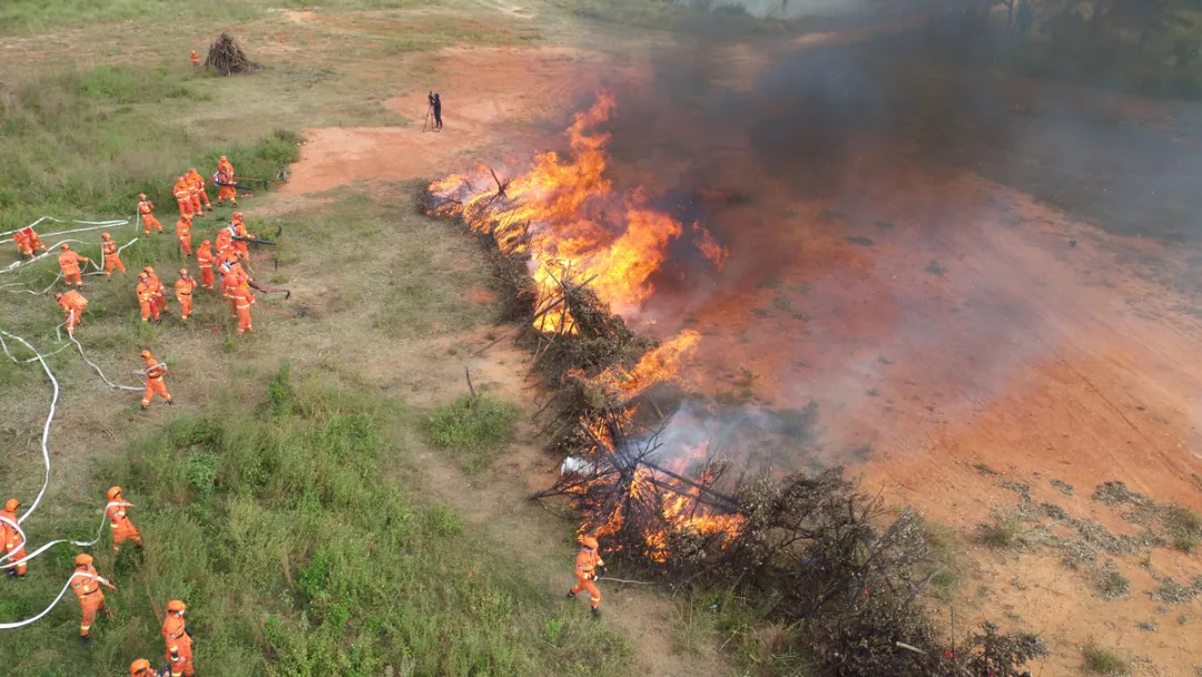 Drones’ rapid aerial imaging transmission, portability, and safety characteristics enable fire command centers to quickly analyze situations and make decisions when facing fire incidents.Most forest fire prevention operations rely on the characteristics of drone accessories to function effectively. This allows for the improvement of data transmission skills and efficiency while keeping the drone engine fixed, and the existing drone systems possess relatively mature command structures that can better adapt to drone data resources. During the application of drone technology, image quality can be effectively enhanced through image resource control, ensuring that all forest fire prevention work can be handled using drone technology. A significant number of drones can realize their application value in conjunction with modern technology.Power Inspection
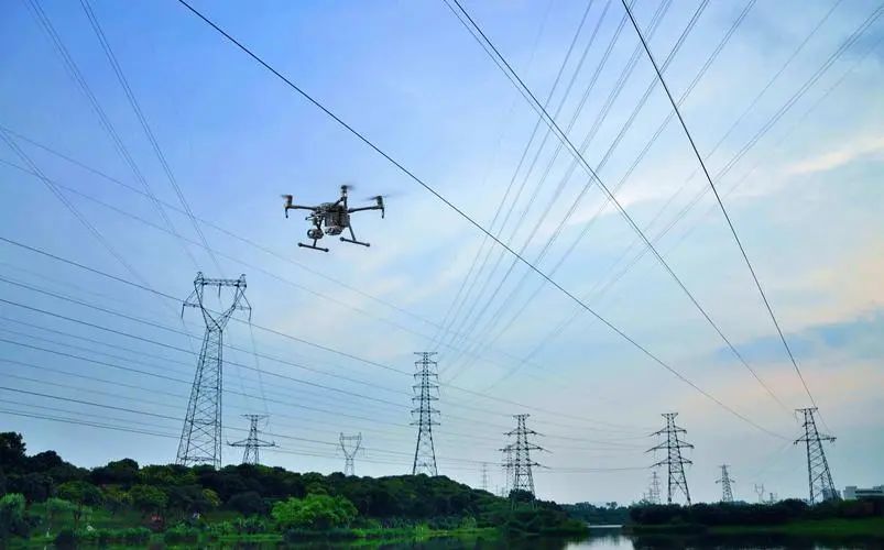 Using drones in conjunction with power transmission construction not only greatly improves work efficiency but also solves construction challenges in complex environments such as crossing rivers, roads, power lines, valleys, and farmland, achieving safe and efficient line laying, accumulating valuable experience for similar future operations, and avoiding damage to vegetation and farmland, thus effectively protecting the environment. This significantly enhances the quality of line inspections, fault detection efficiency, and accuracy.Geological Exploration
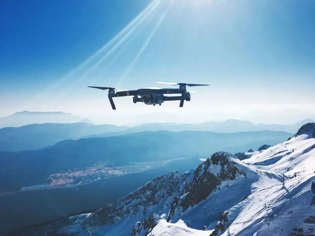 Drones are gaining attention in the resource exploration industry due to their unrestricted space, fast speeds, and high imaging efficiency. They can perform tasks that are dangerous, unstable, and prone to sudden changes while obtaining highly accurate primary geological data, thus protecting the safety of workers.Drones can capture fundamental geological parameters such as the structure, occurrence, and elevation of geological bodies. High-precision aerial photography can even determine rock types and stratification by comparing color differences and particle states through software processing. Models can also be used to conduct geological analysis of entire areas from a macro perspective by integrating surrounding geological terrain, saving geological survey personnel time and effort while significantly improving the efficiency of geological survey work.Aerial Patrol
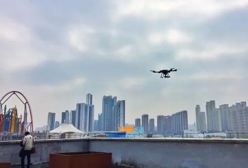 Drones for aerial patrol overcome adverse factors in daily law enforcement processes, such as the inability to see high-altitude situations and blind spots. They can perform aerial inspections without blind spots, accurately lock onto targets, and facilitate remote photographic evidence collection, thereby improving law enforcement efficiency. Drones can effectively free up manpower and address challenges such as limited visibility, low efficiency, and ensuring worker safety.News Scene
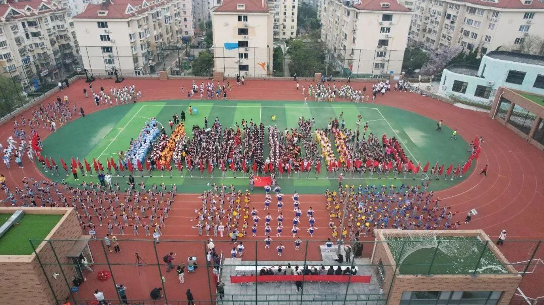 Drones can quickly reach news scenes to complete aerial tasks. Drone aerial photography, with its unique perspective, convenient operation, and reliable quality, has found widespread application in the news industry.In news practice, operators can use drones for aerial photography, presenting viewers with a more authentic and visually impactful experience. When using drones for interviews, the aircraft operator can easily control the drone to fly forward, backward, upward, or downward to achieve the desired technical effect. Additionally, techniques such as “zoom in and out” can achieve fixed-point circling, tracking shots, diagonal flights, straight-line flights, and other complex movements that are difficult for traditional cameras to execute.The “God’s eye view” of drones can comprehensively showcase and restore the scene from an overhead perspective, providing a novel visual experience while also highlighting the spatial relationship between the scene and surrounding areas, enhancing viewer impressions.Environmental Protection
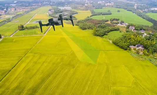 Drones can be used to observe air, soil, vegetation, and water quality conditions, tracking and monitoring sudden environmental pollution events in real time. They can also be employed for environmental law enforcement, using collection and analysis equipment to patrol specific areas and monitor emissions of waste gases and wastewater from factories. Moreover, they can be used for environmental remediation, spraying catalysts and meteorological probes from the air to eliminate smog.Agricultural Pest Control
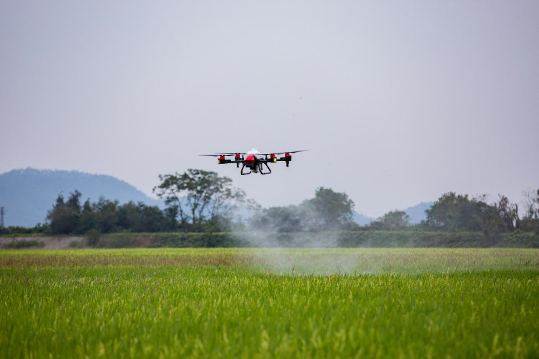 Agricultural pest control is the largest market for civilian drones, utilizing integrated high-definition digital cameras, spectral analyzers, thermal infrared sensors, and other devices to fly over farmlands, collecting data to assess crop risk situations, insurance rates, and more.(Source: U-Fly Drones)