On May 19, China successfully launched the Ocean No. 2D satellite using the Long March 4B rocket from the Jiuquan Satellite Launch Center. The satellite successfully entered its designated orbit, marking a complete success for the mission and heralding the era of tri-networking for China’s ocean dynamic environment satellites.

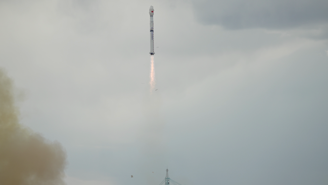 Photo by Wang Haidong
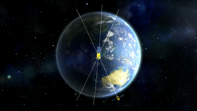
Establishment of China’s First Ocean Dynamic Environment Monitoring Network
According to information released by the National Space Administration, the Ocean No. 2D satellite is the third operational satellite in the national space infrastructure’s ocean dynamic satellite series. It will work alongside the Ocean No. 2B and Ocean No. 2C satellites to form China’s ocean dynamic environment satellite constellation. The primary functions include observing sea surface wind fields, sea surface heights, significant wave heights, gravity fields, and ocean currents, providing strong support for sea condition forecasting, storm warning, precipitation forecasting, surface analysis, and global climate change research.
The National Space Administration is responsible for the organization and management of the Ocean No. 2D satellite project. The China Academy of Space Technology and the Shanghai Academy of Space Technology, both under the China Aerospace Science and Technology Corporation, are responsible for the development of the satellite and launch vehicle systems, respectively. The Satellite Launch and Control System Department is in charge of the launch site and control system implementation, while the Ministry of Natural Resources serves as the user department, with the National Satellite Ocean Application Center responsible for ground system and application system construction.
It is reported that this satellite will form a network in orbit with the Ocean No. 2B satellite launched in 2018 and the Ocean No. 2C satellite launched in 2020, establishing China’s first ocean dynamic environment monitoring network. For over a decade, the Ocean No. 2 satellite development team has adhered to a design philosophy of “multi-functionality and integration,” continuously optimizing and upgrading the capabilities of the Ocean No. 2B, C, and D satellites to monitor ocean dynamic environment data such as sea surface wind fields, sea surface heights, significant wave heights, and sea surface temperatures with all-weather, all-time, and high-precision capabilities.
With the tri-networking, the global ocean monitoring coverage capability exceeds 80%, significantly improving the efficiency and accuracy of ocean monitoring, reaching an internationally leading level, and will efficiently serve China’s efforts in disaster prevention and reduction, maritime traffic, and the development of the marine economy.
Sea Surface Wind Power, Wave Data, Fishing Ground Distribution… All You Need to Know
The Ocean No. 2 series satellites are equipped with microwave scatterometers, which can effectively measure sea surface wind power, with wind speed measurement accuracy better than 2 meters per second, providing a strong guarantee for the timeliness and accuracy of typhoon forecasting. A satellite designer from the Aerospace Science and Technology Group’s Fifth Academy explained that after the Ocean No. 2D satellite is put into orbit, it will further enhance monitoring and warning capabilities, providing important support for disaster prevention and reduction in coastal cities and global disaster monitoring.
Since the launch of the Ocean No. 2B satellite, a ship automatic identification and data collection system has been added based on the Ocean No. 2A satellite, enabling automatic identification of global vessels and the ability to receive, store, and forward buoy measurement data from China’s coastal and other sea areas. Additionally, the navigation system of the Ocean No. 2D satellite has been fully upgraded, featuring dual-mode data reception capabilities for GPS and BeiDou, further enhancing navigation capabilities. Furthermore, after the networking of the Ocean No. 2B, C, and D satellites, precise surveying of the positions, headings, and speeds of vessels on the global sea surface will be achieved, providing important support for global maritime positioning, navigation, and search and rescue operations.
The Ocean No. 2 series satellites are equipped with radar altimeters, which can obtain data on significant wave heights, ocean currents, and global sea waves. This equipment works in conjunction with calibrated radiometers to timely acquire global ocean wave data, effectively monitoring and predicting hazardous waves, with observation accuracy reaching an internationally leading level. The Ocean No. 2 series satellites are also equipped with microwave radiometers for measuring sea surface temperatures, complemented by radar altimeters to identify fronts and mesoscale eddies in the ocean, providing reliable data support for detecting the distribution of ocean fishing grounds. It is understood that since the Ocean No. 2 series satellites have been in orbit, several fishing companies have utilized data from the Ocean No. 2 satellites for promotion in deep-sea fishing, achieving a 5% reduction in fuel consumption and a 2% to 3% increase in catch, resulting in significant economic benefits.
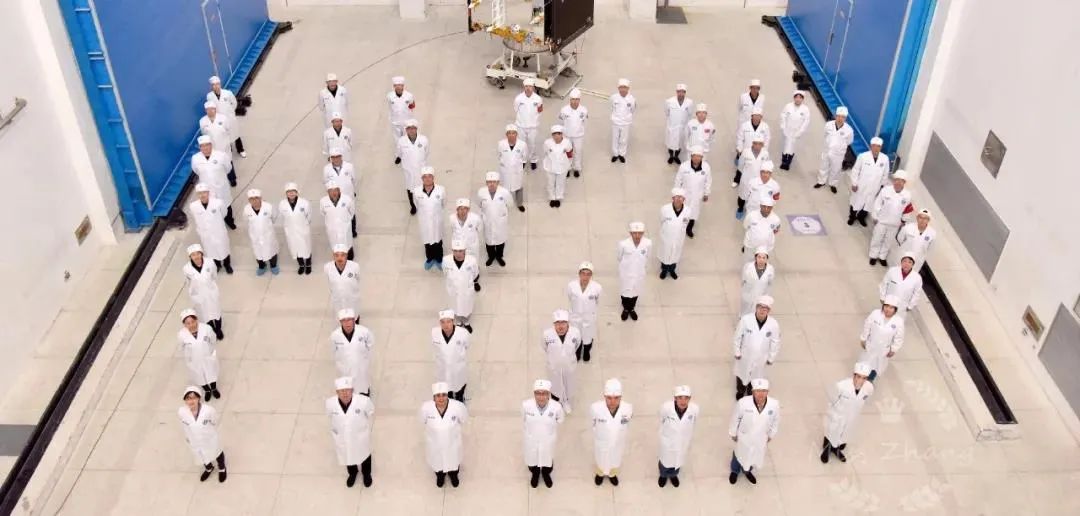
The Ocean No. 2D satellite development team. Photo provided by the Aerospace Science and Technology Group’s Fifth Academy
Entering the “Hourly Level” Era of Global Ocean Monitoring
In addition to measuring significant wave heights, the radar altimeters on the Ocean No. 2 series satellites can also accurately measure global sea surface heights. A satellite designer from the Aerospace Science and Technology Group’s Fifth Academy explained that the Ocean No. 2D satellite’s sea surface height measurement accuracy is better than 5 centimeters, reaching an internationally advanced level, and will provide data support for global climate research. The Ocean No. 2A satellite launched in 2011 has stable sea level change monitoring capabilities, and with the launches of the Ocean No. 2B and Ocean No. 2C satellites, continuous observations have been achieved, contributing high-quality measurement data for global sea level observations, integrating the Ocean No. 2 series satellites into the global sea level observation application system.
The successful launch of the Ocean No. 2D satellite will also leverage the advantages of the ocean dynamic environment satellite networking, further enhancing continuous observation capabilities and significantly improving China’s data support capabilities for adapting to climate change, showcasing the responsibilities and mission of a major country in supporting and serving global climate change research. Moreover, the Ocean No. 2B, C, and D satellites operate on different orbits, and their networking will usher in the “hourly level” era of global ocean monitoring. Zhang Qingjun, the chief designer of the Ocean No. 2 satellites, stated that previously, a single satellite could only observe the globe once every 20 days, which could not meet the demands of maritime transport, ocean fishing grounds, marine scientific research, and maritime safety. However, with the establishment of China’s first ocean dynamic environment monitoring network, global ocean observations will only require 6 hours. After the tri-networking, the observation grid interval of the Ocean No. 2 satellite network will be better than 100 kilometers, reaching an internationally advanced level. Compared to the total area of the global ocean, the observation accuracy is equivalent to being able to read a newspaper on a football field. Zhang Qingjun stated that the “China Ocean Star Network” woven by the Ocean No. 2B, C, and D satellites in space will provide “Chinese strength” for better development, protection, and utilization of the ocean by humanity.
(Comprehensive report from Xinhua News Agency)
If you like this article, please click “See More” in the lower right corner. This article is exclusively edited by the WeChat public account “iNatural Media” of the China Natural Resources Newspaper. Unauthorized reproduction is prohibited, including on public accounts. Please indicate the source: iNatural Media prominently when reprinting. iNatural submission email: [email protected]. Phone: 010-68024627.
iNatural Media
Reporter: Zhao Ning
Editor: Zheng Yanan
Review: Zhao Jiandong, Lan Shengwei
Approval: Zhao Xiaotao