
With the implementation of the water-stabilized base layer and base construction for the expansion project of the G5 Jingkun Expressway from Guangyuan to Mianyang by China Railway Fifth Bureau, key technical parameters such as paving thickness, flatness, and compaction have all met standards. The advantages of the “3D printing-style pile-free intelligent paving + unmanned compaction cluster” system have once again been validated in actual construction, breaking through industry technical bottlenecks and improving road construction efficiency by 30%, with flatness errors controlled within 3 millimeters, setting a new benchmark for intelligent road construction.
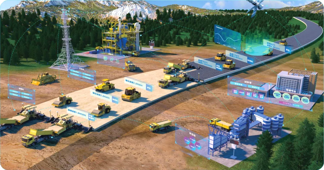
What are the remarkable features of this intelligent system? How does it achieve “intelligent” precise construction? With these questions in mind, we visited the construction site of the Guangmian Expressway LM4 section to decode the “intelligent code” of road construction.
3D Printing-Style Pile-Free Intelligent Paving: Achieving Millimeter Precision in Road Surface
In the construction of highways, the quality control of the geometric shape of each structural layer is limited by traditional measurement techniques, which commonly use cross-section measurement methods. However, the lack of on-site data between two measurement sections fails to fully reflect the true geometric shape of the road. In traditional road construction, workers need to set steel piles every 10 meters on-site, and then guide the paver to level the work using hanging lines.
This method not only consumes a lot of manpower but also leads to flatness errors of 2-3 centimeters due to pile position deviations and collisions. To address this, China Railway Fifth Bureau applied the 3D printing-style pile-free intelligent paving system in the Guangmian Expressway LM4 section, completely solving this construction shortcoming, which relies on two core technologies.
1. 3D Modeling: Creating a “Digital Blueprint” for the Construction Road Surface

The 3D printing-style pile-free intelligent paving technology comprehensively applies optical positioning, communication, and intelligent sensing technologies to achieve automatic leveling of the paver, allowing precise control of design elevation, material thickness, and flatness during road paving construction. Before construction, technicians import the road design’s vertical and horizontal curves, cross-section, and super-elevation parameters into the system to generate a 3D road model. This model serves as an accurate “digital blueprint” down to the millimeter, containing elevation, slope, and coordinate information for each point, automatically adjusting the paving thickness based on the undulations of the next structural layer. It reduces the thickness in areas with continuous elevations and increases it in depressed areas, eliminating factors that cause uneven road surfaces from the source.
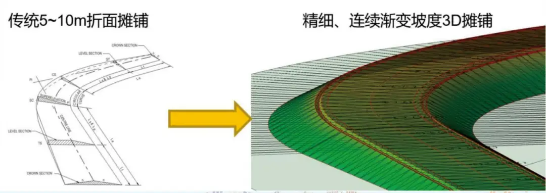
“In the past, we relied on manual calculations for slopes, which could lead to multiple errors over a 100-meter section; now the model automatically generates data with zero manual intervention throughout the process,” a technician pointed to the 3D model on the screen. The model generated by the system includes accurate and detailed pile numbers, cross slopes, longitudinal slopes, coordinates, etc., avoiding human calculation errors and improving construction efficiency and precision. Before paving, the entire road surface is scanned with a scanner, and through point cloud processing (denoising, modeling), data analysis (elevation verification, flatness calculation, theoretical volume calculation), the material usage for each section of the road is calculated in advance, avoiding the traditional construction issues of “over-paving waste and under-paving rework.”
2. Intelligent Control System: The “Smart Brain” of the Paver
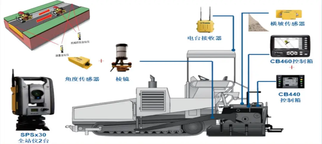
The core of the intelligent control system is the “trinity” control system.
Onboard part: The paver is equipped with a 3D controller, cross slope sensors, hydraulic controllers, etc., acting like “nerve endings” to perceive the machine’s posture in real-time.
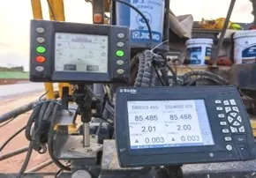
External part: Two total stations act like “eyes,” using advanced imaging scanning technology, with angle measurement accuracy of 1 second, distance measurement accuracy of 2 millimeters, and scanning speed of 26,600 points/second, with a scanning distance of 600 meters. They can perform camera aiming and true color data acquisition, integrating 3D scanning with total station technology for one-click output of result data. One total station locks onto the optical target on the paver, achieving real-time positioning accuracy of 3 millimeters; the other tracks the rear prism to verify the paving elevation.
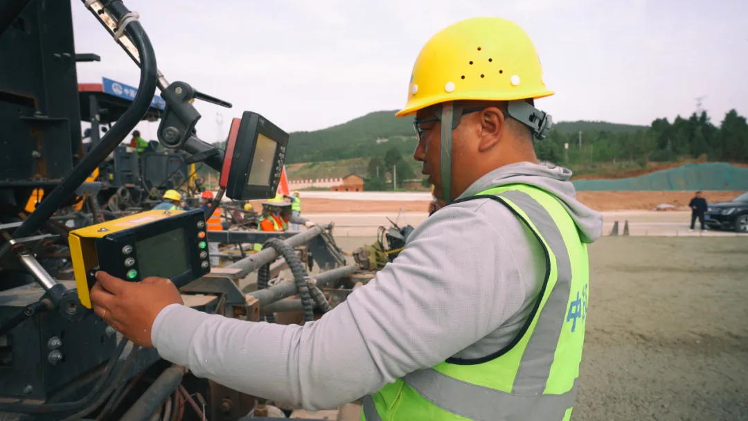
Digital construction cloud platform: As the “brain,” it compares on-site data with the design model, sending adjustment instructions to the hydraulic system 30 times per second to control the elevation of the leveling plate, ensuring that the paving thickness and slope match the set values.
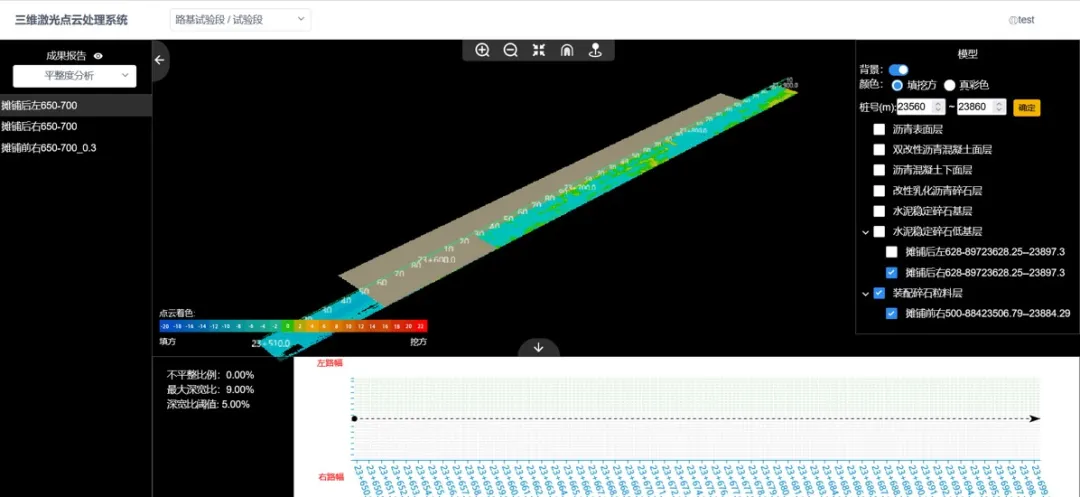
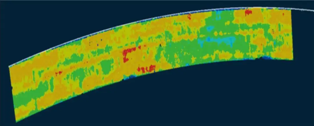
Before operation, the project team must reasonably layout and install digital intelligent paving equipment based on the type of on-site paver and debug it, exporting the road design model to the paver’s 3D control system to guide intelligent paving and perform elevation verification and other tasks. During operation, the intelligent control system controls the paver’s work based on the 3D model and scans the paved road surface, analyzing flatness and thickness in conjunction with pre-paving data. After importing the two sets of scanning data before and after paving into the platform, it calculates the actual paving thickness, generating a color map and cross-section thickness values. After integrating scanning point cloud and other data on the platform, it allows for visual viewing and sharing on the Web and APP.
At the construction site, the paver operates autonomously along the “digital trajectory,” no longer requiring manual hanging lines or pile setting. “In the past, setting piles for several hundred meters could keep several workers busy for a whole day; now, once the equipment is turned on, it can perform precise construction and can work continuously for 24 hours,” said the paver operator.
Unmanned Compaction Cluster: The “Steel Team” Significantly Enhancing Efficiency
1. Beidou Navigation + Intelligent Coordination:Millimeter-Level “Dance Choreography”
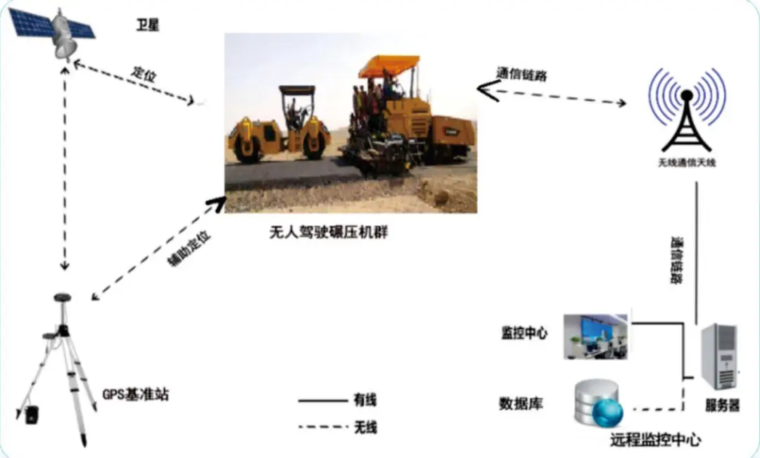
The unmanned roller relies on the high-precision Beidou positioning system it carries, achieving a planar positioning accuracy of 2 centimeters. Combined with millimeter-wave radar and laser sensors, it can obtain precise positioning through the CORS network and sense obstacles within 10 meters—when encountering anomalies, it slows down at 10 meters and performs emergency braking at 5 meters, reacting several times faster than humans.
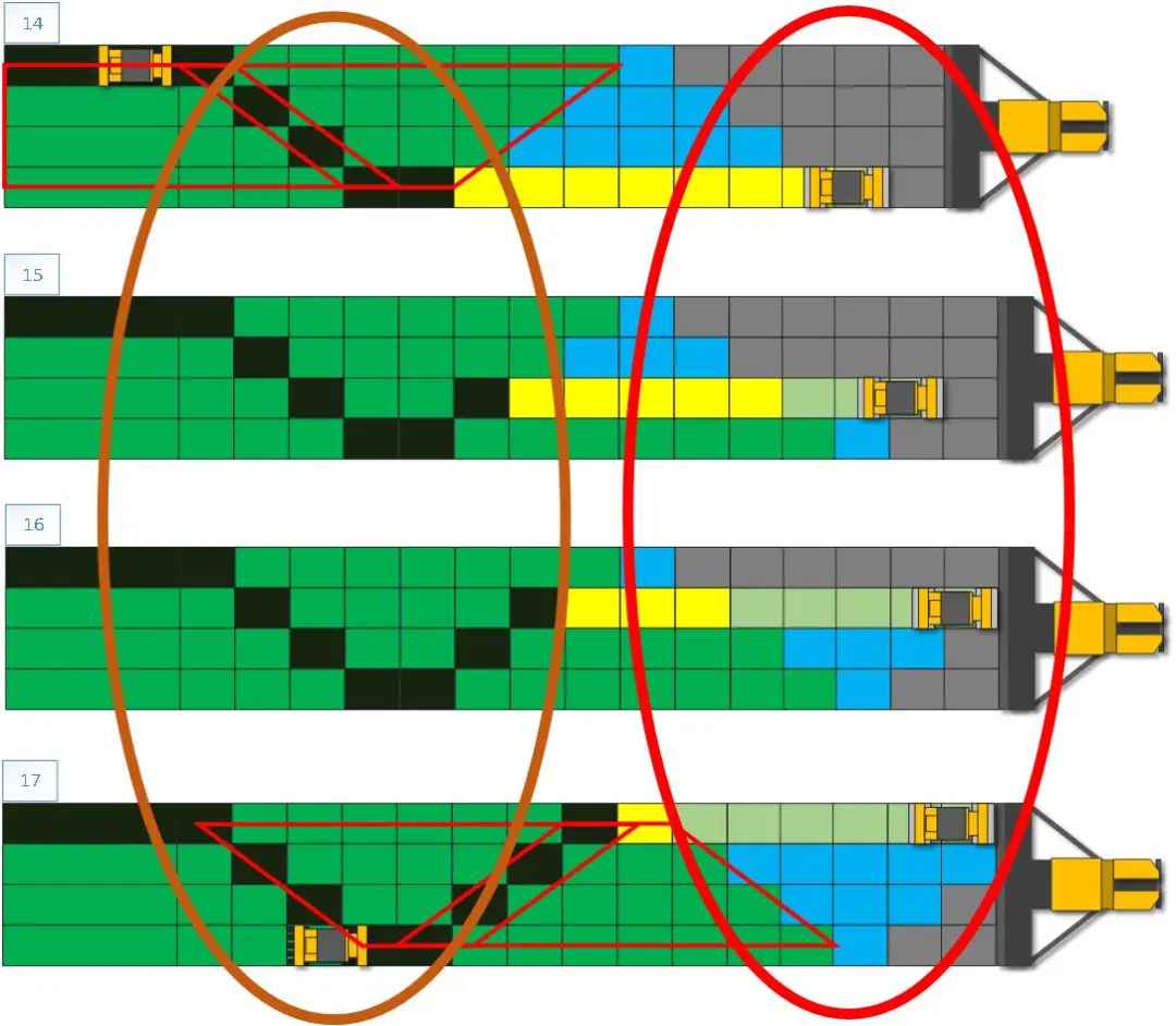
“The water-stabilized layer adopts a block-by-block progressive strategy, with clear divisions for initial compaction, re-compaction, and final compaction.” On-site construction personnel demonstrated the construction plan, stating that during compaction, each roller synchronously compacts within its designated area, and after compaction, they continue to move forward. Combining millimeter-level data collection for counting passes, cluster construction is carried out according to the set strategy, ensuring no over-compaction or under-compaction occurs.
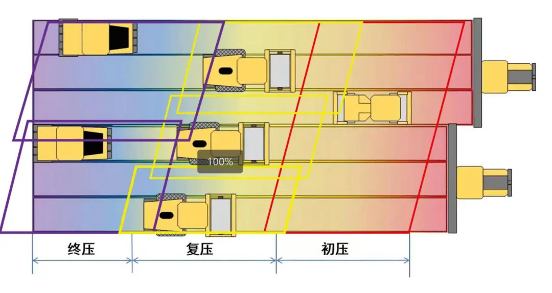
For asphalt surface construction, which must follow the principles of close following and slow compaction, a trapezoidal advancing strategy is adopted. The initial compaction equipment must closely follow the paver, compacting the area as the paver moves. The unmanned cluster compaction operation for asphalt must be carried out with a same-in-same-out strategy, forming overlapping compaction areas to ensure timely elimination of parking wheel tracks, greatly enhancing construction flatness.
2. Three-Level Braking + Intelligent Scheduling: A “Safety Officer” More Reliable than Humans
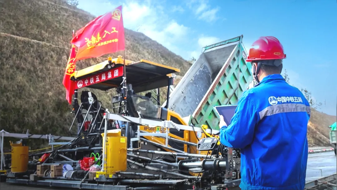
To ensure the safety of the equipment cluster during construction, the system has set up three levels of protection.
Remote emergency stop: Monitoring personnel can stop all equipment with one click on a tablet;
Automatic obstacle avoidance: Radar installed at the front and rear of the vehicle performs real-time scanning, automatically braking when encountering people or obstacles;
Physical emergency stop: Each piece of equipment is equipped with an emergency button on the outside, allowing workers to manually shut it down at any time.
Since the system was implemented, the Guangmian Expressway LM4 construction site has achieved “zero safety accidents,” with nighttime construction efficiency improved by 50%. Traditional construction often halts at night due to worker fatigue; now unmanned equipment can operate continuously, completing the workload of on-site personnel in three days within 24 hours.Full Process Intelligent Management: Data-Driven “Transparent Construction Site”
In the intelligent management backend, various construction data is displayed in real-time on the screen: paver speed, roller compaction speed, current road slope, flatness… This reflects the “digital twin” of 3D paving and unmanned cluster compaction technology, achieving traceability and controllability throughout the construction process.
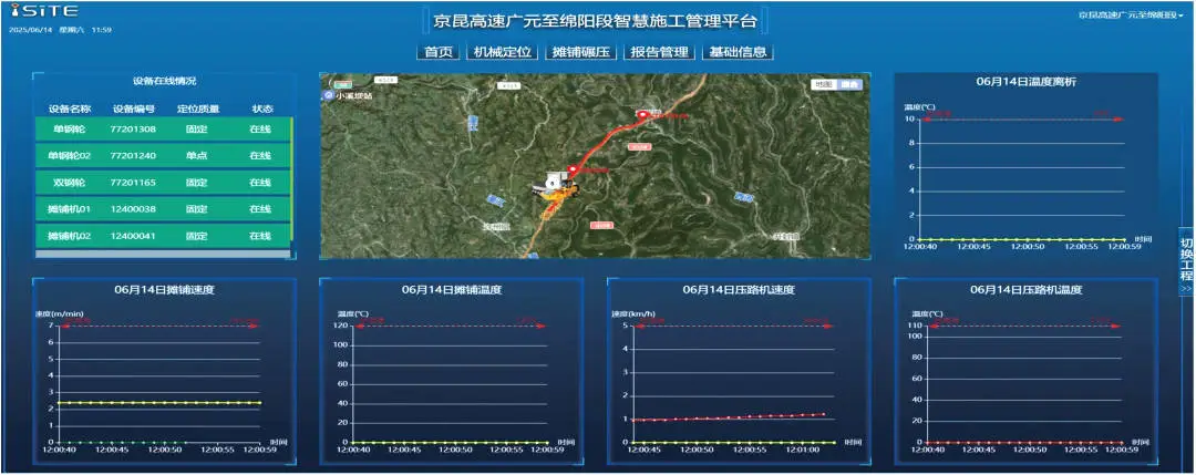
1. Full-Cycle Data Closed Loop: On-site paving, compaction, and testing, each link achieves intelligent control and digitalization. In terms of quality testing, the project team adopts a new type of four-legged mechanical dog 3D scanning process to replace the original manual scanning process, completing 500 square meters of road scanning in just 10 minutes. The generated point cloud data can accurately calculate thickness and slope, being 8 times faster than manual testing; in terms of the early warning system, when the paving speed is too fast or compaction is abnormal, the intelligent management platform automatically sends alerts to management personnel.
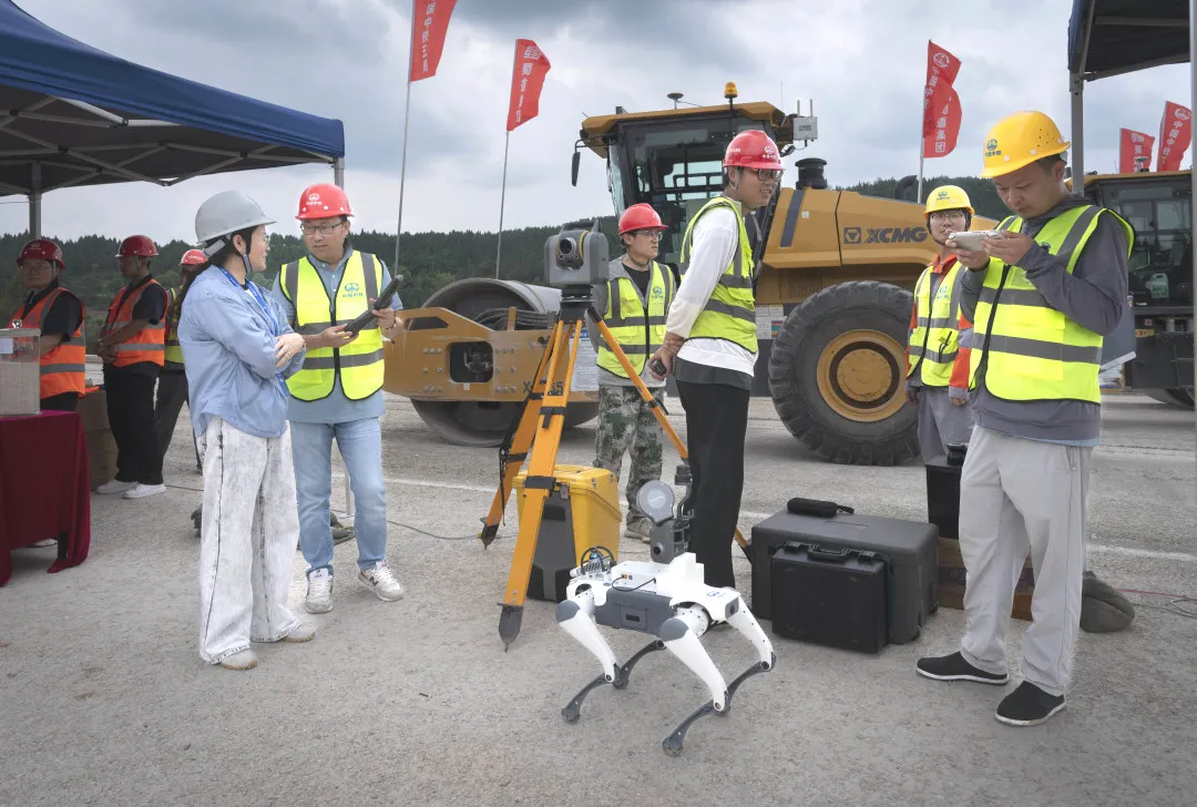
“In the past, to test the compaction of a section of road, multiple core samples had to be taken on-site, with results available 24 hours later; now the system generates compaction color maps in real-time, with red areas indicating weak points that can be immediately reinforced,” said the quality inspection head.
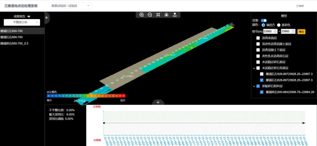
2. Platform Data Visualization: The intelligent management platform clearly presents the project’s design data, structural layer thicknesses, material usage, scanning data, and quality analysis reports, facilitating quick confirmation of construction progress and quality. Meanwhile, project construction management personnel can log into the system backend at any time through the Web or APP to view the above data.
 Cost Reduction and Efficiency Improvement: “Visible Results”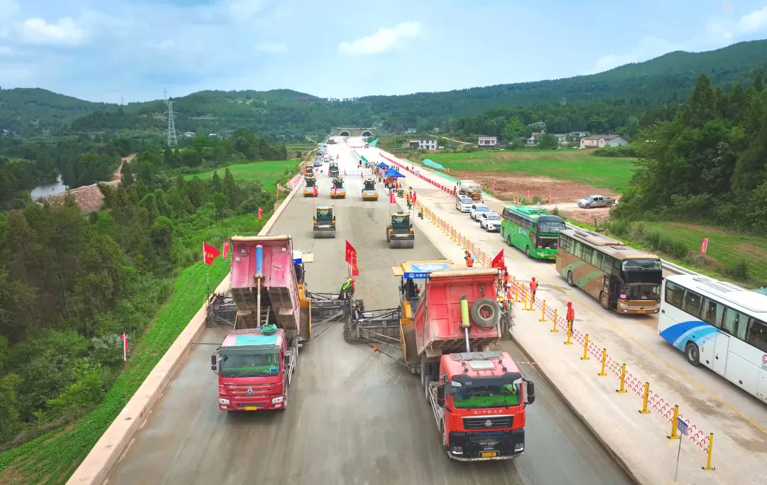
Daring to innovate is the driving force behind industry development. The series of intelligent technology applications in the Guangmian Expressway LM4 section has brought significant changes to traditional road construction methods. The combination of 3D paving and unmanned compaction, aided by the Beidou navigation system and the 3D laser leveling system, automatically completes the mixing material compaction operation, effectively solving the issues of manual errors in hanging lines and balance beams in traditional construction modes, avoiding uneven compaction speeds and paths.
Efficiency: The 3D printing-style pile-free intelligent paving eliminates the traditional manual pile setting process, with unmanned cluster compaction efficiency improved by 25%, effectively shortening construction time;
Quality: The standard deviation of road flatness has decreased from 1.5 millimeters to 0.8 millimeters, far exceeding regulatory requirements;
Cost: By accurately calculating material usage, waste is reduced, and rework costs are minimized, significantly lowering construction costs.
The Path to Breakthroughs in New Productive Forces Behind Technological Innovation
The intelligent construction practice of the Guangmian Expressway LM4 section is not only an upgrade of equipment but also a revolution in construction concepts. The project team’s multiple innovative explorations targeting industry pain points are continuously upgrading the new model of intelligent road construction.
“In the past, we relied on experience; now we rely on data. In the past, we competed with manpower; now we compete with computing power. The use of unmanned equipment clusters for construction has become the intelligent and refined construction technology of the future,” a project technician remarked.
ENDExecutive Editors: Li Yuan, Shen SuEditor: Ruan Jiaying (Fifth Bureau)Content Source: China Railway Fifth BureauChina Railway Media Center