
Click the blue text above to follow us



Gift for readers
👨💻 Conducting research involves a profound system of thought, requiring researchers to be logical, meticulous, and serious. However, effort alone is not enough; often leveraging resources is more important than hard work. Additionally, one must have innovative and inspiring ideas that look up to the stars. When a philosophy teacher asks you what science is or what electricity is, do not find these questions amusing. Philosophy is the mother of science; it seeks to explore ultimate questions and find those self-evident questions that only children would ask but you cannot answer. It is recommended that readers browse in order to avoid suddenly falling into a dark maze and losing the way back. This may not reveal all the answers to your questions, but if it can evoke clouds of doubt in your mind, it may create a beautiful sunset of colors. If it unexpectedly brings you a storm in your spiritual world, then take the opportunity to brush off the dust that has settled on your ‘lying flat’ state.
Perhaps, after the rain, the sky will be clearer…….🔎🔎🔎

1 Overview
1. Research Background and Significance
In InSAR (Interferometric Synthetic Aperture Radar) technology, atmospheric delay is a significant source of error, especially when monitoring surface deformation using multi-temporal InSAR. Atmospheric delay is primarily caused by the ionosphere and troposphere, and the spatiotemporal variations in these atmospheric layers can cause phase delays in radar signals, thereby affecting the accuracy of InSAR measurements. Therefore, conducting research on a joint model for spatially varying stratified atmospheric delay correction in multi-temporal InSAR is crucial for improving the monitoring accuracy and reliability of InSAR technology.
2. Current Research Status
Currently, scholars both domestically and internationally have conducted extensive research on atmospheric delay correction in InSAR and proposed various correction methods. For example, methods based on GPS atmospheric delay correction, methods based on external observation data, and methods that involve stacking or time series analysis of multiple interferograms. However, these methods still have some limitations in practical applications, such as the coverage limitations of GPS data, the difficulty in obtaining external observation data, and the time costs associated with processing multiple interferograms.
3. Research Content
This study aims to construct a joint model for spatially varying stratified atmospheric delay correction in multi-temporal InSAR, which will combine various correction methods to improve the accuracy and efficiency of the correction. The specific research content includes:
-
Analysis of Spatially Varying Stratified Atmospheric Delay Characteristics: By analyzing the spatiotemporal variation characteristics of the atmospheric layers and their impact on InSAR measurements, a theoretical basis for the construction of the correction model will be provided.
-
Joint Model Construction: Combining existing atmospheric delay correction methods, a joint model for spatially varying stratified atmospheric delay correction in multi-temporal InSAR will be constructed. This model will consider the stratified characteristics of the atmosphere and the interactions between different layers.
-
Model Validation and Optimization: Using actual observation data and simulated data to validate and optimize the joint model to ensure its accuracy and reliability.
4. Research Methods
This study will employ the following research methods:
-
Data Analysis and Modeling: Utilizing statistical and machine learning methods to analyze and model atmospheric delay data to extract the spatiotemporal variation characteristics of atmospheric delay.
-
Model Construction and Validation: Combining various correction methods to construct the joint model and validating and optimizing it using actual observation data and simulated data.
-
Numerical Simulation and Experimental Validation: Evaluating the correction effect and accuracy of the joint model through numerical simulation and experimental validation.
5. Expected Outcomes
This study is expected to achieve the following outcomes:
-
Construction of a Joint Model for Spatially Varying Stratified Atmospheric Delay Correction in Multi-temporal InSAR: This model will combine various correction methods to improve the accuracy and efficiency of the correction.
-
Improvement of Monitoring Accuracy and Reliability of InSAR Technology: By correcting atmospheric delay, the application effectiveness of InSAR technology in geological disaster monitoring, land resource surveys, and other fields will be enhanced.
-
Provision of Theoretical Support and Technical Reference for Related Fields: The results of this study will provide theoretical support and technical reference for research in related fields, promoting the further development of InSAR technology.
6. Conclusion and Outlook
This study aims to improve the monitoring accuracy and reliability of InSAR technology by constructing a joint model for spatially varying stratified atmospheric delay correction in multi-temporal InSAR. In the future, further research on atmospheric delay correction methods and technologies will continue, promoting the application and development of InSAR technology in more fields. Additionally, there will be an emphasis on interdisciplinary integration to provide more possibilities for the innovation and development of InSAR technology.
2 Operational Results
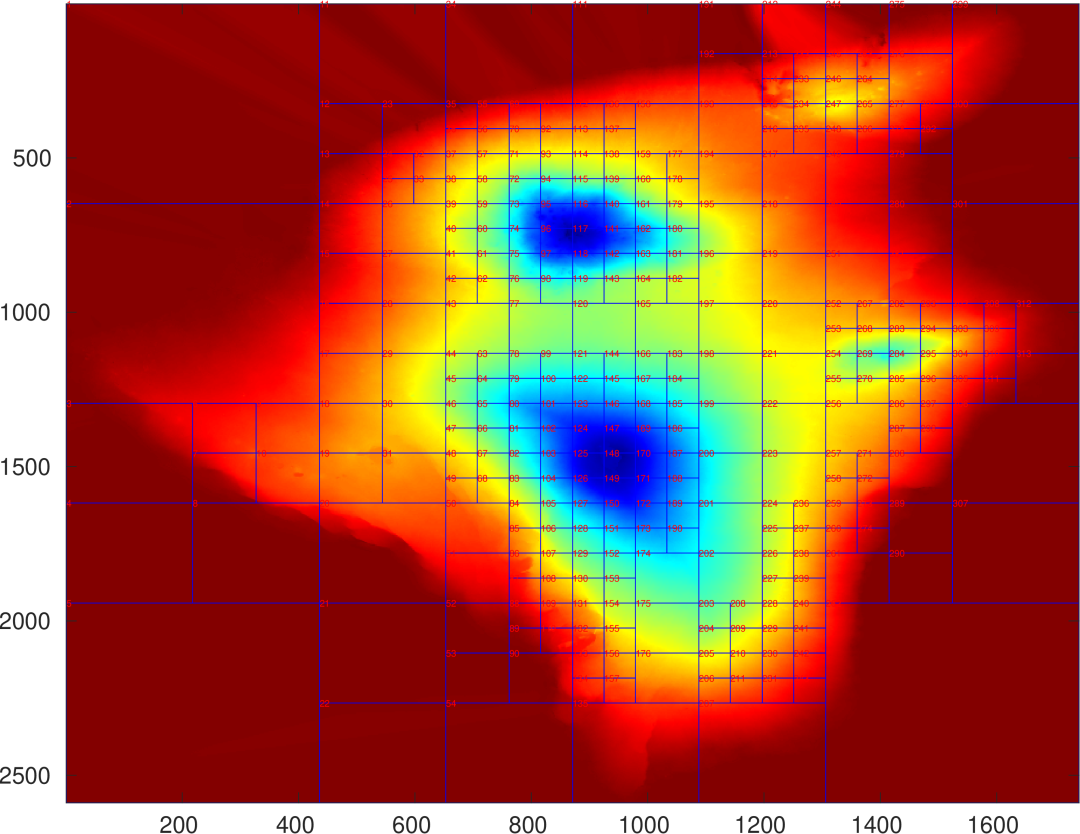
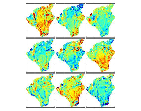
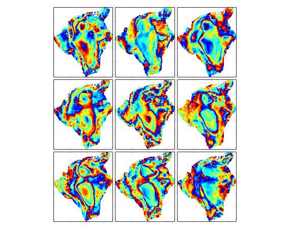
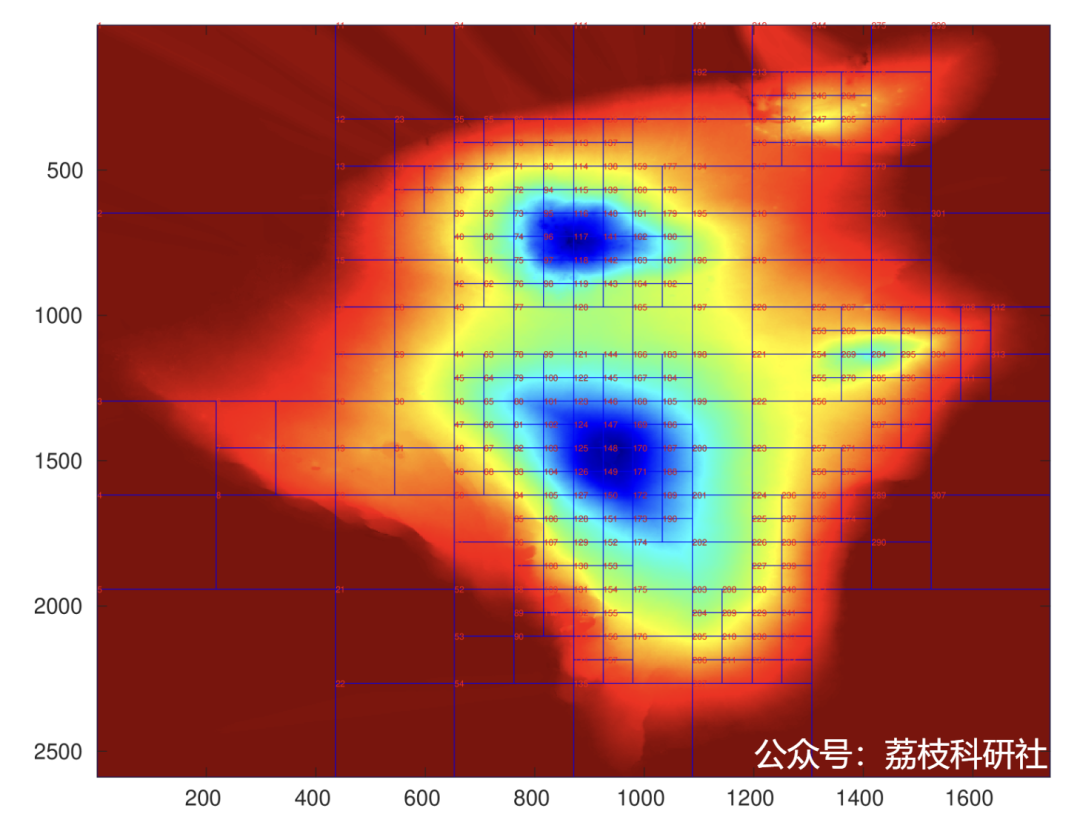
Main function code:%% prepare input fileclearclcload point_ph % point file includes interferogram phase and pixel coordination informationload shortbaseline % baseline file include baseline information of interferogramsfrequency=5.4050005e+09; % frequency of C bandc=299792458; % speed of lightwavelen=c/frequency; % wavelengthslantran=856456.4809; % slant range between SAR sensor and groundincangle=33.9280; % incidence anglewidth=1744; % width of SAR imagelines=2595; % lines of SAR imagespa_r=83.4743; % spatial resolution in range direction spa_azi=56.0328; % spatial resolution in azimuth direction%% generate parameter fileInput=parpre_step_without_obs_2023(shortbaseline,wavelen,slantran,incangle,spa_r,spa_azi,width,lines);%% set threshold of window size and height difference for quadtree segmentationInput.minw_ksize=4; % the minimum window size for quadtree segmentationInput.hdiff_T=1000; % the height difference threshold for quadtree segmentation%% implement tropospheric delay correction [detrend_point_ph, point_orbit_interf] = joint_de_atmos_base_on_patch_speedup_2023_test(point_ph,Input);%% plot interferograms% plot interferograms after tropospheric delay correctionfigure,plot_map(detrend_point_ph(:,1:2),wrap(detrend_point_ph(:,5+1:5+9)),3);% plot original interferogramsfigure,plot_map(point_ph(:,1:2),wrap(point_ph(:,5+1:5+9)),3);
3References
Some content in this article is sourced from the internet, and references will be noted. If there are any inaccuracies, please feel free to contact us for removal.

[1] Sha Pengcheng. Research on InSAR Vertical Stratified Atmospheric Correction and Its Application in Fault Deformation Monitoring [D]. China University of Petroleum (East China), 2020.
[2] Liang, H., Zhang, L., Lu, Z., & Li, X. (2023). Correction of spatially varying stratified atmospheric delays in multitemporal InSAR. Remote Sensing of Environment, 285, 113382.
[3] Liang, H., Zhang, L., Ding, X., Lu, Z., & Li, X. (2018). Toward mitigating stratified tropospheric delays in multitemporal InSAR: A quadtree aided joint model. IEEE Transactions on Geoscience and Remote Sensing, 57(1), 291-303.
4 MATLAB Code Implementation
Data acquisition, more fan benefits, MATLAB|Simulink|Python resource acquisition