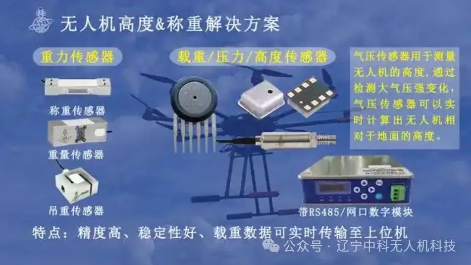


The drone’s barometric altitude sensor, also known as a barometric altimeter or barometer, is an important sensor. When equipped on a drone, it enables the drone to accurately perceive changes in altitude, which is crucial for flight stability and automated operations. Due to its rapid real-time response and low power consumption, the barometer has become an ideal choice for altitude measurement in drones, significantly enhancing the drone’s performance and functionality.

Working Principle of Barometers
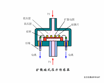
A barometer is a device that measures atmospheric pressure. Based on the physical phenomenon that atmospheric pressure changes with altitude, the barometer can provide real-time altitude information for the drone.
According to Boyle’s law (also known as the law of Boyle, which states that at a constant temperature, the volume of a given mass of ideal gas is inversely proportional to its pressure.), when temperature is constant, the pressure of the gas in a closed container is inversely proportional to its volume. In the atmospheric environment, this means that the air density is higher near the ground, resulting in higher pressure; as altitude increases, the air becomes thinner, and the pressure decreases. The barometer calculates altitude by measuring this pressure change.
To overcome the limitations of a single sensor, modern drones employ various sensor data fusion methods. For example, while accelerometers respond quickly, they suffer from significant integration drift, whereas barometers and GPS can provide relatively stable absolute positioning but have slower response times. Therefore, engineers have designed complementary filtering algorithms to combine data from these sensors to obtain more accurate altitude information.
This multi-sensor data fusion approach not only improves measurement accuracy but also enhances system reliability. Even if one sensor fails, other sensors can continue to provide necessary data support, ensuring the safe flight of the drone.


The Role of Barometers in Drones
Accurate Altitude Measurement: The primary application of barometers in drones is altitude-hold flight, which allows the drone to maintain a set altitude. This is particularly important for tasks such as aerial photography and surveying, as it ensures consistency and accuracy in the captured images.
Flight Control Assistance: During ascent or descent, the barometer provides critical altitude data, helping the flight control system adjust height. It can assist GPS data in determining the exact position of the drone, maintaining level flight, and achieving smooth and accurate landings.
Route Planning and Navigation: By combining data from other sensors (barometer with GPS, Inertial Measurement Unit (IMU), visual sensors, ultrasonic sensors, etc.), more precise flight control and navigation can be achieved. In complex flight environments, it helps the drone adjust altitude, ensuring flight stability and safety.