In today’s technologically advanced world, the movements of every vessel—from nimble fishing boats to massive aircraft carriers—can be meticulously tracked through a vast network of satellites and sensors. With every ripple on the sea monitored, surprise naval maneuvers will soon become a thing of the past. The vast and boundless oceans will no longer be shrouded in mystery but illuminated by streams of data emitted from millions of eyes and ears capable of perceiving every move from space to the seabed.
Open Source Intelligence (OSINT) refers to intelligence obtained entirely from public or commercial sources to address specific intelligence priorities, needs, or gaps. OSINT sources are diverse, including public records, news media, libraries, social media platforms, images, videos, websites, and even the dark web. Commercial technologies for collection and imagery satellites also provide valuable open-source data. The strength of OSINT lies in its ability to provide meaningful, actionable intelligence from a variety of readily available sources.
Thanks to technological advancements, OSINT can provide early warning signals of conflict long before it actually breaks out. On land, the proliferation of low-cost, ubiquitous sensor networks has made battlefields almost transparent, increasing the difficulty of conducting surprise attacks. Open-source data provided by smartphones and satellites can offer mobilization warnings and other key indicators of military exercises. AI-enhanced reconnaissance and real-time data analysis further enhance this capability, proving highly effective in modern conflicts in Ukraine, Azerbaijan, Gaza, Israel, and Sudan. As this model extends to maritime operations, it brings unique challenges and characteristics compared to land operations.
With rapid technological development, “Blue OSINT” has become an important tool in the contemporary naval warfare arsenal of global powers. Blue OSINT leverages data from commercial satellites, social media, and other public sources specifically to enhance maritime awareness, identify emerging threats, and inform strategic decision-making.
The state of Blue OSINT in various conflicts indicates that technology-driven evolution is accelerating, enabling maritime security and sea control missions. The United States Navy (USN) can enhance Blue OSINT collection efforts by utilizing its commercially procured sensor networks and customized unmanned systems to shape the operational environment, prevent and resolve conflicts, and ensure unimpeded maritime communication lines.
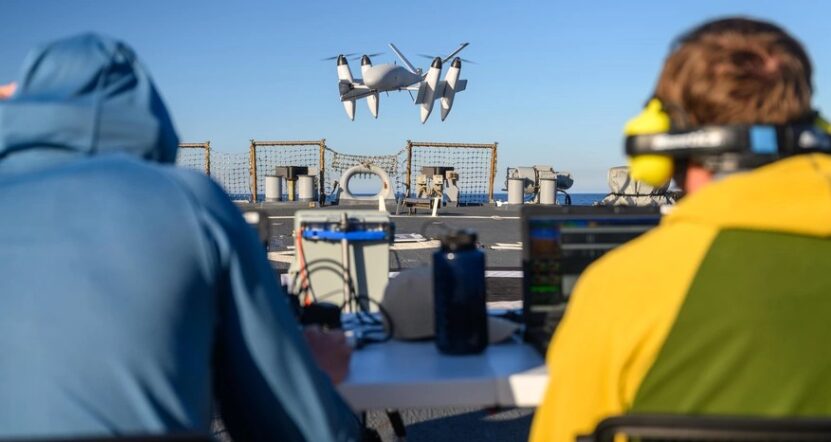
Commercially procured sensors encompass a variety of technologies, including sonar and acoustic sensors, as well as video and seismic equipment for detecting strategic site activities. These sensors can operate independently or be deployed through unmanned systems, providing flexibility and adaptability for various maritime operations. For example, unmanned aerial systems (UAS) equipped with high-resolution cameras and radar can continuously monitor vast ocean areas, while unmanned underwater vehicles (UUV) equipped with sonar capabilities can monitor seabed activities, such as submarine movements and underwater facilities. These unmanned platforms can continuously collect critical data, enhancing the Navy’s situational awareness and readiness without putting sailors at risk.
To provide optimal support to joint forces and maintain strategic advantages, the Navy must incorporate ubiquitous sensor networks and Blue OSINT into its naval strategy to adapt to an increasingly complex maritime environment. The U.S. Navy’s multi-year “Project Overmatch” marks the beginning of developing a “network of networks” and promoting Joint All-Domain Command and Control (JADC2) initiatives.
Integrating “Blue OSINT” and sensor networks into naval strategy complements traditional naval power while reducing the risks and costs associated with conducting intelligence missions. Furthermore, the open-source nature of this information enhances the Navy’s ability to share information and collaborate with allies and partners while circumventing cumbersome security classification issues. By relying on easily shareable information, the Navy can better synchronize efforts with partner navies, making maritime command a more coordinated and feasible task.
Blue OSINT and Continuous Maritime Monitoring
In the pre-conflict phase, global satellite coverage and social media provide a wealth of data that can map maritime activities with unprecedented detail. Non-profit organizations like Global Fishing Watch utilize commercial satellite constellations to track vessels and monitor maritime activities. The increased affordability and accessibility of satellite technology enable non-governmental and commercial entities to contribute to enhancing maritime domain awareness in new ways. For instance, maritime radar emissions, once exclusive to military and intelligence satellites, are now easily observable and can be “posted on Twitter,” making it easier to identify vessels when actors employ deception tactics. Similarly, there are numerous “vessel spotting” accounts on platforms like X (formerly Twitter), where enthusiasts post images and updates of vessels passing through strategic chokepoints and major straits, further enriching the available data.
Through continuous monitoring and large-scale data analysis, “Blue OSINT” can significantly mitigate the challenges of monitoring large Exclusive Economic Zones (EEZ). It offers a cost-effective alternative to traditional patrols, allowing navies in these countries to adopt a more targeted approach when deploying limited resources. By adopting “Blue OSINT,” naval forces can enhance their surveillance and response capabilities without imposing a heavy fiscal burden, ensuring these forces remain agile and efficient in maritime operations. Additionally, the data streams from ubiquitous sensor networks can be combined with “Blue OSINT” collections, providing naval intelligence experts with nearly endless data to support complex reconnaissance operations without increasing the risks for sailors and special operations personnel collecting the data.
In addition to countless intelligence collection opportunities, utilizing “Blue OSINT” also presents technical challenges for the U.S. Navy. Ubiquitous sensor networks and “Blue OSINT” tools generate vast amounts of data, necessitating substantial investments in software and analytical tools to effectively manage and interpret this information. Intelligence professionals must sift through endless data to extract actionable insights. Even the most skilled analysts require software and computer processing capabilities to help organize and parse raw data.
To address these challenges, the U.S. Navy and other maritime forces are increasing investments in commercially procured sensor networks and cutting-edge analytical tools. In June 2024, the National Geospatial-Intelligence Agency released its first non-classified commercial solicitation to help track illegal fishing activities in the Pacific region. Such investments aim to acquire, utilize, and process the massive amounts of data generated, which is a critical step toward achieving comprehensive maritime domain awareness. Improved software and analytical tools help maximize the potential of “Blue OSINT” and sensor networks, ensuring that intelligence analysts can provide better information to decision-makers at the fastest possible speed.
Strategic Deployment of Distributed Sensors
While “Blue OSINT” can provide valuable information about chokepoints and shipping lanes, it cannot comprehensively cover the high seas. Its effectiveness is higher in densely populated areas and coastal regions where the density of electronic devices and human activities far exceeds that of the high seas. Additionally, OSINT data is often easily manipulated, posing challenges to ensuring the accuracy and reliability of the information collected. For example, while vessels emitting Automatic Identification System (AIS) signals can be tracked online, the Navy has realized that vessels’ transponders are frequently manipulated to conceal their locations, ultimately limiting the reliability of the signals.
To circumvent these limitations of open-source data, the Navy and intelligence agencies can strategically deploy covert sensor networks at critical locations, such as ports, straits, and other important chokepoints, to enhance their Blue OSINT capabilities. This combination of data streams can effectively monitor and collect data on vessel movements, communications, and adversarial intentions. Additionally, other covert sensors can be hidden on the seabed or disguised on civilian vessels, such as fishing boats. Utilizing distributed sensors and “Blue OSINT” data ensures continuous, comprehensive maritime situational awareness, even in areas with limited military assets.
However, relying solely on fixed sensor networks is insufficient to cover the dynamic maritime environment. Deploying distributed sensor mobile networks requires various platforms and technologies. While military satellites, ships, and aircraft equipped with advanced sensors can provide intermittent coverage, they are costly, limited in number, and their discoveries are not easily shared with partners and allies. To fill these gaps, allied navies should invest in affordable, scalable solutions such as unmanned surface vehicles (USVs), UUVs, and drone systems. These platforms equipped with various sensors can effectively detect and track adversarial movements, ensuring the Navy maintains situational awareness in the vast Pacific and other critical areas.
Small drone systems launched from naval vessels can be used to quickly monitor large ocean areas, providing real-time data on surface and subsurface activities. Adversaries recognize the strategic advantages of drone systems and have made bold moves to surpass the U.S. Navy by developing aircraft carriers specifically for launching and recovering drone systems instead of complex manned platforms like fighter jets. This significant investment in carriers dedicated to unmanned aerial vehicles should prompt the U.S. to reconsider and potentially adjust its future resource allocation strategies. Similarly, unmanned underwater vehicles can patrol for extended periods at a fraction of the cost of manned vessel operations, such as the “Saildrone” patrolling the Indian Ocean, providing the U.S. Navy with a powerful sensor network. UUVs deployed from submarines or surface vessels can monitor seabed activities, such as the movements of submarines and other submerged assets.
By monitoring the aerial, surface, and subsurface environments, unmanned underwater vehicles and their sensors can significantly enhance situational awareness across the maritime domain. However, they can only be effective when integrated into a cohesive architecture that combines traditional intelligence, surveillance, and reconnaissance (ISR) with Blue OSINT data and affordable long-term persistent sensors. The Overmatch project demonstrates how this integration can be achieved by developing a network that connects sensors, shooters, and command nodes across all domains. For instance, the “Overmatch Project” aims to leverage advanced data analytics, artificial intelligence, and secure communications to create a unified maritime operational picture, enabling faster and more informed decision-making. By integrating these elements, the U.S. Navy can ensure effective utilization of unmanned systems and their sensors to maintain a combat advantage in the maritime domain.
Moreover, the low signal characteristics of some of these sensors increase their chances of remaining undetected by adversaries, thus providing a strategic advantage. By deploying sensors in unexpected locations and, in some cases, disguising them as civilian assets, the Navy can collect intelligence without alarming potential threats.
Blue OSINT and Sensor Networks in Conflict
While Blue OSINT collection and distributed sensor networks can easily gather data in uncontested waters, they can also be immediately applied in modern maritime conflicts. For example, the transparency provided by Blue OSINT will make it difficult for the Navy to maneuver without detection. Satellites and social media continuously monitor naval docks, strategic chokepoints, and even some high seas areas, making tactical raids increasingly difficult to achieve. Due to the omnipresence of “Blue OSINT,” historical battle scenarios—such as Japan’s surprise attack on Pearl Harbor, the D-Day invasion, or the successful German fleet raids in the English Channel during World War II—will be harder to realize in modern times.
Blue OSINT is likely to be used to detect and closely track adversarial activities, including the movements of amphibious assault vessels and submarines. OSINT analysts frequently examine satellite images of adversarial shipyards and military facilities, which can provide early signs of mobilization.
However, relying solely on satellite imagery and AIS for Blue OSINT is insufficient. To provide comprehensive assessments, multiple intelligence capabilities must be in place. For instance, in 2020, two commercial companies collaborated to utilize radio frequency and synthetic aperture radar collection techniques to detect illegal, unregulated, and unreported fishing activities near the Galapagos Exclusive Economic Zone. This open-source technology revealed the ability to identify fishing vessels entering the EEZ that had turned off their automatic identification systems. In future conflicts, similar methodologies can be employed to combine multiple sources of Blue OSINT to identify and track vessels. This approach will bypass the traditional practices of exploiting AIS vulnerabilities to evade detection while also revealing adversarial intentions.
The Russia-Ukraine conflict has demonstrated how OSINT can thwart raid exercises and provide critical target data deep behind enemy lines. However, it also highlights the limitations of OSINT in sparsely populated environments, such as the high seas. For example, in December 2023, when missiles flew over the Red Sea, 18% of the world’s container ship capacity rerouted. While civilian mariners and commercial shipping contribute to “Blue OSINT” in peacetime, their absence in high-risk conflict situations will place a heavier burden on satellite and unmanned systems.
Deception and Stealth
While the Navy can leverage these technologies, its adversaries can and almost certainly will do the same. The Navy must develop countermeasures to mitigate the risks posed by sensor networks while fully exploiting their advantages. One approach is to invest in advanced deception tactics designed to mislead adversaries. These tactics include using decoys, electronic warfare, and signal deception to create false targets and confuse enemy sensors. The Navy has quietly been developing these tools to obscure its true actions and intentions, ultimately misleading adversaries and making it difficult for them to accurately target objectives.
In addition to deception, there is a need to enhance the Navy’s stealth capabilities to evade adversarial distributed sensor networks. This includes not only minimizing the electromagnetic signals of vessels but also employing innovative designs and operational tactics to reduce radar cross-sections and avoid detection.
【For the full content, please visit Zhuanzhi and click on “Read the Original” in the lower left corner】
Please follow Zhuanzhi Intelligent Defense on WeChat (click above to follow)
For more related content, please visit Zhuanzhi and click “Read the Original” in the lower left corner
Scan to add Zhuanzhi Assistant, for consulting services:Customized reports in Chinese, tailored materials