Geospatial Analysis with Python: Processing Landsat Imagery
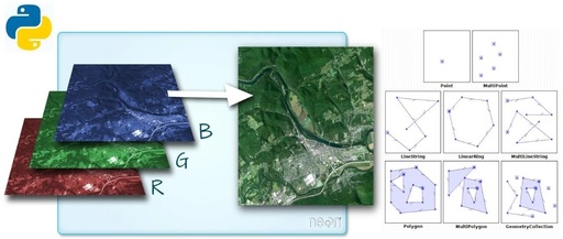
“ The rioxarray package is used to read, cloud-remove, and fill pixels in Landsat data.” 01 — Data Reading and Display This section discusses the rioxarray package for processing Landsat data. The example data uses the cold-spring-fire dataset from the earthpy package, which can be downloaded directly via the earthpy package or accessed from the … Read more