Recently, Hangzhou has enjoyed warm sunshine and pleasant temperatures, making it hard to believe that we are already in the Minor Snow solar term. However, the strongest cold wave of the second half of this year has been dispatched, affecting most of the central and eastern regions of China from north to south. As a result, Hangzhou will experience a significant drop in temperature, and the arrival of true winter is not far off. Citizens are advised to take precautions early!
The cold air will arrive this afternoon, with temperatures dropping by 8°C.
Hangzhou is not far from officially entering winter.
This morning, the lowest temperature in Hangzhou was 11.9°C, making it the warmest morning in the past two weeks. It is expected that today’s maximum temperature will reach around 22°C. Today is a “warm-up” before the cold air arrives, and the northern cold air is already on its way.
The Hangzhou Meteorological Station has issued a cold air alert: Currently, a cold air mass from the north is moving east and south, and it is expected to affect our city from noon today, leading to a noticeable drop in temperature and an increase in north winds. The average daily temperature is expected to drop by 6 to 8°C. From the 24th to the 25th, the lowest temperature in the plains will be 3 to 6°C, and in the mountainous areas, it will be 1 to 3°C, with frost expected. Today, the maximum north wind force in the plains will be 4-6 levels, and in the lakes and high mountainous areas, it will be 5-7 levels, with some areas reaching level 8.
After the arrival of the cold air, air quality will temporarily worsen, so please take preventive measures.
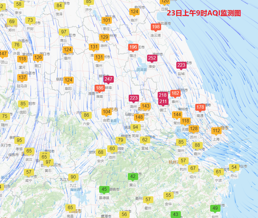
This cold air is moving quickly, as it was only in North China last night, and by this morning, it has already reached central Anhui and Jiangsu. It is expected that after noon today, Hangzhou will start to experience north winds, but the initial cooling effect will not be significant. It is expected that after 14:00, temperatures will gradually drop, and the north winds will gradually strengthen. Tonight, Hangzhou will feel the chill of the cold wind.
Due to the lack of moisture from warm and humid air currents, there will not be many clouds in the sky, and until the end of November, except for the 25th and 26th, which will be mainly cloudy, the rest of the time will have very good sunny weather.
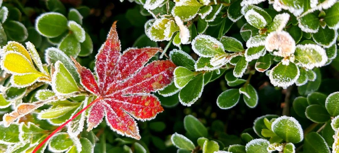
Photography/ Jiang Zhiqing
The northern cold air will continue to cause disturbances, and it is expected that another cold air mass will affect the region on the 27th, and another will move south on the 30th. The cold air is determined to queue up to move south.
Hangzhou’s temperatures fluctuate greatly, with the lowest temperature around 6°C on the 24th and 25th. After the cold air on the 27th, temperatures will continue to drop, and by the 29th and 30th, the lowest temperature will drop to around 1°C.
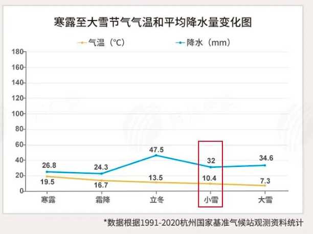
As we are in the Minor Snow solar term, temperatures are gradually dropping to winter standards, and in most years, the transition from autumn to winter is completed around this time. In previous years, Hangzhou’s winter has typically started between late November and early December, so it seems that winter in Hangzhou may not be far off, and it might be time to prepare down jackets and cotton coats!
Yellow Cold Wave Warning!
The strongest cold wave of the second half of the year has been dispatched.
Yesterday was the first day of the Minor Snow solar term, and the cold wave has been dispatched. The first area to receive it, Mohe in Heilongjiang, saw a temperature drop of 20°C this morning, reaching -27.3°C, showcasing the extreme cold. Currently, the cold wave is continuing to push south, and the most intense period of temperature drop will occur today and tomorrow.
Let’s take a look at the national freezing map to see where the extreme temperature drops will occur next.
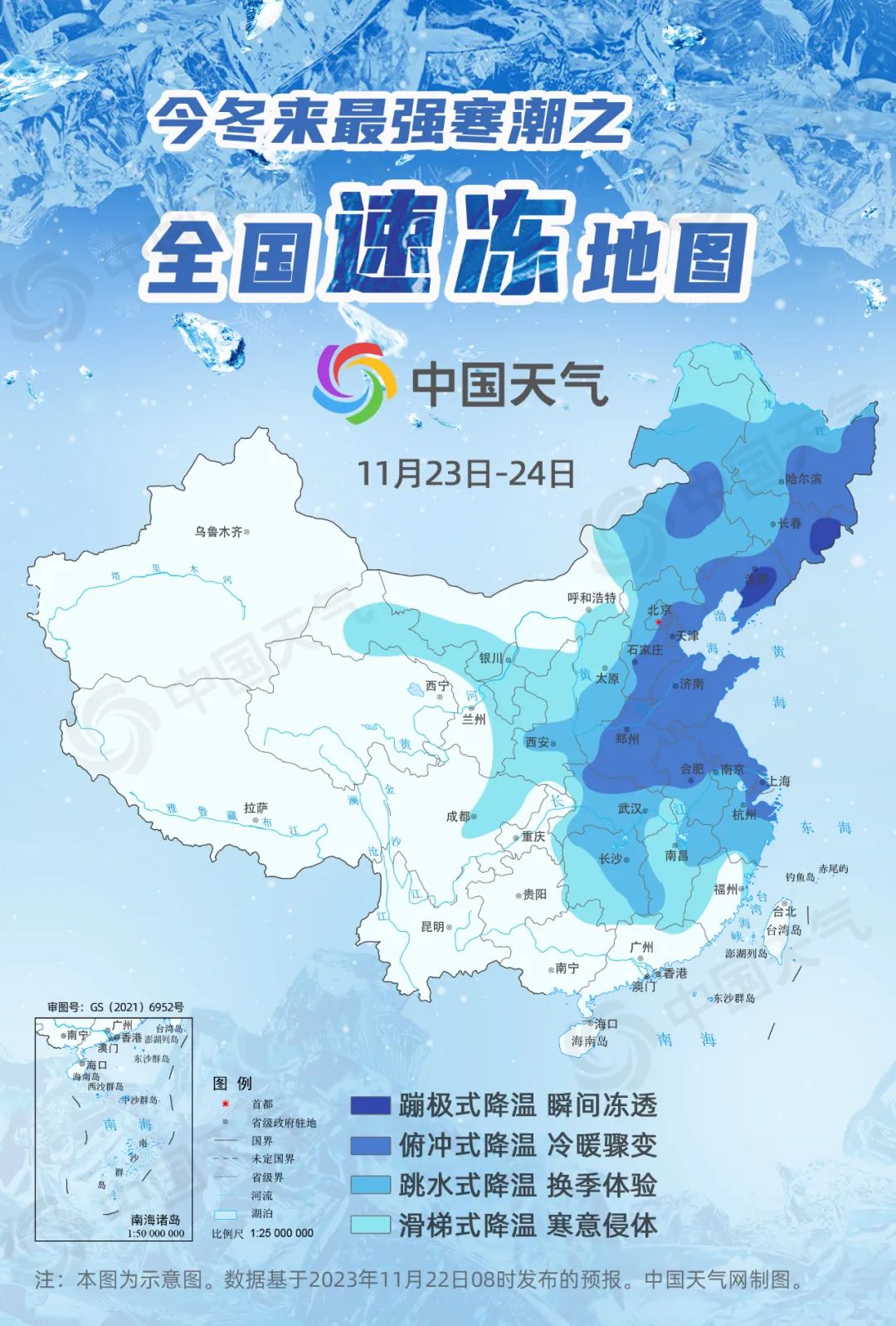
At 10 AM today, the Central Meteorological Station continued to issue a yellow cold wave warning:
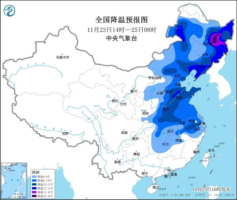
Due to the cold wave, it is expected that from 14:00 on November 23 to 08:00 on November 25, areas including central and eastern Inner Mongolia, Northeast China, North China, Huanghuai, Jianghuai, Jianghan, and northern and western Jiangnan will experience a temperature drop of 6 to 10°C.

Hangzhou North Lake during the Minor Snow season. Photography/ Traveler
Weather Trend Forecast
24th (Friday): Sunny to partly cloudy, 6-14°C, north wind 4-5 levels;
25th (Saturday): Partly cloudy, 7-15°C, east wind 3-4 levels;
26th (Sunday): Partly cloudy to overcast, 8-20°C, light breeze;
27th (Monday): Partly cloudy to sunny, 9-20°C, light breeze;
28th (Tuesday): Partly cloudy to sunny, 6-20°C, northwest wind 4-5 levels;
29th (Wednesday): Sunny to few clouds, 1-14°C, light breeze.
(Hangzhou Meteorological Station issued on November 23 at 10 AM)
Warm Reminder
1. Temperature fluctuations are significant, please pay attention to temperature changes and the adverse effects of lower temperatures on health on the mornings of the 24th and 25th.
2. In late November, our city will have continuous sunny weather, with dry air and high meteorological fire risk levels, so please pay attention to fire and electrical safety.
Data from/ Central Meteorological Station, China Weather, Municipal Meteorological Bureau
Editor/ Shen Ruyi
Layout/ Shen Ruyi