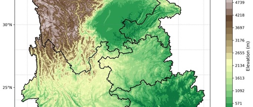
Drawing a Topographic Map of the Southwest Region Using Python
Drawing a Topographic Map of the Southwest Region Using Python Author: The Eighth Galaxy – Xinyue Email: [email protected] Terrain data is pre-selected based on the latitude and longitude range, [Using CDO selection: cdo sellonlatbox,97,112.5,20,30 input.nc xinan.nc] Add the terrain data xinan.nc to the Southwest region map. Code: import pandas as pd import numpy as np … Read more
