On the afternoon of August 30, the Yangtze River Nanjing Navigation Bureau conducted a real-time drone image transmission command and dispatch drill. The drill was commanded by Deputy Director Zhou Wei, with participation from the Navigation Operation Command Center (duty room), the Beacon Office, and the Yangtze Dashengguan Navigation Office.
The Yangtze Dashengguan Navigation Office has now normalized the inspection work of drones on the opposite bank markers and some buoys, and has compiled a list of inspectable buoy names, take-off and landing locations, travel times, and flight durations, creating a “Drone Inspection Buoy Overview Table.”
14:00
Drill Subject One: Simulated Buoy Malfunction
Zhou Wei randomly selected a buoy from the “Drone Inspection Buoy Overview Table”: Downstream Bureau Flow Measurement #2 Dedicated Buoy.
Duty officer Zhu Yanhui checked the digital channel and found that this buoy is a dedicated buoy, which does not have a terminal installed, making it impossible to determine its status through the digital channel. Subsequently, he checked the comprehensive security management platform, hoping to confirm its status through the surveillance footage near the water area, but did not find any associated cameras.
14:02
Notify the Yangtze Dashengguan Navigation Office
The duty officer called Xu Jian from the Navigation Department of the Dashengguan Office: “Hello, the Maritime Bureau reports that the Downstream Bureau Flow Measurement #2 Dedicated Buoy has been hit; can you go check it out?”
“Okay, this dedicated buoy is relatively close to the Dashengguan Yangtze River Bridge maintenance base. I will drive there first, check the overall situation of the buoy with the drone, and then arrange the next steps,” Xu Jian quickly recalled the situation of the buoy and responded after comprehensive consideration.
“Okay, thank you for your hard work.”
14:05
Driving to the Take-off Point
Xu Jian drove to the Dashengguan Yangtze River Bridge maintenance base with the drone and connected the real-time image transmission to the bureau’s navigation operation command center.
14:29
Take-off Preparation
Upon arriving at the take-off location, he took out the DJI Mavic 2 drone he carried with him and prepared for take-off.
14:34
Arrived at the Designated Water Area for Inspection
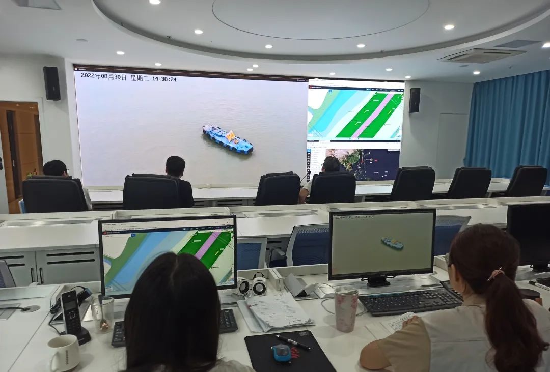
The drone arrived at the Downstream Bureau Flow Measurement #2 Dedicated Buoy and circled around it for inspection. After a preliminary check, the buoy structure was found to be intact. Xu Jian reported the on-site situation to the duty room and arranged for the navigation maintenance workboat to carry out buoy restoration work.
Subsequently, inspections and photographs were taken of nearby water areas, including the Downstream Bureau Flow Measurement Dedicated Buoy, Dashengguan Bridge Area #5 Red Buoy, Dashengguan Qidun #1 Left and Right Navigation Buoys, Dashengguan Bridge Area #5 Black Buoy, and Dashengguan Bridge Area #3 Red Buoy.
14:39
Drill Subject Two: Simulated Investigation and Evidence Collection
“Xu Jian, simulate tracking that ship in the footage on your way back,” the command center announced the start of the simulated investigation and evidence collection.
“Steady now, scan the Longhui 088 from all angles, and check the draft situation as well,” the command center issued some detailed operational instructions,“Also take a look at the appearance of our dock.”
14:48
Drill Successfully Completed
The drone landed smoothly on the navigation barge 12402, and the command center announced the successful completion of this real-time drone image transmission command and dispatch drill.
►►►
In the next steps, the bureau will use the “Sky Eye” flight team as a platform to deepen research on drone 5G image transmission technology, focusing on improving the quality of real-time image transmission, continuing regular training with drone simulators, and enhancing the proficiency of drone operators, thereby comprehensively improving the standardized construction level of grassroots navigation offices.
Authors: Mu Qiang, Qian Shilei, Xu Jian
Reviewed by: Xue Danfeng, Pan Xiaofeng Edited by: Fan Yajun