The development and rise of New China carry the historical hardships,
and encapsulate the irreplaceable memories of the Chinese people.
After a century of ups and downs, geology,
is an indispensable,
vivid chapter in the history of China’s development.
Every inch of the vast territory of our motherland,
has left its mark on the development of geology.
Today, let us follow Xiao Ju to reminisce
about the century-long rise and fall of geology!
 Geological Enlightenment: The Eastward Spread of Western Learning
China’s geology gradually formed during the process of spreading and introducing Western modern scientific culture, which is the result of the “Eastward Spread of Western Learning”. By the mid-19th century, Western countries such as Europe and America had established and perfected the theoretical and methodological system of modern geology, completing the institutional construction of the discipline.
In the tenth year of the Ming Dynasty (1582), the Italian Jesuit Matteo Ricci came to China to preach, marking the beginning of the “Eastward Spread of Western Learning”.
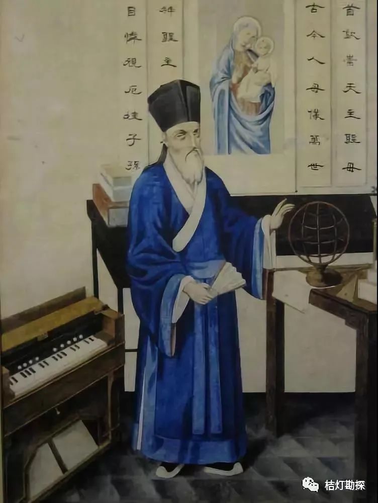
Statue of Matteo Ricci, the Italian Jesuit missionary
In 1584, he drew the first Chinese world map, “Shan Hai Yu Di Tu” in Zhaoqing. In the following twenty years, he successively produced eight Chinese world maps, including “Shan Hai Yu Di Quan Tu” and “Kun Yu Wan Guo Quan Tu”, bringing the Western “new view of the earth” to ancient China, thus enlightening Western modern geology in China.
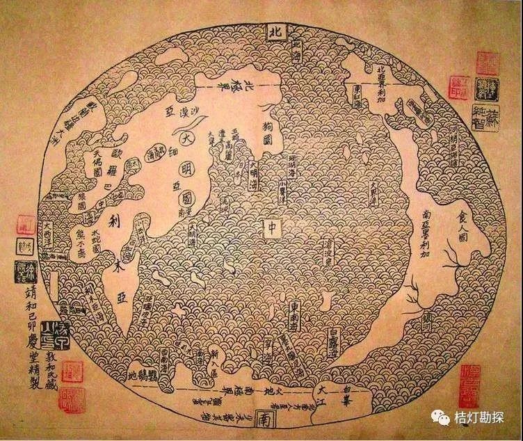
“Shan Hai Yu Di Tu”
In 1623, missionary Aluo compiled the earliest Chinese version of the world geography monograph “Zhi Fang Wai Ji”, dividing the world into five continents and four oceans, further deepening the understanding of the earth among the Chinese people.
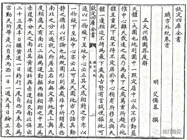
“Zhi Fang Wai Ji” included in the “Four Treasuries”
However, in the first year of the Yongzheng reign (1723), the Qing government issued a ban on missionary activities, expelling missionaries and closing the door to the spread of Western learning in China.
Just as China was closing itself off, the industrial revolution in the Western world greatly promoted and advanced the development of modern geology. By the mid-19th century, the knowledge system of Western geology was basically formed, and the academic institutionalization was initially completed, making geology an independent science.
However, at this time, China was completely unaware of everything happening in the Western world!
It was not until the Opium War that the closed doors of China were forcibly opened by the powerful ships and cannons of Western powers, and Western missionaries came one after another, marking another peak of the “Eastward Spread of Western Learning” in China.
From 1853 to 1854, the Meihai Bookstore printed the first Chinese version of the Western geography encyclopedia “Di Li Quan Zhi”, which for the first time used the Chinese term “geology”. This was the first time the Chinese people directly encountered the concept of “geology” through reading materials.
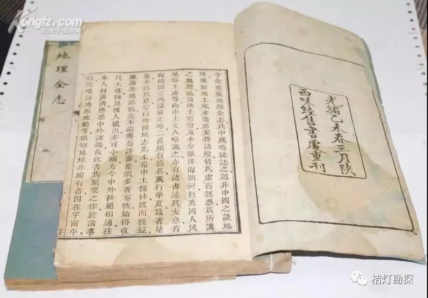
“Di Li Quan Zhi”
Influenced by missionaries and Western learning, starting from the Self-Strengthening Movement, the Chinese began to establish translation agencies to translate and publish Western geological books or textbooks.
From 1872 to 1873, Ma Gaowen interpreted, and Hua Hengfang transcribed, translating and printing the classic work of American mineralogist Dana, “Jin Shi Shi Bie”, which systematically discussed the crystal forms, physical properties, chemical properties, and classification methods of minerals, introducing Western mineral crystal theory and testing methods to China for the first time.
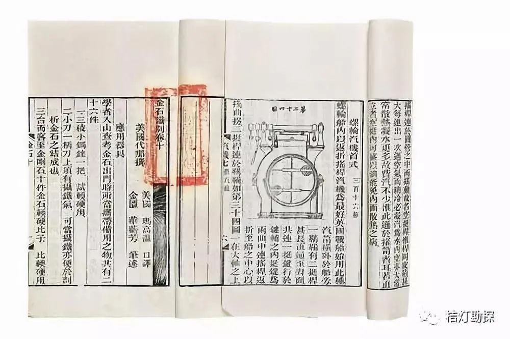
“Jin Shi Shi Bie”
In 1873, they translated and published “Di Xue Qian Shi” based on the world-famous work “Principles of Geology” by British geologist Lyell, which was the first to comprehensively introduce advanced geological theories and methodologies such as the realistic thought of “discussing the present in light of the past” into China.
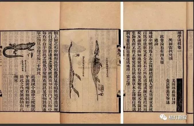
“Di Xue Qian Shi”
Learning from the West: Studying Abroad
Gradually, people realized that relying solely on the one-way limited communication method of translating foreign books could not fundamentally change the backward state of geological science in China.
Therefore, from 1872 to 1875, the Qing court sent four batches of a total of 120 children abroad to study advanced Western technology. This was the first time in Chinese history that government-sponsored students were sent abroad.
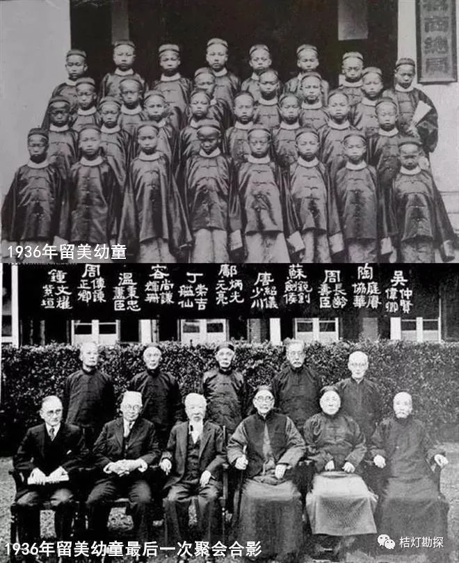
Children studying in the United States in 1936
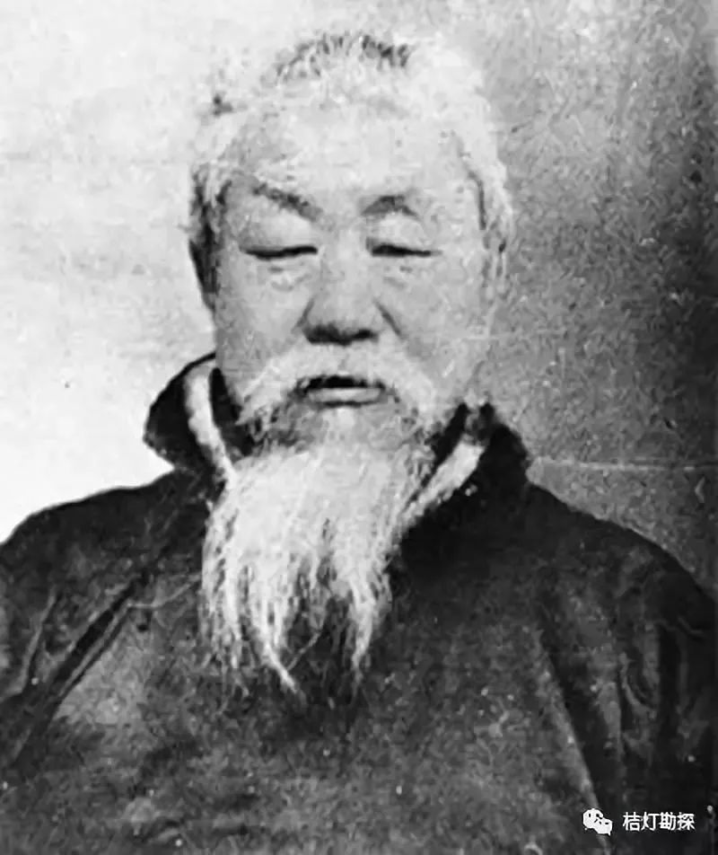
Kuang Rongguang was one of the first batch of children studying in the United States. After graduating from high school in the United States, he entered Lafayette College (studying geology). In 1881, he was called back to China before graduation and was assigned to the Tangshan Kaiping Coal Mine. He served as the co-manager of gold mines in Zhaoyuan, Pingdu, and Haining, chief engineer and director of Lincheng Coal Mine, and chief mineral surveyor of the Mineral Survey Bureau of Zhili Province.
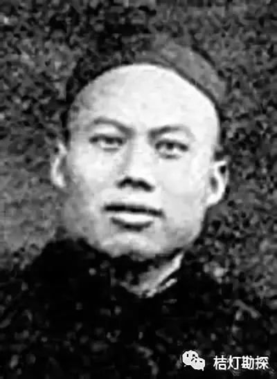
Kuang Rongguang
In 1910, based on field survey data, he published the first regional geological map of China, “Zhili Geological Map” (scale approximately 1:250,000) in the inaugural issue of the “Geological Magazine” (the first academic journal of geology in China), marking the basic elements of geological maps.
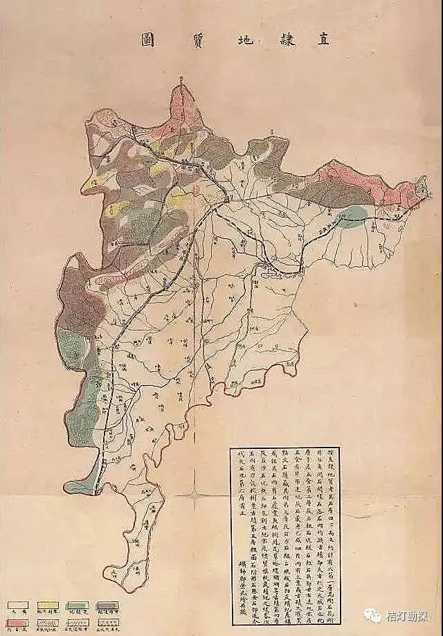
Zhili Geological Map (Kuang Rongguang)
In the second and third issues of the “Geological Magazine”, he also published the “Zhili Mineral Map” and the “Zhili Fossil Map”. The former indicated the distribution of six major mineral types: gold, silver, copper, iron, lead, and coal, making it the earliest provincial mineral map in China; the latter recorded the distribution of eight types of fossils, including trilobites, stone leaves, fish-scale trees, ferns, clams, snails, corals, and palm trees, and is considered the first paleontological map created by a Chinese, marking an important beginning for paleontology in China.
Awakening of the Chinese: The Earliest Geological Activities
The influx of Western knowledge awakened the enlightened scholars in China, who gradually recognized the role of geological science in resisting foreign humiliation and enriching the nation, and began to actively collect and translate foreign materials for reference.
The translation, compilation, and introduction of Western geological books in China have distinct characteristics of the times:
Before the 20th century, they were mainly based on works from Europe and America; after the defeat in the First Sino-Japanese War, a large number of Japanese geological books began to be translated.
Yu Heqin
In 1902, Yu Heqin and others compiled and published “Mineralogy Textbook” based on Japanese works, which was the earliest mineralogy textbook compiled by Chinese. In geology, in 1906, Chen Wenzhe and others compiled and published China’s first set of “Geology Textbooks”, which discussed the basic theories of geology from aspects such as sedimentology, rock types, dynamics, structure, and geological history.
Zhang Xiangwen
In 1908, geographer Zhang Xiangwen published the book “Newly Compiled Geography” based on the characteristics of China combined with the latest knowledge from abroad, which is the first natural geography work in China. In 1909, he also compiled and published the “Latest Geology Textbook” in four volumes based on Japanese “Geology” and other references, which is the first geology textbook compiled by Chinese.
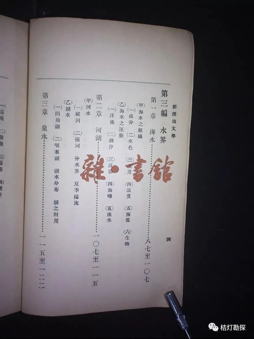
Newly Compiled Geography
Through the dissemination of geological knowledge, the public began to understand the world and China, aiming to achieve national strength and prosperity, in September 1909, Zhang Xiangwen and others organized and founded China’s earliest academic organization for natural sciences – the Chinese Geological Society (moved to Beijing in 1912), with Zhang being elected as the president. Geologists and geographers such as Kuang Rongguang, Ding Wenjiang, Zhang Hongzhao, Weng Wenhao, Bai Meichu, Xie Jiarong, Yuan Fulih, Wang Hengsheng, Li Chunyu, Tan Xichou, Zhu Kezhen, Xu Bingchang, as well as a group of scientists and social figures from non-geological fields such as Zhang Taiyan, Cai Yuanpei, and Zhang Jian, and even some foreign geologists in China joined.
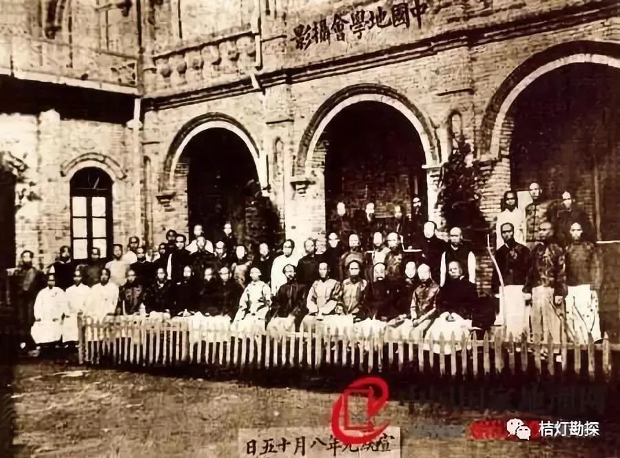
Chinese Geological Society
To promote geological research and development in China, in 1910, Zhang Xiangwen and others organized the publication of China’s earliest geological journal – “Geological Magazine”. By the time it ceased publication in 1937, “Geological Magazine” had published 181 issues, featuring over 1,520 articles, and more than 140 geological maps, mineral maps, topographic maps, etc. Among them, over 120 articles discussed geological knowledge, basic theories of geology, the development of geological disciplines, and geological survey reports.
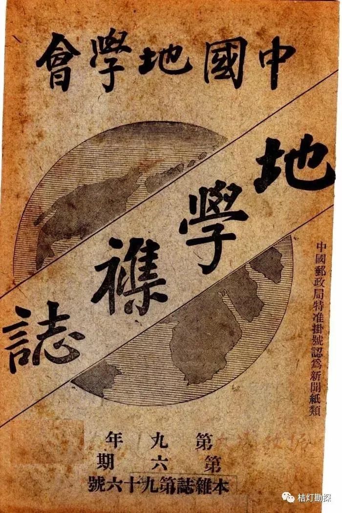
“Geological Magazine”
It is worth noting that as the only geological journal during the late Qing and early Republic period, about one-third of the articles published in “Geological Magazine” were written by Chinese themselves, which basically reflected the level of geological research in China in the early 20th century, and some played a foundational role in the history of the development of geology in China, serving as important literature during the early stages of modern geography and geology in China.
(Central) Geological Survey Institute Established and Developed
Until the end of 1910, China did not have its own geologists.
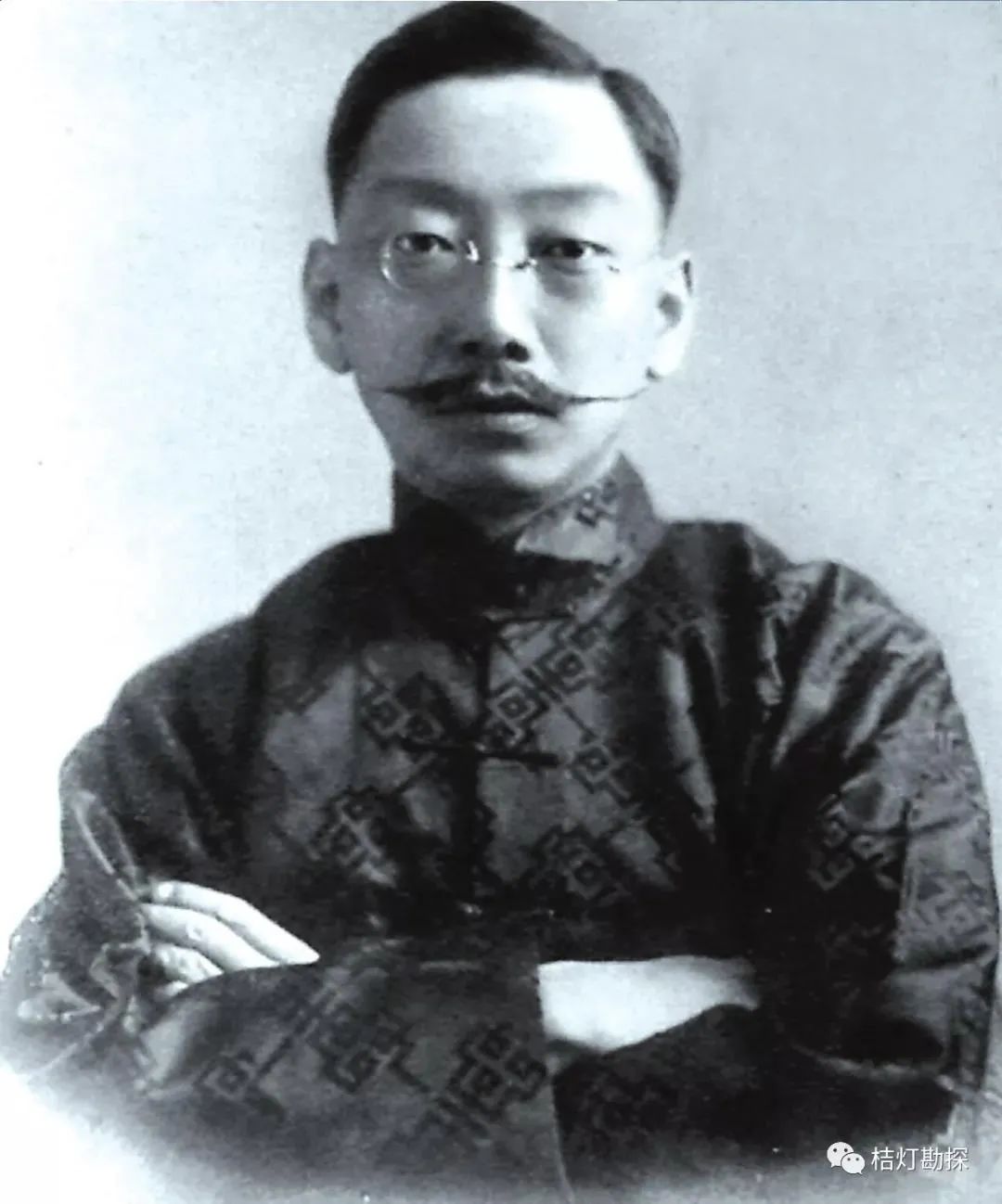
In April and May 1911, Ding Wenjiang (1887-1936), the founder of China’s geological career, returned to China after obtaining dual bachelor’s degrees in zoology and geology from the University of Glasgow in the UK. In the summer of the same year, another founder of Chinese geology, Zhang Hongzhao (1877-1951), graduated from the geology department of Tokyo Imperial University in Japan with a bachelor’s degree in science and returned to China. In early 1913, the first PhD in geology in China, Weng Wenhao (1889-1971), graduated from the University of Leuven in Belgium and returned to China. The return of these three individuals marked the first time China had its own geologists.
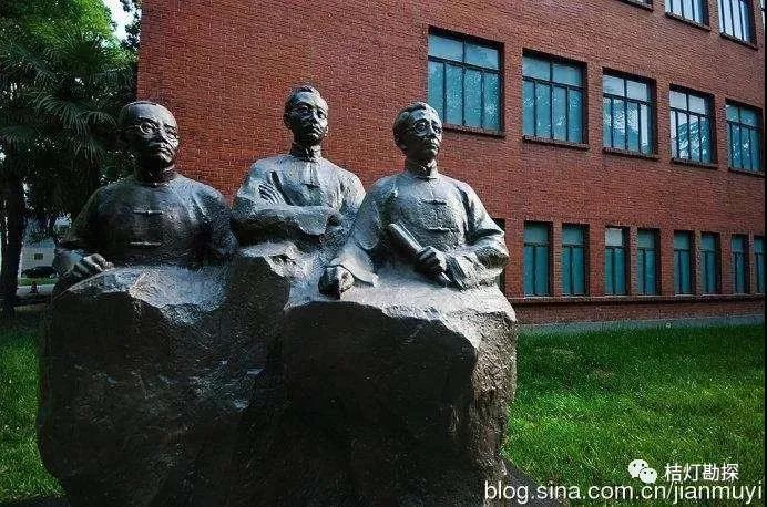
Founders of China’s geological career: Zhang Hongzhao, Ding Wenjiang,
Weng Wenhao (from left to right)
In January 1912, the Provisional Government of the Republic of China was established, and to save the nation through industry, the Geological Section was established under the Mining Department of the Ministry of Industry, marking the first appearance of the term “geology” in Chinese official documents, with Zhang Hongzhao serving as the first section chief.
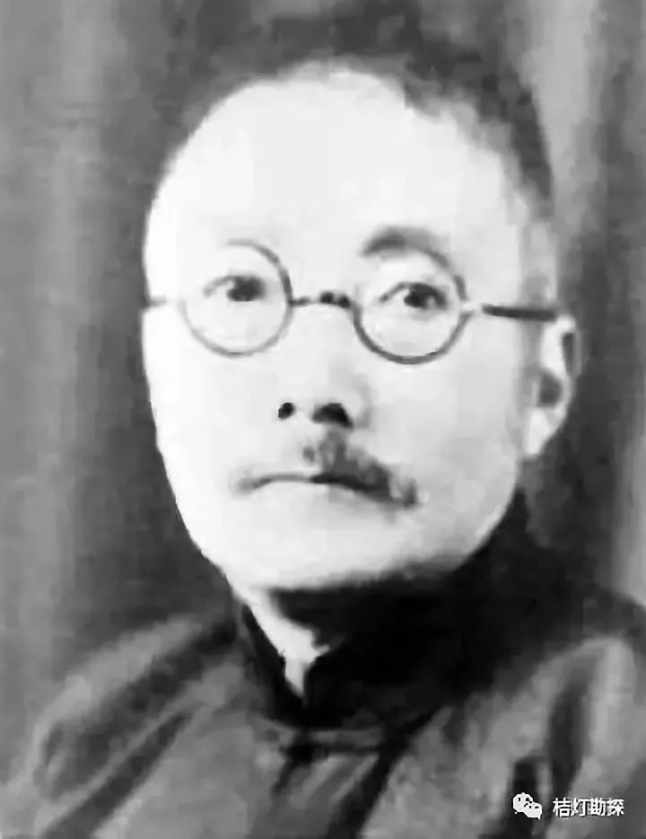
Zhang Hongzhao
In April 1912, the provisional government moved to Beijing, and the Geological Section was transferred to the Ministry of Industry. Ding Wenjiang was invited from Nanyang Middle School to take over as the head of the Geological Section.
On September 4, 1913, the Geological Survey Institute (hereinafter referred to as the Geological Survey Institute) and the Geological Research Institute (hereinafter referred to as the Geological Institute) were officially established at No. 3 Fenzi Hutong, Beijing, with Ding Wenjiang appointed as the director of both institutes.
Ding Wenjiang
On October 1, 1913, the Geological Institute opened, with 30 students enrolled. After three years of study and field practice, 21 students graduated, including Ye Liangfu, Wang Zhuquan, Xie Jiarong, Tan Xichou, Li Jie, Liu Jicheng, Li Xueqing, Zhou Zanheng, Zhu Tinghu, Xu Yuanmo, Xu Weiman, Lu Zuyin, Zhao Zhiwen, Ma Bingduo, Tong Buying, Liu Shicai, Chen Shuping, and Zhao Rujun. They were the first batch of geologists trained by China, commonly referred to as the “Eighteen Arhats” of Chinese geology.
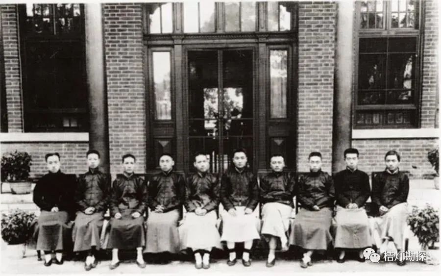
Group photo of some students from the Geological Research Institute (from left: Lu Zumeng, Ye Liangfu, Xu Yuanmo, Zhou Zanheng, Xu Weiman, Zhu Tinghu, Liu Jicheng, Li Xueqing, Xie Jiarong, Zhao Zhiwen)
After graduation, these students entered the Geological Survey Institute as geological surveyors or research surveyors, marking the establishment of the first professional geological team in China, and the Geological Survey Institute began to operate normally. They surveyed geological maps and investigated rocks, minerals, and fossils in Hebei, Shandong, and other regions.
Geological work in China, whether field surveys or indoor research, shifted to being primarily conducted by Chinese, thus ending the “sad situation where only foreigners conducted geological surveys on Chinese territory”.
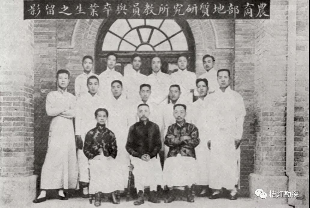
Group photo of faculty and some students from the Geological Research Institute in 1916
After this group of students graduated, the Geological Institute ceased operations. In 1917, the geology department of Peking University resumed enrollment, taking on the responsibility of continuing to train Chinese geology students. Although the Geological Institute only enrolled one class, it holds an important position in the history of geology in China, praised by foreign scholars as “the first brilliance of Chinese science”, with many leading talents in the Chinese geology community, such as Xie Jiarong, Wang Zhuquan, Ye Liangfu, Li Jie, Tan Xichou, Zhu Tinghu, and Li Xueqing, all coming from the Geological Research Institute.
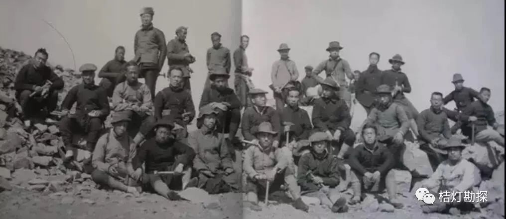
Field practice of students from the Geological Research Institute in 1916 in Hebei Luan County
In February 1916, the Geological Survey Institute moved to No. 3 Fengsheng Hutong, Beiping, and was renamed the Geological Survey Bureau. In October, it was renamed the Geological Survey Institute again. In 1921, it moved to No. 9 Bingmasi Hutong, Beiping (now No. 15 Bingmasi Hutong). During this period, research rooms and laboratories were added, a geological society was established, publications were produced, and research institutions gradually improved, with the research team expanding and survey areas covering the entire country. Achievements were made in geological surveys and the excavation of the Zhoukoudian site and ancient human culture, marking a glorious period for the Geological Survey Institute.
Classroom of the Geological Research Institute at No. 3 Fengsheng Hutong, Beiping in 1915
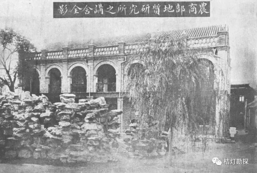
After the September 18 Incident, the Japanese invaders threatened North China. To avoid the war, in December 1935, the Geological Survey Institute moved south to a new site at 942 Zhujiang Road, Nanjing (now No. 700). After Shanghai fell, it was ordered by the government to move west, arriving in Changsha in December of the same year, first working at the Hunan Geological Survey Institute at No. 33 Shanglijia Po, and moving to the northern city of Yujiachong in February 1938.
The following year, in July, it moved to Chongqing, where it was supported by Director Hou Defeng, and settled in the Sichuan Geological Survey Institute at Xiaojuezi Fuxingguan.
After the “Chongqing Bombing”, in the spring of 1939, it was relocated again to No. 29 Wenxing Bay, Beibei, and with the help of patriotic entrepreneur Mr. Lu Zuofu, it moved into the building of the Chinese Academy of Sciences in the west, while also building a two-story building behind the academy, which was completed in April 1939. After several relocations and hardships, it finally settled down.
After the victory of the War of Resistance, in 1946, the Geological Survey Institute returned to its old site at Zhujiang Road, Nanjing.
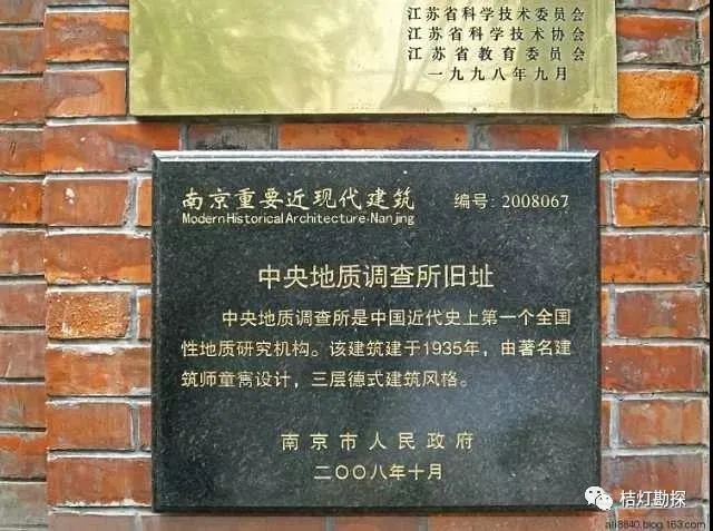
Old site of the Central Geological Survey Institute in Nanjing
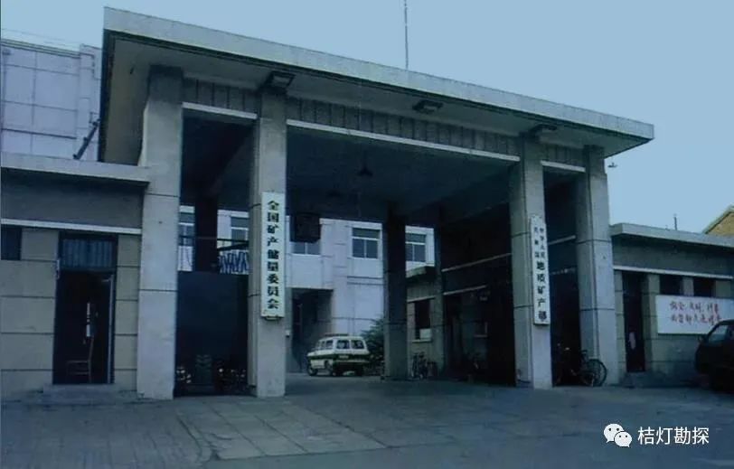
On the eve of the founding of New China, the Geological Survey Institute, the Geological Research Institute of the Central Academy of Sciences, and the Mineral Survey Department of the Resource Committee, along with several provincial geological survey institutes and higher education institutions, had about 200 geologists, which was all the geological “heritage” left by the old era to New China.
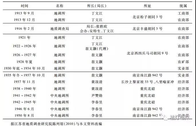
Evolution of the Geological Survey Institute
Development of Geological Work in New China
From the founding of the country to the mid-1960s, with the large-scale development of economic construction in New China, the urgent demand for mineral resources drove the geological work in our country, and geological science entered a period of vigorous development.
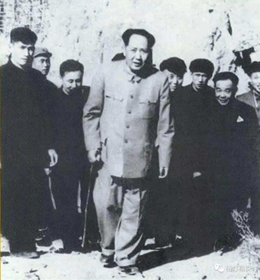
Mao Zedong inspecting the construction of the Guanting Reservoir in 1954
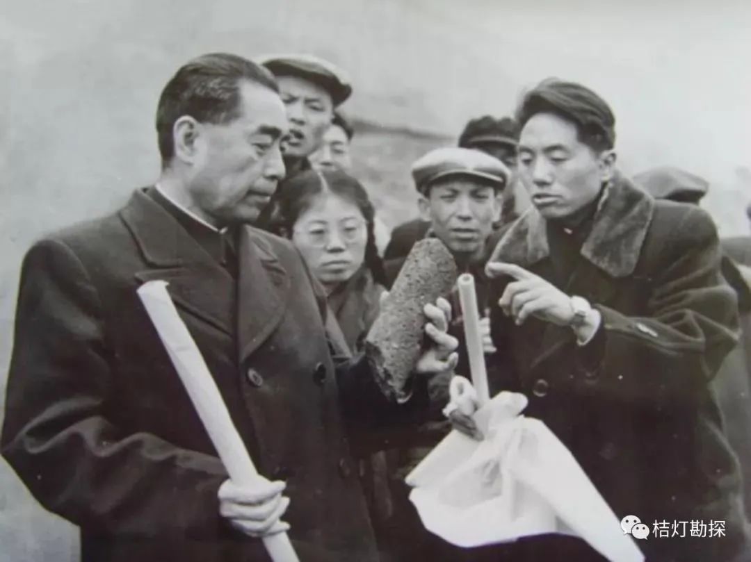
Zhou Enlai inspecting the Three Gorges team of the Ministry of Geology in 1958
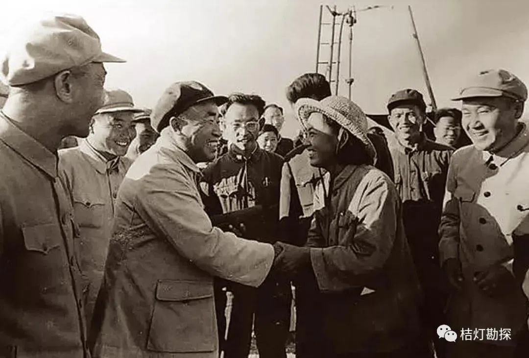
Zhu De visiting drilling workers during his inspection of the Karamay Oilfield in 1958
The nationwide mineral resource census and the large-scale regional geological survey starting in 1958 at a scale of 1:200,000 accumulated a vast amount of extremely valuable primary data across various categories. These basic geological materials described a wide variety of geological entities and phenomena, laying a solid foundation for the various branches of geological science in China.
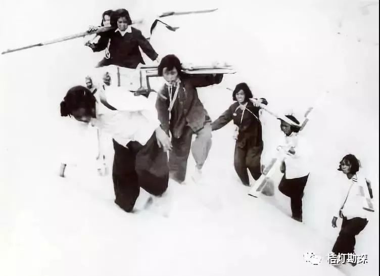
Women surveyors active in Qaidam in the 1950s
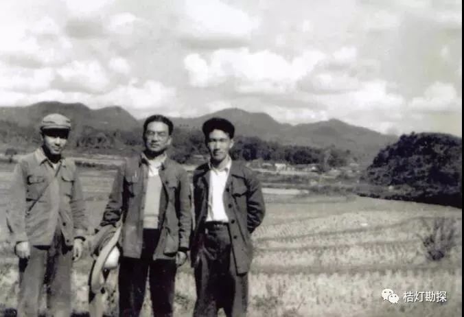
Geological survey conducted by geological team members in Northeast Jiangxi in 1957
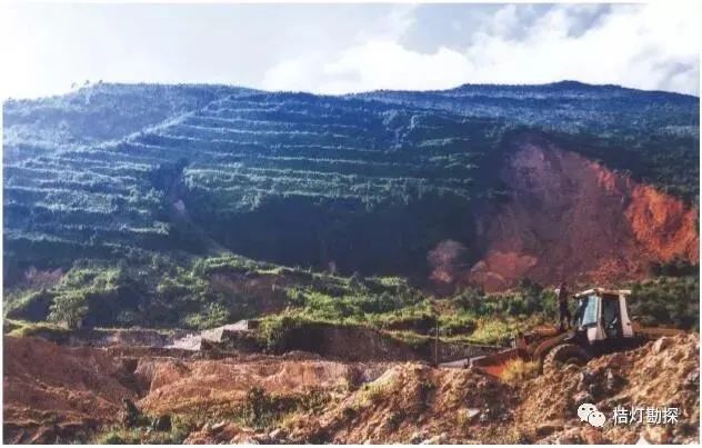
Providing tantalum and niobium raw materials for China’s first artificial earth satellite “Dongfanghong” No. 1 in the Li Mu mining area of Guangxi
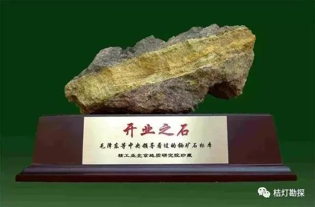
China’s first uranium ore
In terms of geological theory, it basically inherited the geological theories introduced from Europe and America by the older generation of geologists before the founding of the country, combined with China’s geological realities, supplemented by the main geological schools from the Soviet Union. It can generally reflect the level of international geology in the 1940s to 1950s.
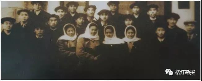
In the early days of liberation, China sent a large number of students in geology, electricity, and other specialties to study in the Soviet Union
The ten years of the Cultural Revolution brought unprecedented disasters. Geological work came to a standstill, and scientific research and international exchanges were interrupted. At the same time, the international geological community was experiencing a “geological revolution” that was in full swing. The geological community in China lost valuable time, widening the academic gap with the international geological community.
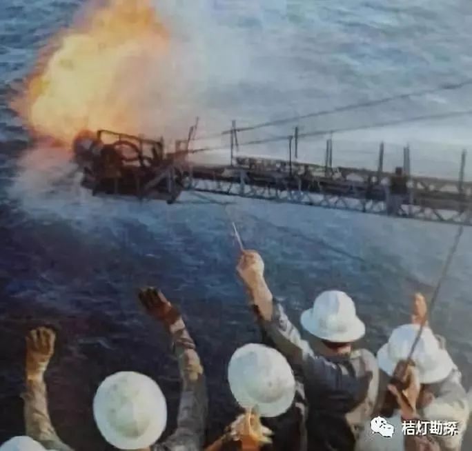
In 1979, the “Exploration No. 2” drilling platform was under construction in the Pearl River Estuary Basin
“Zhu Wu Well” trial obtained industrial oil flow
Since the late 1970s, the environment of reform and opening up has facilitated the renewed development and prosperity of geological science in our country. The three consecutive five-year national science and technology projects, “Six Five”, “Seven Five”, and “Eight Five”, as well as numerous research projects organized by various systems and industries, have promoted the reconstruction and rapid development of geological science in our country; at the same time, the restoration of higher geological education, the dispatch of students and visiting scholars, and the strengthening of international academic exchanges have allowed the geological community in our country to keep pace with the international geological frontier, introducing new ideas and theories, gradually shortening the academic distance with the international community, and preparing conditions for “aligning” with international standards in some fields.
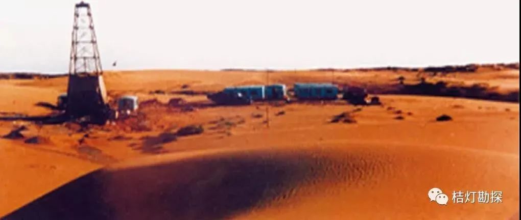
Geological exploration drilling rig standing in the depths of the Maowusu Desert in the early 1980s
In summary, the main achievements of geological science in New China can be stated as follows.
● From the 1950s to the mid-1960s, a vast amount of basic geological materials of various categories was accumulated.
● Over the decades, a large number of informational, practical, and regional manuals, atlases, regional stratigraphic tables, and various basic geological maps of different scales and details have been published.
● A complete system of secondary disciplines with distinct characteristics and mutual support has basically formed; using these secondary disciplines as a link, various academic organizations at all levels have been established; a number of academic journals have been published, promoting domestic and international academic exchanges.
● In response to the needs of economic and social development, a number of applied geological sub-disciplines have been formed in various fields such as energy, minerals, engineering geology, hydrogeology, environmental geology, and geological disaster forecasting. These sub-disciplines are rooted in the needs of national economic and social development, and in turn, have made historical contributions to the latter.
● With the infiltration of high-tech, a number of emerging and interdisciplinary geological sub-disciplines have emerged, such as mathematical geology, remote sensing geology, isotope geology, and planetary geology. These new geological branches are developing vigorously and are in their infancy.
● Since the 1990s, with the strengthening of international academic exchanges, the geological community in our country has aimed at the forefront of international geology, striving to catch up, and has made some remarkable progress in shortening academic distances and achieving academic “alignment”.
At the same time, with the strategic adjustments of the country, the management institutions of the national geological industry have also undergone continuous changes:
1950 – The National Geological Work Planning Guidance Committee was established
1952 – The Ministry of Geology of the Central People’s Government was established
1954 – Renamed the Ministry of Geology of the People’s Republic of China
1970 – The Ministry of Geology was abolished, and the Geological Bureau of the National Planning Commission was established
1979 – The National Geological Bureau was renamed the Ministry of Geology of the People’s Republic of China
1982 – Renamed the Ministry of Geology and Mineral Resources of the People’s Republic of China
1998 – The Ministry of Geology and Mineral Resources was abolished, and its functions were merged into the newly established Ministry of Land and Resources
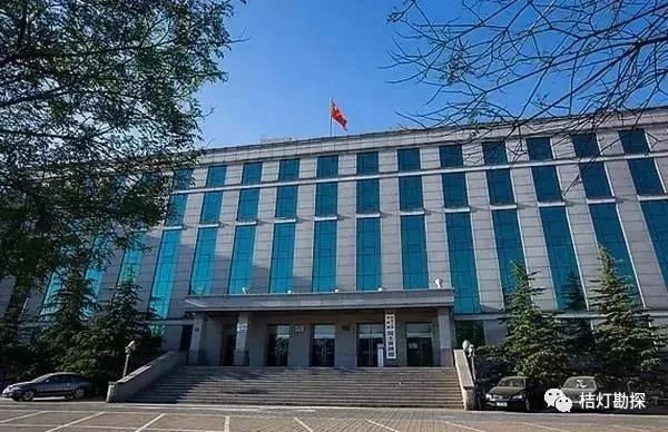
2018 – The Ministry of Land and Resources was abolished, and the Ministry of Natural Resources was established
……
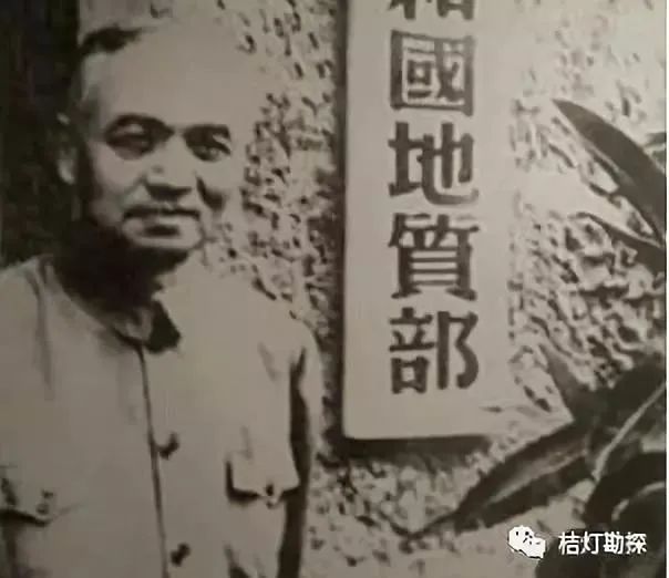
The Ministry of Geology of the People’s Republic of China was renamed in 1954
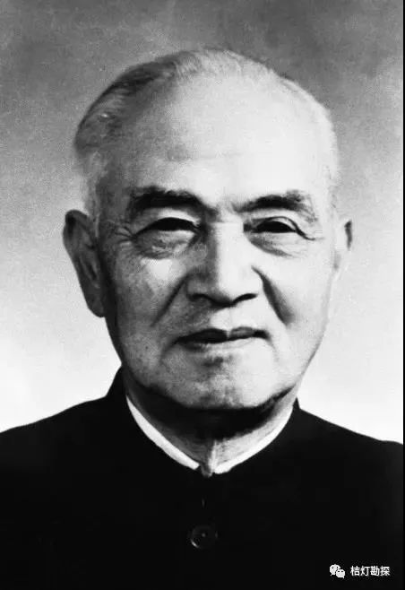
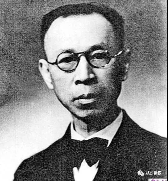
First Minister of Geology: Li Siguang (1889.10.26-1971.4.29)
Li Siguang, originally named Li Zhonghui, was a geologist, educator, musician, and social activist from Huanggang, Hubei, and is one of the founders of Chinese geological mechanics, a major leader and founder of modern earth sciences and geological work in China, and one of the outstanding scientists who made significant contributions to the development of New China.
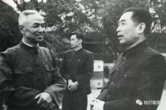
Premier Zhou Enlai meeting with the first Minister of Geology, Li Siguang in 1952
In 1920, Li Siguang accepted the invitation of Mr. Cai Yuanpei, the president of Peking University, to return to China, serving as a professor and head of the geology department at Peking University; after 1928, he served as the director of the Geological Research Institute of the Central Academy of Sciences for a long time; in 1950, he returned to China secretly and served as the vice president of the Chinese Academy of Sciences and the director of the Geological Work Planning Guidance Committee; from 1952 to 1970, he served as the Minister of Geology of the People’s Republic of China.
In May 1982, the Ministry of Geology was renamed the Ministry of Geology and Mineral Resources
In 1998, the Ministry of Geology and Mineral Resources was abolished and its functions were merged into the newly established Ministry of Land and Resources
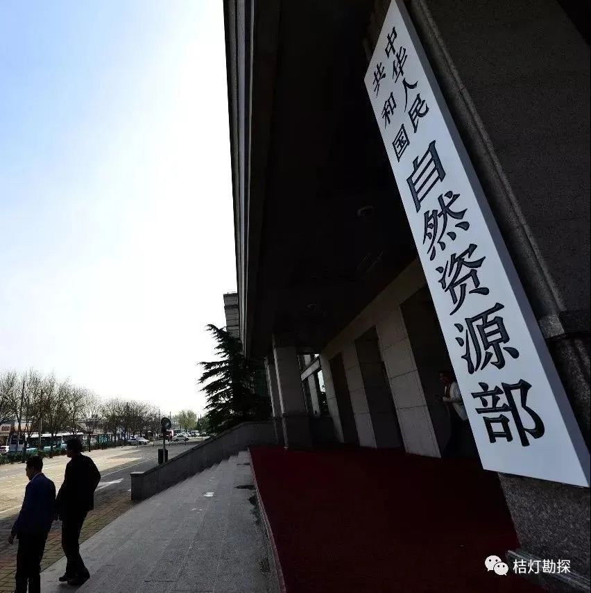
In 2018, the Ministry of Land and Resources was abolished and the Ministry of Natural Resources was established
Achievements of Geological Work in the New Era
In recent years, through the unremitting efforts of several generations of geologists, China’s geological work has achieved world-recognized accomplishments.
2017 Geological Work Major Achievements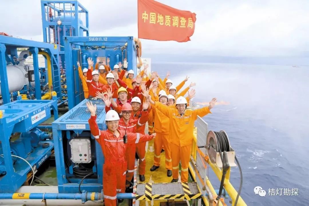
China’s first successful trial extraction of natural gas hydrates in the sea. The trial extraction of natural gas hydrates in the sea, organized and implemented by the research team led by Ye Jianliang from the Guangzhou Marine Geological Survey Bureau of the Ministry of Land and Resources, is the world’s first safe and controllable extraction of mud-silt type natural gas hydrates, which account for over 90% of global resources and are the most difficult to develop. The continuous trial extraction lasted for 60 days, with a total gas production of over 300,000 cubic meters, setting world records for both gas production duration and total volume.
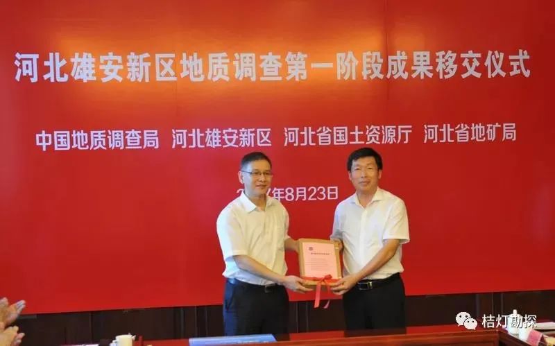
Geological survey in Xiong’an New Area has begun. In the geological survey work of Xiong’an New Area, the China Geological Survey organized more than 1,700 engineering technicians from multiple units, adhering to innovative concepts, technological innovations, and mechanism innovations, obtaining over 900,000 data points and achieving fruitful results.
Significant breakthroughs in shale gas investigation in the Cambrian-Silurian strata in Yichang, Hubei. The research team led by Chen Xiaohong from the Wuhan Geological Survey Center of the China Geological Survey achieved significant breakthroughs in the investigation of shale gas in the lower Paleozoic strata in Yichang Huangling uplift in 2017. The E-Y1HF well achieved an industrial gas flow of 60,200 cubic meters/day in the Cambrian strata, and the E-Y2HF well and E-Y1HF well also obtained high-yield shale gas flows in the Cambrian and Silurian strata, respectively.
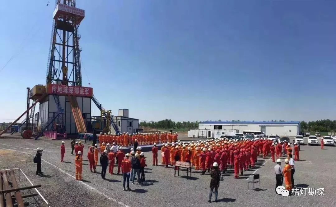
Three technological breakthroughs in the Songliao Basin resource and environmental deep drilling project (Songke 2 well) set world records. The Songke 2 well drilled deeper than the designed target of 6,400 meters, breaking three world records. The developed deep well large-diameter series core drilling system and high-temperature high-pressure measurement instruments provide various technical methods for China’s ultra-deep geological exploration projects.
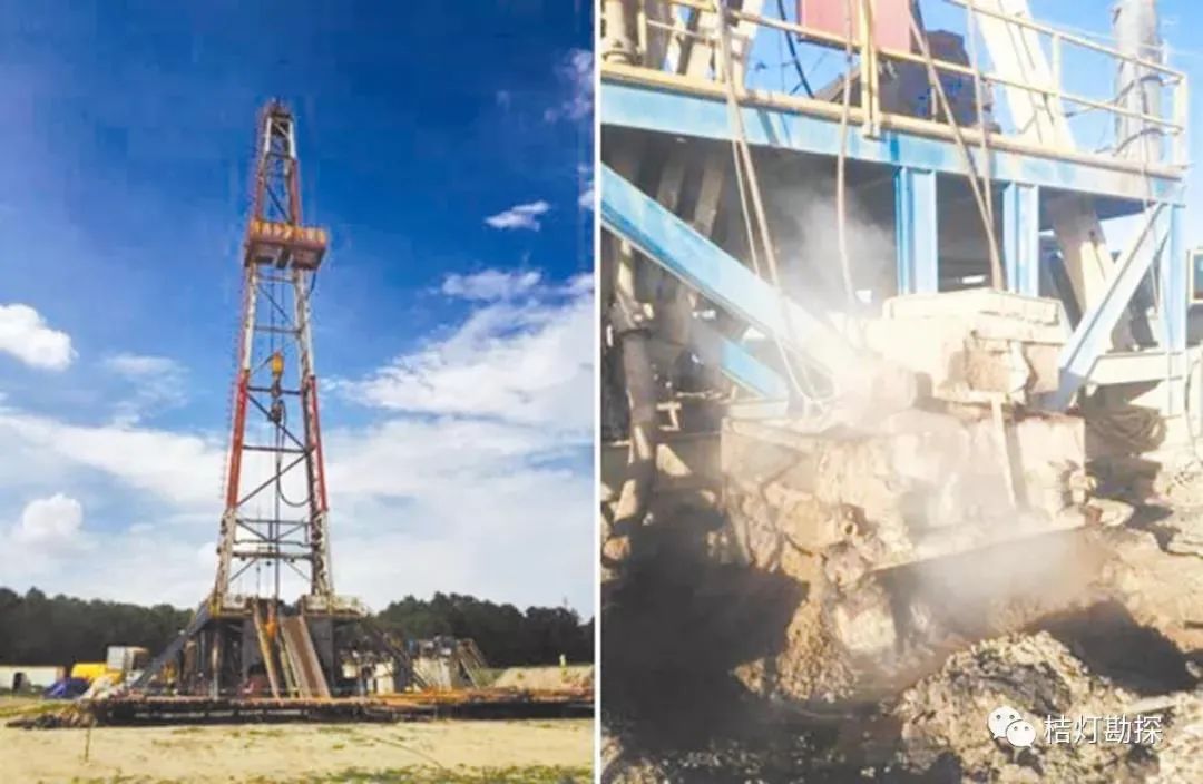
China’s first discovery of the shallowest and hottest geothermal rock mass. The geothermal rock exploration project in the Qinghai Gonghe Basin, jointly implemented by the China Geological Survey and the Qinghai Provincial Department of Land and Resources, passed expert review. The project successfully drilled five geothermal exploration wells in the Gonghe Basin, all of which encountered geothermal rock masses. Among them, the GR1 geothermal exploration well reached a depth of 3,705 meters, with a bottom temperature of 236°C, and an average temperature gradient of 8.8°C/100 meters below 3,366 meters. This is the first time China has discovered the shallowest and hottest geothermal rock mass, achieving a significant breakthrough in geothermal exploration in China.
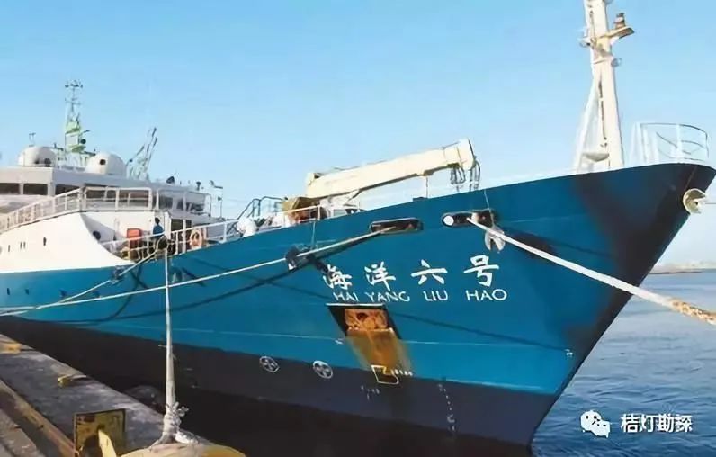
“Ocean Six” Antarctic scientific expedition achieved multiple breakthrough innovative results. The comprehensive geological and geophysical survey conducted by “Ocean Six” in the Antarctic waters from 2016 to 2017 obtained high-precision seabed topographic data for the first time in the Antarctic survey area, high-resolution multi-channel seismic data, and sediment core samples. Using the independently developed geothermal gradient measurement system, geothermal flow data in the Antarctic waters were obtained for the first time, filling the gap in China’s geothermal flow survey in the Antarctic region. A large amount of meteorological and navigational data for the Southern Ocean, such as wind and wave flow, was accumulated, opening a new model for Antarctic scientific research involving multiple ships, multiple stations, and land-sea integration.
 2018 Geological Work Major Achievements
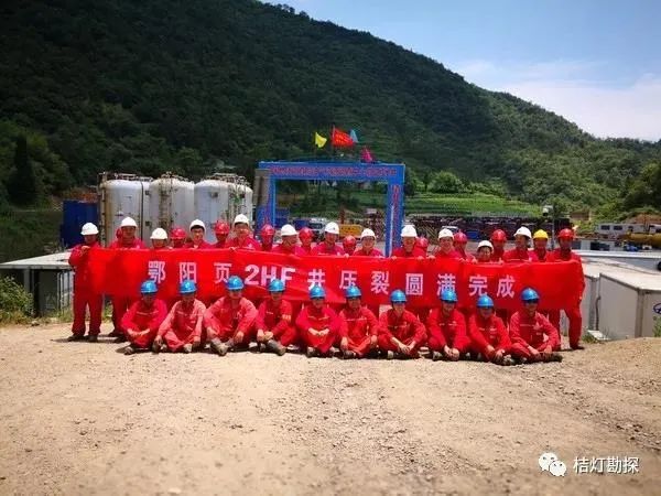
Major breakthroughs in shale gas investigation technology in the western Hubei region. Under the coordination of the joint command of the southern shale gas investigation technology attack in Yichang, organized by the Wuhan Geological Survey Center and the Oil and Gas Resource Survey Center of the China Geological Survey, significant breakthroughs were achieved in the shale gas investigation technology attack in the western Hubei region.
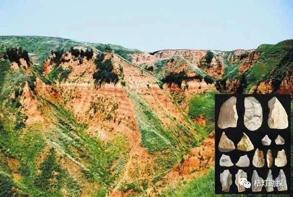
New record of the loess-paleosol sequence and ancient human activity history 2.1 million years ago in Lintian, Shaanxi. A team led by Zhu Zhaoyu from the Guangzhou Institute of Geochemistry of the Chinese Academy of Sciences and the Institute of Vertebrate Paleontology and Paleoanthropology discovered the erosion surface of loess in front of the Qinling Mountains after 17 years of comprehensive geological research in the Lintian area of Shaanxi, pushing the dating of the skull of the Peking Man from 1.15 million years ago to 1.63 million years ago; a new continuous loess-paleosol sequence profile was discovered in the upper Chen area, and 17 layers of Old Stone Age cultural layers were found, dating from 1.26 million to 2.12 million years ago, making the Lintian area one of the earliest sites of ancient human activity outside Africa. This achievement was published in “Nature” and “Journal of Human Evolution”. The discovery of the rare multi-layered Old Stone Age cultural layers in the continuous loess-paleosol sequence has expanded the new direction of China’s loess research, which is already at a world-leading level.
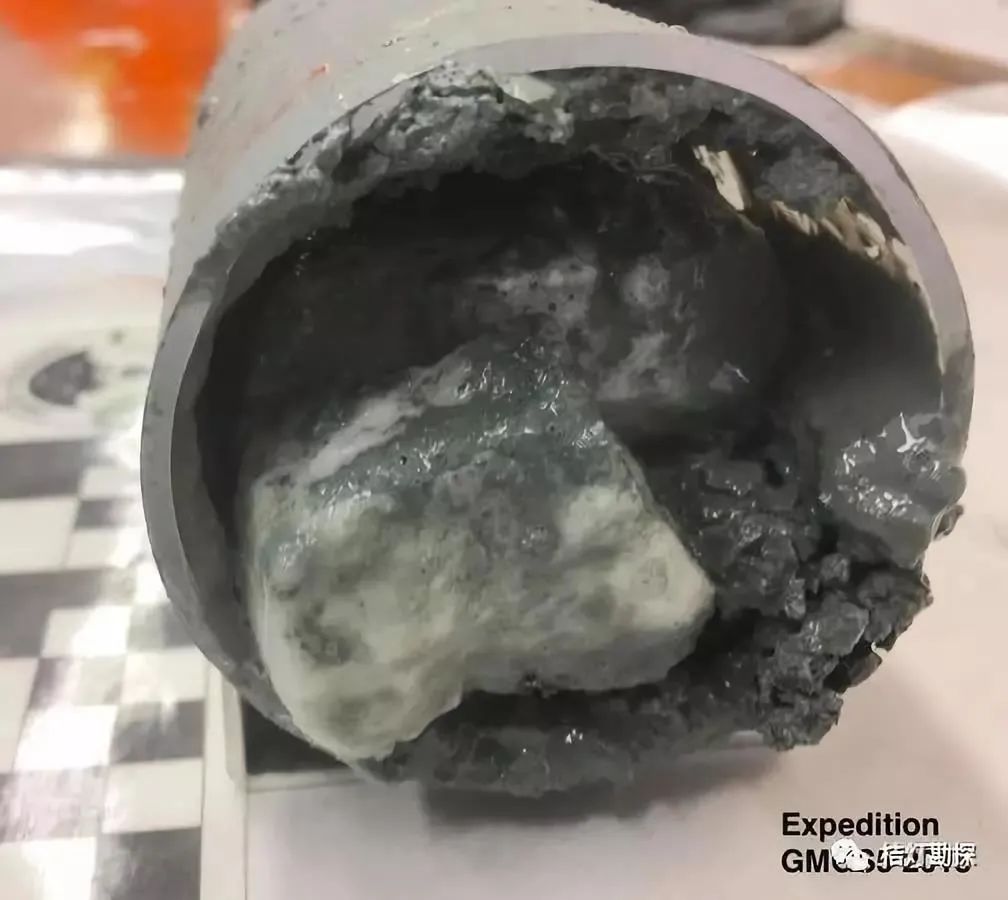
Innovations in the theory of natural gas hydrate formation and breakthroughs in new mining areas. In the six pilot holes drilled in the northern South China Sea, three sites were found to have high resistivity anomalies and low sonic time anomalies, indicating the presence of natural gas hydrates. Drilling and in-situ testing were conducted at these three sites, leading to the first discovery of thick, high-purity, multi-type, and multi-layered natural gas hydrate deposits, becoming the third enrichment area of natural gas hydrates in the northern South China Sea. At the same time, the contribution of deep pyrolysis gas to the formation of natural gas hydrates was confirmed, revealing the causal relationship between shallow natural gas hydrate deposits and the evolution of deep oil and gas systems, providing new ideas for comprehensive exploration and mining in the pilot experimental area.
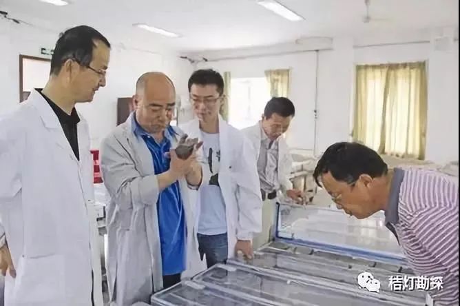
Significant progress in the theory, key technologies, and exploration of shale oil enrichment in the lacustrine saline basin of the Junggar Basin. Led by the Xinjiang Oilfield Branch of China Petroleum, collaborative research on the theory of shale oil enrichment in the lacustrine saline basin of the Junggar Basin was conducted, proposing an innovative theoretical understanding and three supporting technologies: establishing the theory of shale oil enrichment in lacustrine saline basins, guiding the discovery of 1 billion tons of shale oil; developing shale oil logging evaluation technology centered on the “seven relationships”, increasing the success rate of trial oil from 35% to 100%; forming a set of shale oil sweet spot prediction technology containing engineering geological parameters and hydrocarbon source rock quality, increasing the prediction accuracy from 70% to 100%; integrating innovative technologies for efficient drilling and volume fracturing of shale oil horizontal wells, achieving efficient exploration and effective utilization of saline lacustrine shale oil, with single well daily production exceeding 100 tons and cumulative oil production of 18,000 tons in a year and a half. Under the guidance of the above theoretical understanding and supporting technologies, the integrated evaluation of shale oil pre-exploration capacity in the Jimusaer depression is rapidly advancing, confirming controllable reserves of over 1 billion tons and entering the stage of large-scale production.
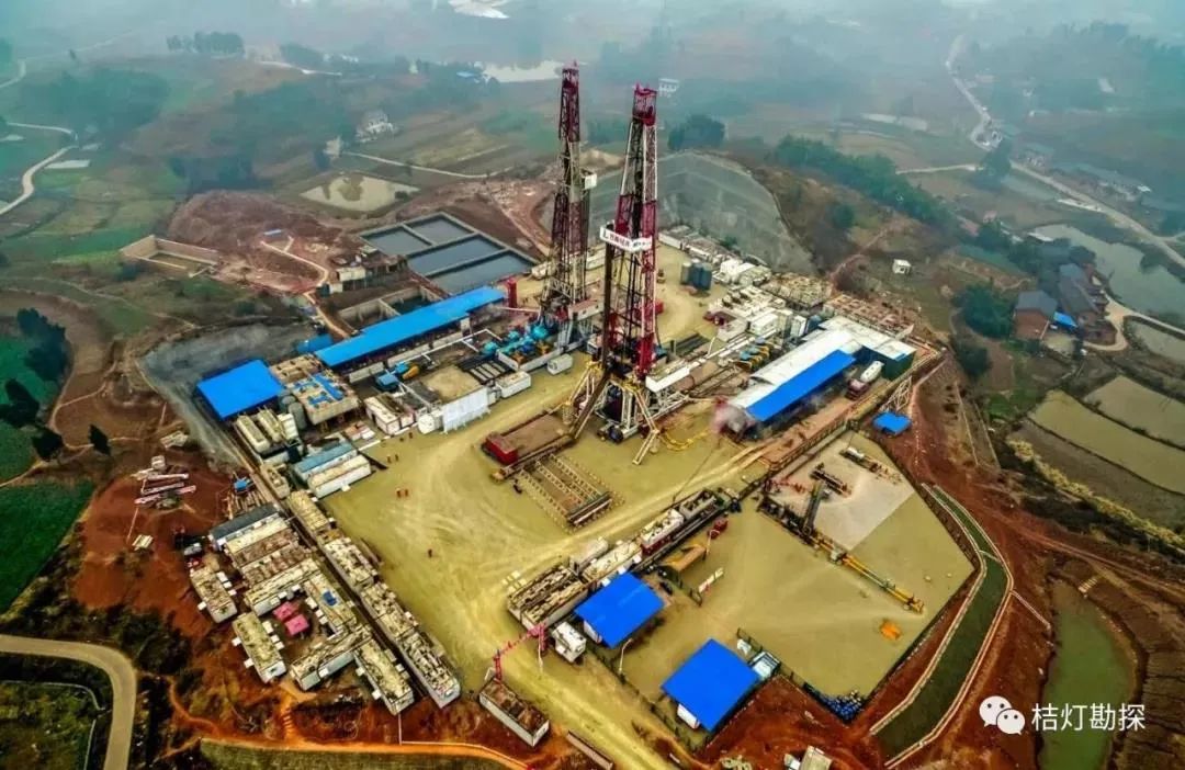
Discovery of a large shale gas field with over 100 billion cubic meters in the Weirong shale gas field in the Sichuan Basin. Sinopec Southwest Oil and Gas Company has discovered a large shale gas field with over 100 billion cubic meters in the deep shale gas field of the Sichuan Basin. In response to the geological evaluation, drilling, and fracturing challenges of deep shale gas buried deeper than 3,500 meters, the research team liberated their thoughts, innovated theoretical understanding, deepened resource evaluation, and strengthened technical research, proposing one theory and four supporting technologies: the “three-dimensional” enrichment theory of marine deep shale gas, establishing comprehensive geological evaluation technology for deep shale gas based on lithology, electrical properties, paleobiology, etc.; establishing dual “sweet spot” geophysical prediction technology for deep shale gas; establishing rapid drilling and horizontal well trajectory optimization control technology; and establishing deep shale gas fracturing transformation technology to improve the effectiveness of fracture and cluster transformation. The Weirong gas field has submitted proven reserves of 12.47 billion cubic meters, establishing a new position for capacity construction, with significant social and economic benefits, and is of great significance for promoting green development.

From the dedication and patriotism of “fighting until tears dry and hair falls” during the invasion of foreign powers,
to the sense of responsibility in the new era of climbing the Qinghai-Tibet Plateau and entering Xinjiang;
from the collection of field geological data starting from “the hammer’s discovery, to the endless discussion”
to the historical innovation of the first successful trial extraction of natural gas hydrates in the sea;
geologists are always at the forefront of the construction of the motherland.
They traverse mountains and rivers, measuring the sky and the earth,
writing their deepest love for the motherland with their own hands!
Main References:
Guo Lianjie, Ye Danian
“The Origin and Development of Chinese Geology”
Jiang Yanwen, Wu Zhiyong, Shi Baohang
“Chinese Geological Science at the Turn of the Century – Review and Outlook”
Images sourced from the internet
Copyright belongs to the copyright owner!
Source | “Ju Lantern Exploration” WeChat platform
Editor | Chen Ye